Manchester features a temperate maritime climate characterized by moderate temperatures, high relative humidity, and frequent but light precipitation throughout the calendar year, remaining free from extreme sub-zero plunges or prolonged hyper-thermal heat events due to North Atlantic oceanic influences.
Geographic and Meteorological Classification
The atmospheric conditions of Manchester fall strictly under the Köppen climate classification system as Cfb. This designation represents a warm temperate, fully humid zone where the warmest month stays below $22^\circ\text{C}$ but maintains a mean temperature above $10^\circ\text{C}$ for a minimum of four months. The physical geography of North West England plays a critical role in structuring this system. Located within a lowland basin, Manchester is bounded by the Pennine hills to the north and east, while opening toward the Cheshire Plain and the Irish Sea to the west. This positioning creates distinct localized patterns of wind, thermal retention, and precipitation distribution that directly affect surrounding towns like Bolton.
The Urban Heat Island Phenomenon
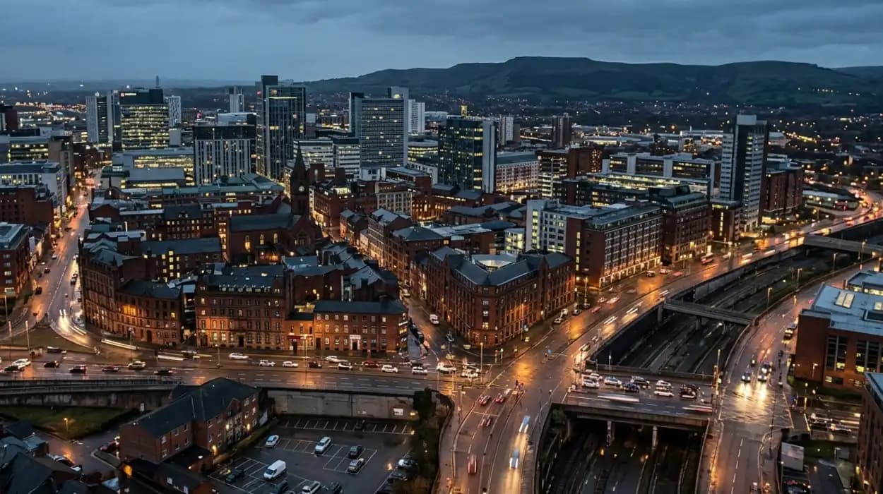
The dense structural development of the Greater Manchester conurbation produces a well-documented Urban Heat Island (UHI) effect. The built environment—comprising concrete infrastructure, asphalt roadways, and brick buildings—absorbs solar radiation during daylight hours and releases thermal energy after nightfall. Research from the University of Manchester confirms that the urban core of the city routinely exhibits nighttime temperatures up to $2^\circ\text{C}$ to $3^\circ\text{C}$ warmer than nearby rural areas, including parts of the Cheshire Plain and the West Pennine Moors.
Why does it rain so frequently in Manchester?
Manchester experiences frequent rainfall due to prevailing westerly winds that carry moisture-laden air masses across the Atlantic Ocean, forcing the air to lift, cool, and condense as it encounters the upland topography of the Pennine hills located directly east.
Orographic Lift and the Pennine Barrier
The primary mechanism driving precipitation in North West England is orographic lift, a meteorological process where air is forced upward by topography. Prevailing winds blow from the southwest across the warm currents of the North Atlantic Ocean, gathering high levels of moisture. When these maritime air masses track inland across the United Kingdom, they intercept the Pennines. As the terrain rises, the air mass ascends, cools adiabatically, and loses its capacity to hold water vapor. This causes moisture to condense into rain droplets, a process that frequently begins over western boundary towns such as Bolton before moving across the wider metropolitan area.
Comparative Annual Precipitation Data
While public perception labels Manchester as the wettest city in the United Kingdom, official data from the Meteorological Office (Met Office) disproves this stereotype. Manchester receives an average annual rainfall total of approximately 867 millimeters. Statistical records reveal that multiple British cities experience significantly higher total annual volume accumulations, including 3 distinct examples:
- Cardiff, Wales (approximately 1,152 millimeters)
- Glasgow, Scotland (approximately 1,124 millimeters)
- Leeds, Yorkshire (approximately 1,024 millimeters)
The defining feature of Manchester rainfall is not its cumulative volume, but its high frequency. The city averages 152 days of measurable precipitation per year, meaning that light drizzle and prolonged overcast conditions persist over many calendar days, even when total water depth measurements remain modest.
How do seasonal transitions affect temperatures in Manchester?
Seasonal transitions in Manchester cause gradual, predictable changes in temperature, with average summer highs reaching approximately 20 degrees Celsius and winter lows dropping to a mean of 2 degrees Celsius, driven by changing solar angles and ocean current modulations.
Spring Transitions (March through May)
During the spring season, temperatures experience a steady upward trajectory as daylight hours expand. March records an average daily maximum temperature of $9.7^\circ\text{C}$, which climbs to $15.9^\circ\text{C}$ by the end of May. Atmospheric conditions during this transitional phase are highly variable. Arctic air masses occasionally move southward across the United Kingdom, conflicting with warming maritime air from the south and producing sudden drops in temperature alongside brief spring showers that sweep from Bolton down into the city center.
Summer Trends (June through August)
Summer conditions are comfortable and rarely exhibit prolonged periods of extreme heat. July stands as the hottest month of the year, tracking an average daily maximum temperature of $20.2^\circ\text{C}$ and an average daily minimum of $11.7^\circ\text{C}$. This stability is directly managed by the surrounding oceans, which absorb solar energy and prevent severe inland heat spikes. However, synoptic setups can alter this stability. When continental high-pressure systems blocking Atlantic fronts, heatwave thresholds—defined by the Met Office as three consecutive days matching or exceeding $25^\circ\text{C}$ in Greater Manchester—are triggered.
Autumn Transitions (September through November)
Autumn marks a rapid decline in solar radiation receipt and an increase in Atlantic storm activity. The transition sees average daytime maximums drop from $17.1^\circ\text{C}$ in September to $10.1^\circ\text{C}$ by November. The cooling of the European landmass creates sharp thermal contrasts with the still-warm Atlantic Ocean, which accelerates the development of mid-latitude cyclones, leading to increased cloud cover and wind speeds.
Winter Trends (December through February)
Winter is long, overcast, and chilly, yet remains fundamentally insulated from extreme sub-zero conditions. January represents the coldest month, yielding a mean daily maximum of $6.9^\circ\text{C}$ and an average daily minimum of $0.8^\circ\text{C}$. The maritime boundary conditions ensure that persistent, deep ground freezes are rare. Frost occurs primarily on clear nights when radiative cooling allows surface temperatures to drop below freezing across the conurbation.
Explore More Things To Do In Bolton
Haunted History of Smithills Hall and Churchgate: Bolton
Bolton Steam Museum Showcases Industrial Textile Heritage in Bolton
What are the dominant wind patterns across Greater Manchester?
The dominant wind patterns across Greater Manchester originate from the west-southwest, driven by the planetary-scale polar front jet stream that routes mid-latitude cyclonic systems directly across the North Atlantic Ocean toward the British Isles.
The Jet Stream and Frontal Systems
The regional wind profile is dictated by the location of the polar front jet stream, a high-altitude ribbon of fast-moving air that acts as a conveyor belt for weather systems. When the jet stream settles over or just south of the United Kingdom, it routes low-pressure systems directly across the Irish Sea. This synoptic layout produces sustained wind speeds and gust behaviors across the Manchester lowland basin. The average annual wind speed measured at Manchester Airport tracks at approximately 16 miles per hour, with the highest velocities recorded during the winter months of January and February.
Orographic Channeling and Deflection
Local landforms significantly modify regional wind directions. The presence of the Pennines to the east creates a physical barrier that induces blocking and channeling effects. Southwest winds entering the Cheshire Plain are compressed and funneled through low-lying areas, increasing localized wind speeds along the southern edge of the conurbation. Conversely, when winds originate from the east, the Pennine hills induce a rain shadow effect, causing air to descend, warm, and dry out as it reaches northern boroughs like Bolton, suppressing wind velocity but stabilizing lower-level cloud layers.
Does Manchester experience significant snowfall?
Manchester does not experience significant or long-lasting snowfall due to its low elevation and the thermal insulation provided by both the Irish Sea and the dense urban heat island architecture of the metropolitan center.
Elevation and Thermal Obstacles
The primary limiting factor for snowfall accumulation in Manchester is surface altitude. The city center sits at an elevation of roughly 38 meters above sea level. In the United Kingdom, snowfall probability correlates directly with elevation, with temperatures dropping by approximately $1^\circ\text{C}$ for every 150 meters of ascent. While higher-elevation boroughs like Bolton and the high Pennine peaks located 15 miles east frequently record snow cover, the air over low-lying Manchester remains too warm to sustain frozen precipitation. Instead, falling snow melting into sleet or cold rain is the dominant winter precipitation type.
Statistical Air Frost and Snow Records
Historical data gathered over 30-year baselines underscores the scarcity of significant snow events within the city boundary. The inner urban core averages fewer than 5 days of lying snow per year. Air frost—which occurs when the air temperature drops below $0^\circ\text{C}$ at a height of one meter above the ground—is recorded on an average of 25 to 30 days annually, predominantly in January and February. When substantial snow accumulations occur, they are driven by specific continental anomalies, such as continental easterly winds routing cold air masses across the North Sea.
How does humidity vary throughout the year?
Relative humidity in Manchester remains consistently high throughout the entire calendar year, fluctuating between an average minimum of 73 percent in May and a maximum of 87 percent in December due to steady moisture inputs from the ocean.
The Mechanics of Relative Humidity
Relative humidity measures the current amount of water vapor in the air relative to the maximum amount that the air can hold at its specific temperature. Because Manchester is regularly subjected to maritime air masses, the absolute water vapor content of the atmosphere remains elevated. During winter, lower air temperatures reduce the moisture-carrying capacity of the atmosphere, causing relative humidity values to peak near saturation levels. This results in frequent winter mist, low cloud ceilings, and fog formation that settles heavily over regional valleys from Bolton to Manchester center.
Seasonal Dew Point Dynamics
The interaction between temperature and moisture availability is illustrated by tracking the dew point, which is the exact temperature to which air must be cooled to achieve complete saturation. The annual mean dew point for Manchester is $6.6^\circ\text{C}$.
- In summer, despite warmer daytime conditions, high evaporation rates from the Irish Sea elevate dew points to around $12^\circ\text{C}$, creating a damp, mild ambient feel.
- In winter, dew points drop to near $2^\circ\text{C}$, matching actual air temperatures and causing water vapor to condense out as surface dew or condensation on cold infrastructure.
What historical weather extremes have been recorded in Manchester?
Manchester has recorded historical weather extremes including a maximum high temperature of 37.0 degrees Celsius during a European heatwave event in July 2022 and a historic low of minus 17.6 degrees Celsius during a severe winter freeze in January 1984.
Historical Thermal Extrema
The highest officially verified temperature within Greater Manchester was logged on July 19, 2022, during an unprecedented synoptic plume that pulled hot air northward from North Africa across Western Europe. Stations within the metropolitan zone recorded a maximum reading of $37.0^\circ\text{C}$. Conversely, the absolute minimum temperature record occurred on January 18, 1984, when an intense high-pressure system settled over deep snow cover, causing extreme radiative cooling that drove temperatures down to $-17.6^\circ\text{C}$ at the baseline monitoring stations, felt severely across the outlying north-western districts including Bolton.
Severe Precipitation and Inundation Events
The region has also faced extreme rainfall events tied to slow-moving convective systems or atmospheric rivers. A notable historical precedent occurred during Storm Eva in December 2015, when prolonged heavy rain fell on saturated upland catchments. The River Irwell, which drains through the center of Manchester and Salford, recorded its highest river level since modern records began, overtopping flood defenses and inundating adjacent urban sectors. This event demonstrated the vulnerability of the lowland basin to intense winter storms.
How is climate change altering weather patterns in North West England?
Climate change is altering weather patterns in North West England by driving an upward trend in average annual temperatures, increasing winter precipitation volumes, and elevating the frequency and intensity of severe summer heatwaves.
Shifting Thermodynamic baselines
Analytical data published by the Met Office confirms that the climate baseline for Manchester is actively shifting. Comparing the 1961–1990 climate reference period against the updated 1991–2020 averages reveals a clear warming trend. The average annual temperature has increased by approximately $0.8^\circ\text{C}$. This temperature shift accelerates the hydrological cycle, as a warmer atmosphere holds roughly 7 percent more water vapor per degree of warming, modifying regional precipitation characteristics.
Future Impacts and Projections
According to the United Kingdom Climate Projections (UKCP18) frameworks, these trends will intensify over coming decades. The implications for Greater Manchester are structured across 3 primary areas:
- Increased Flood Risk: Winter precipitation volumes are projected to increase by up to 20 percent by mid-century, escalating flash flooding risks across dense urban catchments.
- Summer Aridity and Heat Stress: Summers will become progressively drier and hotter, with high-end projections indicating that typical summer maximum temperatures could regularly surpass $30^\circ\text{C}$ by 2050, compounding the urban heat island effect.
- Infrastructure Stress: The combination of intense single-day rainfall events and extreme thermal spikes will place significant stress on transportation networks, drainage systems, and energy grids designed for historic, milder baselines.
Localized Adaptation Measures
To mitigate these climate shifts, the Greater Manchester Combined Authority (GMCA) has established adaptation initiatives across the 10 metropolitan boroughs, including Bolton. These public programs focus heavily on installing sustainable urban drainage systems (SuDS) and expanding green infrastructure to absorb excess storm runoff and cool urban spaces through evapotranspiration. This long-term planning is essential to ensure the region's infrastructure remains resilient against the changing realities of Manchester weather.
FAQS
What type of climate does Manchester have?
Manchester has a temperate maritime climate classified as Cfb under the Köppen climate system, featuring mild summers, cool winters, and regular rainfall throughout the year.