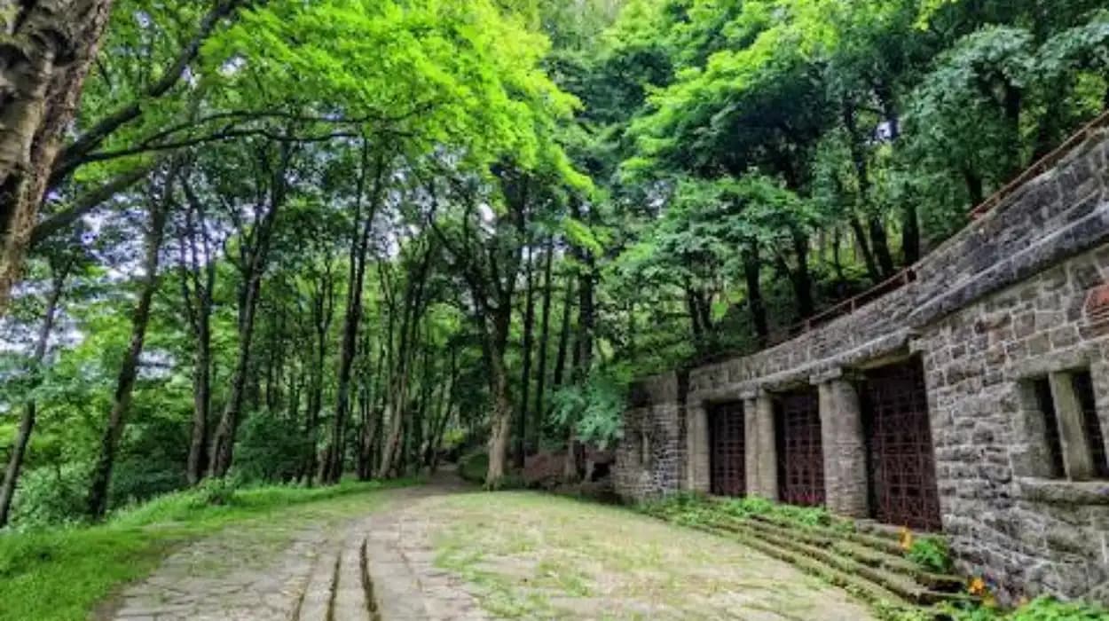
Bolton Borough contains a network of historic settlements shaped by agriculture, textile manufacturing, transport, religion, water management and local government. The modern metropolitan borough was created on 1 April 1974 and brought together the former County Borough of Bolton with established communities including Farnworth, Kearsley, Horwich, Blackrod, Westhoughton, Little Lever and South Turton.
For visitors interested in Lancashire history, these communities provide a different perspective from central Bolton. Their historic streets, former industrial sites, country estates, churches, stone buildings and surrounding landscapes preserve evidence of centuries of settlement and economic change.
The villages and village-like communities across the borough did not develop according to one pattern. Blackrod retained a strong medieval and agricultural identity before industrialisation. Horwich expanded rapidly around engineering and railway employment. Westhoughton developed from an agricultural settlement into an industrial community. Edgworth and Bradshaw retained strong connections with the surrounding valleys and moorland. Rivington preserves an unusually important combination of manor, landscape, reservoirs and designed parkland.
This geographical variety makes the borough particularly valuable for heritage tourism. A visitor can travel a relatively short distance and encounter medieval architecture, Georgian and Victorian buildings, industrial archaeology, designed landscapes and surviving rural settlement patterns.
Why are Bolton Borough’s villages historically important?
Bolton Borough’s villages are historically important because they preserve evidence of medieval settlement, Lancashire agriculture, textile production, transport development, Victorian local government and twentieth-century industrial change within a compact Greater Manchester landscape today.
The historical importance of the borough comes partly from its position between the industrial towns of Lancashire and the upland landscapes of the West Pennine Moors. Bolton developed as a market centre, while surrounding settlements occupied valleys, agricultural land and transport corridors.
Bolton Council’s historical records show that the area contained numerous separate townships before modern administrative boundaries were established. In 1872, the Bolton Rural Sanitary Authority included Bradshaw, Edgworth, Entwistle, Harwood, Heaton, Longworth, Quarlton and part of Sharples, among other communities. The authority was replaced by a Rural District Council in 1895 before its constituent townships were redistributed in 1898.
These administrative changes are important because they demonstrate that the modern borough is not a single historical settlement. It is the result of several centuries of changing local-government structures.
Industrialisation transformed the landscape between the eighteenth and twentieth centuries. Bolton Council's landscape assessment identifies the period from 1700 to 1900 as the most important influence on the borough's landscape development. Mills and bleaching works developed along waterways including the River Tonge, Bradshaw Brook and the Croal and Irwell valleys. Canals, railways and roads then reinforced these industrial corridors.
The surviving villages therefore provide historical evidence of the transition from rural Lancashire communities to an industrial and eventually metropolitan landscape.
How did Blackrod develop from an old Lancashire settlement?
Blackrod developed as an established Lancashire township before becoming an industrial community, retaining its own local institutions until 1974, when the whole settlement became part of Bolton Metropolitan Borough and continued its separate civic identity through Blackrod Town Council.
Blackrod is one of the borough's clearest examples of a settlement with a long independent administrative history. Bolton Council records describe Blackrod as a township and village in Lancashire, historically connected with the Wigan Union and County Court District, the rural deanery of Bolton and the Diocese of Manchester.
A Local Board of Health was created for Blackrod in 1872. The board reflected the Victorian expansion of local public administration, when communities increasingly assumed responsibility for sanitation, roads and other public-health functions.
Blackrod Urban District Council replaced the Local Board in 1894. The urban district continued until 1972, after which local government was reorganised again. The entire township became part of Bolton Metropolitan Borough in 1974, while Blackrod Town Council was also established that year.
For heritage visitors, this administrative history provides an important framework for understanding Blackrod. Its identity did not disappear when metropolitan government was introduced. Instead, the settlement retained a town council and a continuing local civic structure.
Blackrod's historical position also reflects the wider transformation of northern settlements. Agriculture, local trades, transport and later industrial employment altered the community without removing its older territorial identity.
The surrounding landscape remains important for interpreting this history. The relationship between settlement, roads, open land and neighbouring communities demonstrates how Lancashire townships developed before the modern metropolitan boundary existed.
Blackrod is particularly useful for visitors studying local-government history because its surviving civic identity provides a direct connection between nineteenth-century urban administration and the post-1974 metropolitan system.
What makes Horwich an important historic place to visit?
Horwich is historically important because its nineteenth-century industrial expansion created a major engineering and railway community, while its earlier Lancashire township identity remains visible through local institutions, surviving buildings and its relationship with the surrounding West Pennine landscape.
Horwich has a particularly strong connection with industrial history. Before becoming part of Greater Manchester, it was a township and civil parish in Lancashire and formed part of the Bolton Poor Law Union. A Local Board of Health was established in 1872, followed by Horwich Urban District Council in 1894.
The settlement became closely associated with railway engineering through the Lancashire and Yorkshire Railway's locomotive works. The railway industry created employment and encouraged population growth, housing development and supporting businesses.
Horwich therefore illustrates a major mechanism of industrial urbanisation. A previously rural settlement was transformed when large-scale engineering created a concentration of skilled employment. Industrial infrastructure then influenced streets, housing, transport and community institutions.
The town's position beneath the West Pennine uplands also gives it a distinctive geographical context. The built environment developed alongside open moorland and reservoirs, creating a landscape where industrial and rural histories remain closely connected.
Visitors interested in industrial archaeology should consider Horwich as part of a wider historical route rather than viewing it only as a modern residential town. Its development demonstrates how railway technology altered communities across northern England during the nineteenth and twentieth centuries.
Horwich also forms an important gateway towards Rivington and the surrounding upland landscape. This connection allows visitors to examine the relationship between industrial towns, water infrastructure, designed landscapes and rural recreation.
To experience this historic landscape in person today, consult our comprehensive [Historic Villages That Shaped Modern Bolton] for itineraries and visiting parameters.
Why should tourists visit Westhoughton for local history?
Westhoughton deserves a place on a heritage itinerary because it developed from an agricultural settlement into an industrial community, gained its own urban district administration in 1894 and retains historic civic buildings and traditions linked to its Lancashire past.
Westhoughton has one of the clearest documented transitions from rural settlement to industrial town within the borough. Bolton Council's conservation-area appraisal describes it as an ancient settlement that originated as an agricultural community. The settlement name is associated with an enclosure or village and land between brooks.
At the beginning of the fourteenth century, the Lordship of Westhoughton was granted to the Abbot and Canons of Cockersand Abbey. Following the Dissolution of the Monasteries in the sixteenth century, the lordship reverted to the Crown.
This ecclesiastical connection demonstrates how medieval landholding shaped the settlement before industrialisation.
The nineteenth century brought major economic change. Cotton manufacturing expanded, and Westhoughton developed a stronger industrial character. The growth of cotton mills contributed to the establishment of an Urban District in 1894.
Westhoughton Town Hall provides a particularly useful surviving example of this civic transformation. The building was constructed for Westhoughton Urban District Council, with foundation stones laid in April 1903. It opened on 7 December 1904. The architects were the Bolton firm Bradshaw and Gass, with the design probably associated with Arthur Hope.
The building demonstrates the connection between industrial prosperity and civic architecture. Local government required permanent offices and public buildings as urban populations expanded.
Westhoughton's heritage also includes the well-known “Keawyed” tradition. A local story concerns a cow trapped by its head in a five-bar gate. The story became associated with the community's nickname. In June 2026, Bolton Council unveiled three bronze statues on Cricketers Way commemorating elements of Westhoughton's history, including the cow tradition and the area's cricket connections.
These modern commemorations demonstrate how local heritage continues to shape public space.
What can visitors discover in Edgworth and the former Turton area?
Edgworth and the former Turton area preserve a distinctive combination of rural settlement, industrial heritage, Victorian civic development and upland landscapes, reflecting the historical communities that once operated separately before the 1974 reorganisation created new metropolitan boundaries.
Edgworth belongs to a historical landscape that was once administered through Turton Urban District. Bolton Council records show that Turton's boundaries were extended in 1898 to include Belmont, Bradshaw, Edgworth, Entwistle, Harwood, Longworth and Quarlton.
The history of Turton is particularly significant because the 1974 reorganisation divided its former territory. North Turton, including Belmont, Edgworth, Chapeltown and Entwistle, became part of the enlarged Blackburn borough, while South Turton, including Bromley Cross, Bradshaw and Harwood, became part of Bolton Metropolitan Borough.
This division demonstrates why present-day administrative boundaries do not always correspond with older cultural landscapes.
Edgworth also has strong connections with nineteenth-century industrial philanthropy. Bolton Council records identify James Barlow, a nineteenth-century industrialist and philanthropist, as a resident of Greenthorne, Edgworth. Barlow was associated with the Edgworth Spinning Company and supported local institutions, including the foundation stone of Edgworth Wesleyan Chapel in 1862.
His activities illustrate the relationship between cotton wealth, religious institutions, education and philanthropy in Victorian Lancashire.
The wider Turton landscape is also connected with water infrastructure. Reservoir construction and improvements to water supply were essential elements of industrial development in the nineteenth century. Local industrialists and civic authorities invested in water infrastructure because growing populations and factories required reliable supplies.
For visitors, Edgworth is therefore valuable not simply for its village character but for the connections between rural geography, industrial capitalism, religious life and Victorian civic development.
What makes Bradshaw and Harwood valuable heritage destinations?
Bradshaw and Harwood are valuable heritage destinations because their historic landscape preserves farmsteads, stone buildings, former rural settlements and links to Turton administration, showing how agricultural communities were incorporated into the industrial and metropolitan development of Bolton.
Bradshaw's history is closely connected with the old Turton area. Before the 1974 reorganisation, Bradshaw formed part of Turton Urban District. It later became part of South Turton within Bolton Metropolitan Borough.
Historic buildings provide important evidence of the area's earlier agricultural character. Bradshaw Hall Farm includes a former barn dating from the seventeenth and nineteenth centuries. Historic England records the structure as a Grade II listed building. The building contains a timber frame, stone walls and a stone-slate roof.
Such buildings demonstrate how farming structures evolved over time while retaining elements of earlier construction.
Bradshaw's historic identity also appears in the records of people connected with Bolton's civic development. James Scowcroft, who served as Bolton mayor in 1846–47, was born in Bradshaw, Turton, in 1788. His biography records his earlier involvement in local administration before Bolton's municipal incorporation.
Harwood similarly formed part of the former Turton administrative landscape. The settlement's historical significance is tied to its position between rural communities and the expanding industrial town.
The wider Bradshaw and Harwood landscape is particularly useful for understanding how nineteenth-century Bolton expanded beyond its central urban core. Roads connected rural settlements with markets, mills and commercial districts, while industrial wealth influenced local housing and community institutions.
For genealogical researchers, these changing boundaries are important. A historical family record referring to Turton, Bradshaw or Harwood does not automatically correspond to the modern administrative geography. Researchers need to establish the relevant township, parish, district and county for the specific date being investigated.
This distinction is essential when using parish registers, census records, electoral documents, maps and local-government archives.
Why is Rivington one of the borough’s most distinctive historic landscapes?
Rivington is distinctive because its historic landscape combines a medieval manor, Rivington Hall, nineteenth-century reservoirs, a twentieth-century public park and designed gardens associated with industrialist William Hesketh Lever and landscape designer Thomas Hayton Mawson.
Rivington provides one of the strongest examples of landscape transformation within Bolton Borough. Its history combines medieval landholding with Victorian water engineering and Edwardian landscape design.
Historic England records that the Manor of Rivington was owned by the Pilkington family from 1212 until 1605. Rivington Hall and the manor later passed through several ownership changes before the estate became connected with industrialist William Hesketh Lever, later the first Viscount Leverhulme.
The construction of reservoirs changed the landscape during the nineteenth century. Liverpool Corporation developed reservoirs on the western side of Rivington as part of its water-supply system. The historical relationship between the reservoirs and surrounding land helped shape the later development of the estate.
Lever purchased the estate after Liverpool Corporation declined an offer involving the hall and manor. In 1901, he offered approximately 160 hectares of land to Bolton Corporation for use as a public park. The landscape was developed as Lever Park, while land retained for his private estate became associated with Rivington Gardens.
Thomas Hayton Mawson designed the park and gardens. Lever Park was laid out between 1901 and 1911, and Historic England records that its overall layout remained substantially recognisable in the 1929 Ordnance Survey map.
Rivington Hall itself is Grade II* listed.
This combination makes Rivington particularly significant for heritage education. The landscape demonstrates how water infrastructure, industrial wealth, public recreation and private estate design interacted during the nineteenth and early twentieth centuries.
The site also illustrates the long-term consequences of industrialisation. Infrastructure originally developed to support expanding urban populations later became part of a recreational and heritage landscape.
How does Smithills demonstrate the survival of medieval heritage near Bolton?
Smithills demonstrates the survival of medieval heritage because Smithills Hall originated as a medieval hall house, retains important historic fabric, occupies a documented historic estate and is surrounded by a designed landscape that remains protected as a Grade II park and garden.
Smithills is one of the most important historic landscapes associated with Bolton. Smithills Hall is Grade I listed, while its surrounding park and garden are Grade II listed on the National Heritage List for England.
Historic England identifies the origins of the hall as early fourteenth century, with later additions during the fifteenth or early sixteenth century. A west wing was added in the late sixteenth century, while later alterations included work associated with architect George Devey during the nineteenth century.
The estate's history extends even further. Historic England records that the Hospitallers owned the estate from the late twelfth century or earlier. The Radcliffe family lived there from 1335, and ownership later passed through the Barton, Byrom and Ainsworth families. Bolton Corporation acquired the estate in 1938.
The estate therefore provides evidence for several distinct periods of landownership and architectural development.
Its landscape covers approximately 48 hectares and includes agricultural land, moorland and landscaped grounds. Historic England describes the park and gardens as a setting that integrates the medieval hall with nineteenth-century landscape design.
Smithills Hall became a public museum in the twentieth century. Historic England records that the medieval Great Hall and earlier parts opened to the public as a museum in 1963, while the Victorian rooms opened during the early 1990s.
Smithills therefore has exceptional educational value. A visitor can examine medieval architecture, later additions, Victorian restoration and historic landscape design within one estate.
The site also demonstrates the importance of conservation. Listing protects significant buildings and landscapes through the statutory heritage system, while continued public access allows historic structures to remain part of contemporary cultural life.
How did industrialisation change the character of Bolton’s villages?
Industrialisation changed Bolton’s villages by introducing mills, transport infrastructure, new employment, expanding populations and civic institutions, transforming agricultural settlements while leaving surviving farms, halls, roads, churches and industrial structures as evidence of earlier landscapes.
The industrial transformation of Bolton Borough was strongly linked to water, transport and textile production. Bolton Council's landscape assessment identifies 1700–1900 as the decisive period in the development of the borough's modern landscape. Mills and bleaching works concentrated along waterways, while canals, railways and roads developed through valley corridors.
The process changed both physical geography and social organisation.
Cotton manufacturing required large buildings, power sources, labour and transport. Villages located near streams or transport routes became increasingly connected to industrial centres. New housing developed around workplaces, while churches, schools, shops and civic buildings expanded to serve growing populations.
Westhoughton provides a clear example of this process. Its agricultural origins were followed by industrial growth, particularly through cotton manufacturing, which contributed to the establishment of its urban district in 1894.
Horwich demonstrates another industrial mechanism. Railway engineering created a specialised industrial workforce and transformed the settlement's economic importance.
The industrial landscape also created large-scale buildings whose architectural value remains significant. Historic England records the development of major cotton mills elsewhere in Bolton, including Swan Lane Mills, where two early twentieth-century phases created a 210,000-spindle double mill under one roof, later expanded by a third mill adding another 120,000 spindles.
These figures demonstrate the enormous scale of Lancashire's textile industry.
Industrialisation did not completely erase rural landscapes. Instead, the borough developed a layered geography in which old farmhouses, halls and village roads remained beside factories, railway infrastructure and workers' housing.
This layered character explains why Bolton's villages are useful historical destinations. Each settlement contains evidence of different economic periods rather than representing a single architectural era.
How should tourists interpret Bolton’s village heritage today?
Tourists should interpret Bolton’s village heritage as a connected historical landscape in which medieval landholding, agricultural settlement, industrialisation, Victorian administration, transport development and modern conservation remain visible through buildings, landscapes and surviving community institutions.
A heritage visit to Bolton Borough becomes more meaningful when individual settlements are understood within their wider historical relationships.
Blackrod illustrates independent township administration. Westhoughton demonstrates agricultural origins followed by industrial growth. Horwich represents railway engineering and industrial employment. Edgworth and Bradshaw reveal the historical structure of the Turton area. Rivington demonstrates the transformation of an estate through reservoirs and landscape design. Smithills preserves medieval architecture within a protected historic landscape.
The borough's administrative history is essential to interpreting these places. The current metropolitan borough was created in 1974, but the settlements within it had different political and administrative histories before that date.
Historic maps are therefore valuable research tools. Ordnance Survey maps, estate maps and local-government records can reveal former roads, boundaries, buildings and land uses that are no longer obvious from the modern landscape.
Smithills provides an especially strong example of documentary continuity. Historic England cites a 1620 estate map by William Senior, a 1769 map by Hugh Oldham and nineteenth-century Ordnance Survey mapping among the sources documenting the estate's development.
These records are valuable to educators, historians and genealogical researchers because they connect physical places with documented ownership and settlement patterns.
Conservation also determines how these historic landscapes survive. Listed buildings, registered parks and gardens, conservation areas and local heritage policies provide mechanisms for protecting significant structures and landscapes.
The National Heritage List for England records nationally significant buildings, parks, gardens, scheduled monuments and other heritage assets. Smithills Hall's Grade I status and its surrounding Grade II landscape demonstrate how different heritage designations can protect interconnected elements of one historic place.
For tourists, the result is a borough where heritage can be explored through both individual landmarks and wider landscapes.
Which Bolton villages provide the strongest heritage itinerary?
The strongest heritage itinerary combines Blackrod, Horwich, Westhoughton, Edgworth, Bradshaw, Rivington and Smithills because together they represent medieval estates, agricultural settlement, industrialisation, railway development, Victorian civic government and twentieth-century conservation.
A broad heritage itinerary should begin with the historical geography of the borough rather than treating each village as an isolated destination.
Blackrod provides an introduction to township history and local administration. Its nineteenth-century Local Board and later Urban District demonstrate how Victorian public administration developed outside major cities.
Horwich adds the industrial and railway dimension. Its history demonstrates how engineering employment reshaped a previously Lancashire-based township.
Westhoughton provides a strong example of agricultural origins followed by nineteenth-century industrial and civic development. Its town hall and surviving local traditions connect modern public space with the community's historical identity.
Edgworth and Bradshaw introduce the former Turton landscape. Their historical significance lies partly in the way older rural communities were incorporated into changing administrative structures during the nineteenth and twentieth centuries.
Rivington then provides a different type of heritage experience. Its medieval manor, reservoirs, Lever Park and designed landscape demonstrate the interaction between industrial wealth, public recreation and landscape architecture.
Smithills provides a final concentration of medieval and later architectural evidence. Its Grade I hall and Grade II historic landscape demonstrate how a medieval estate survived through centuries of alteration and twentieth-century public ownership.
Together, these settlements show that Bolton's heritage is not confined to its town centre. The surrounding communities preserve the economic, architectural and administrative foundations that shaped the modern borough.
Why will Bolton’s villages remain important for future heritage research?
Bolton’s villages will remain important for heritage research because their surviving buildings, historic landscapes, administrative records, maps and industrial remains provide primary evidence for studying Lancashire society, urbanisation, industrialisation, migration, genealogy and conservation across several centuries.
The historical value of Bolton's villages extends beyond tourism. They provide evidence for researchers studying how communities changed as Britain industrialised.
Genealogical research benefits from the survival of separate township identities. Records created before 1974 often refer to historical administrative units rather than the present metropolitan borough. Understanding these boundaries helps researchers interpret census returns, parish registers, electoral records and local-government documents correctly.
Architectural research also benefits from surviving buildings. Bradshaw Hall Farm's former barn demonstrates traditional timber-frame and stone construction, while Smithills Hall preserves medieval fabric alongside later additions.
Landscape research provides another important field. Rivington demonstrates how reservoirs and designed landscapes transformed a historic manor estate, while Smithills demonstrates the integration of medieval architecture with nineteenth-century parkland and gardens.
Industrial archaeology remains equally important. Bolton's landscape contains surviving mills, transport routes, former industrial sites and post-industrial landscapes. The council's landscape assessment identifies these remains as important elements of both historical interpretation and nature conservation.
The preservation of local archives is therefore essential. Bolton Library and Museum Service holds significant historical material, including the archive of Bradshaw Gass & Hope, the Bolton architectural practice founded in 1862 by Jonas James Bradshaw. The archive covers thousands of commissions and provides researchers with extensive evidence of the borough's architectural development.
Bolton's villages consequently have value at several levels. They are destinations for cultural tourism, sources for academic research, locations for community heritage projects and physical records of social and economic change.
The most important historical lesson is that the modern borough is a layered landscape. Medieval estates, agricultural settlements, industrial communities, Victorian institutions and twentieth-century metropolitan administration all contributed to its present form.
For visitors, this makes Bolton Borough particularly suitable for heritage exploration beyond conventional town-centre sightseeing. The villages provide direct evidence of how people occupied, worked in, governed and reshaped the landscape over time.
Their surviving architecture and landscapes also demonstrate why local history matters. A farmhouse, former mill, town hall, hall, reservoir or village road can preserve information about economic systems, social structures and political boundaries that written records alone cannot fully explain.
Bolton's historic villages therefore deserve to be treated as connected components of the borough's heritage rather than isolated scenic locations. Blackrod, Horwich, Westhoughton, Edgworth, Bradshaw, Rivington and Smithills each represent different stages in the development of the region.
Together, they form a practical historical route through the transformation of Lancashire's rural communities into the modern metropolitan landscape of Greater Manchester.
FAQS
What are the most charming villages to visit in Bolton Borough?
Some of the most historically interesting villages and village communities in Bolton Borough include Blackrod, Horwich, Westhoughton, Edgworth, Bradshaw, Rivington and Smithills. Each has distinctive connections with agriculture, industry, architecture, local government or historic estates.