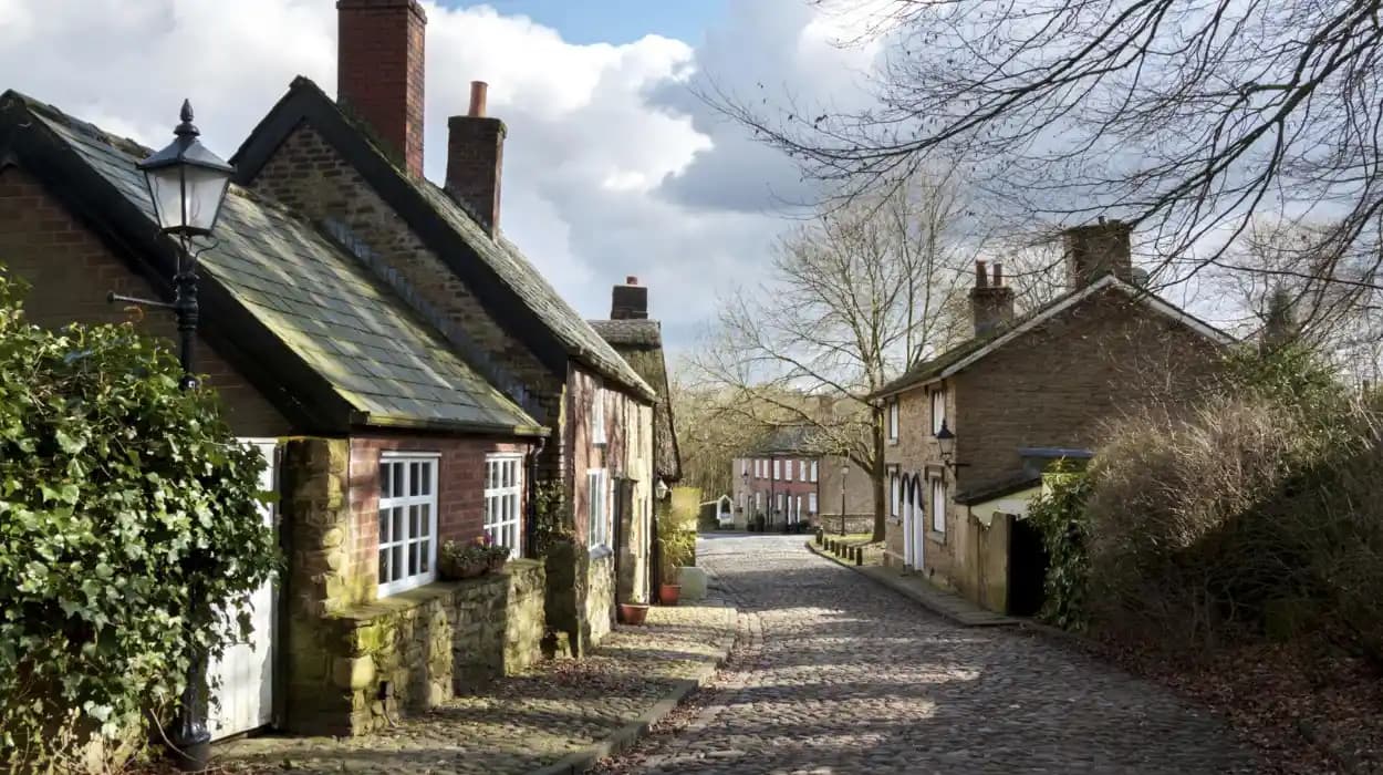
Bolton’s modern identity was formed through the gradual integration of historic townships, villages, industrial settlements, rural communities and market centres. The present metropolitan borough is therefore more than the historic town of Bolton itself. Its character reflects centuries of development across Blackrod, Horwich, Farnworth, Kearsley, Little Lever, Westhoughton, South Turton and older surrounding townships.
Bolton Metropolitan Borough was created on 1 April 1974. The new authority brought together the former County Borough of Bolton with Farnworth and the urban districts or towns of Kearsley, Horwich, Blackrod, Little Lever, Westhoughton and South Turton. Bolton Council's civic heraldry records this eight-part foundation through eight red Lancashire roses on the borough shield.
This administrative change did not erase the individual histories of these communities. Each developed its own institutions, industries, churches, transport connections, civic leadership and built environment. Those earlier identities remain visible in streets, farms, railway structures, mills, churches, conservation areas, memorials and surviving historic buildings.
How did historic villages become part of modern Bolton?
Modern Bolton developed through centuries of separate township government, industrial expansion, transport growth and twentieth-century local-government reform, culminating in the 1974 creation of Bolton Metropolitan Borough from Bolton, Farnworth, Kearsley, Horwich, Blackrod, Little Lever, Westhoughton and South Turton.
The history of Bolton is best understood as a process of integration rather than a single urban expansion. Before modern municipal government, Lancashire communities were organised through townships, civil parishes, ecclesiastical parishes and other local administrative arrangements.
Bolton itself consisted principally of Great Bolton and Little Bolton. The River Croal formed an important historical division between them. Bolton Borough was incorporated in 1838, bringing Great Bolton and Little Bolton into one municipal authority. Charles James Darbishire became the first mayor.
Beyond the central town, surrounding townships retained separate identities. Some remained predominantly rural. Others developed rapidly through cotton spinning, coal mining, engineering, transport and housing.
The nineteenth century transformed this arrangement. Industrialisation increased population density and created demand for public health administration, roads, drainage, water supplies, schools and other services. Local Boards of Health appeared in communities including Farnworth, Kearsley, Little Lever, Horwich, Blackrod and Westhoughton.
The creation of urban districts gave these communities formal local-government structures. Their councils managed services that had previously been organised through older township systems.
The 1974 reorganisation created the administrative framework recognised today. The new metropolitan borough brought these separate histories together while preserving many local identities through town councils, place names and heritage sites.
This explains why modern Bolton contains communities that retain distinctive architectural and historical characteristics despite sharing one metropolitan authority.
Why was Blackrod important to the development of Bolton?
Blackrod was an established Lancashire township and village before becoming an urban district in 1894 and joining Bolton Metropolitan Borough in 1974; its historic farms, stone cottages, schools, railway connections and local government institutions preserve evidence of its agricultural and industrial development.
Blackrod occupies an important position in the northern part of the modern borough. Bolton Council records Blackrod as a township and village within historic Lancashire, associated with the Hundred of Salford, the Wigan Poor Law Union and the ecclesiastical parish of Bolton le Moors.
Modern local government began in Blackrod in 1872, when a Local Board was established. The board dealt with essential infrastructure including water supply and drainage. In 1894 it became Blackrod Urban District Council. That authority continued until the local-government reorganisation of 1974.
Education also formed an important part of Blackrod's development. John Boardman provided land for a school in 1846 for children from labouring and manufacturing families. A Methodist school opened in 1870, while the Senior School, now Blackrod Primary School, opened in 1939.
The physical landscape retains evidence of its earlier rural character. Bolton Council's Blackrod Neighbourhood Development Plan identifies traditional stone cottages and farms as important elements of the local built environment. The same document records the community's transition into a predominantly residential settlement connected by bus and rail to larger employment centres.
Blackrod also contains surviving transport heritage. Historic England records Bridge No. 64 over the Leeds and Liverpool Canal as a structure designed by engineer John Rennie in the 1790s. This demonstrates the importance of canal infrastructure to the wider industrial landscape.
The village therefore represents a transition from agricultural township to connected industrial and residential community.
How did Horwich shape Bolton's industrial history?
Horwich became one of the borough's most significant industrial communities through nineteenth- and twentieth-century engineering development, while its earlier township structure, railway connections and surviving historic buildings preserve evidence of the transition from rural Lancashire settlement to major industrial town.
Horwich was historically a township and civil parish in Lancashire. Its ecclesiastical parish belonged to Deane, and the township formed part of the Bolton Poor Law Union. These arrangements placed Horwich within the administrative network surrounding Bolton before metropolitan government existed.
A Local Board of Health was established in Horwich in 1872. In 1894, the area became Horwich Urban District Council. The urban district remained separate until the creation of Bolton Metropolitan Borough in 1974.
The decisive transformation came through industry and transport. Horwich became strongly associated with railway engineering and manufacturing. The arrival of major railway activity changed employment patterns, population growth and the physical structure of the settlement.
Historic England's records demonstrate that the wider Horwich landscape retains buildings from several periods. Bolton Fold Farmhouse and Cottage dates from the late seventeenth century and retains dressed stone, mullioned windows and a stone-slate roof. Wilderswood Manor House dates from 1722 and retains elements of its earlier stone construction.
These buildings provide an important contrast with Horwich's industrial heritage. They demonstrate that the community did not begin with the Industrial Revolution. Agricultural and domestic structures existed before large-scale engineering transformed the town.
Horwich therefore illustrates a major pattern in Bolton's history: an older rural settlement became integrated into regional industrial networks through railways, engineering and urban development.
Its history also demonstrates why modern Bolton cannot be reduced to cotton manufacturing alone. Engineering, transport and railway production were equally important to the borough's industrial identity.
What role did Farnworth play in the growth of modern Bolton?
Farnworth developed from a Lancashire township into a formally governed urban district and municipal borough before joining Bolton in 1974; its industrial growth, civic institutions, public park, churches and surviving nineteenth-century buildings preserve its independent urban identity.
Farnworth was historically a township and civil parish in Lancashire. Its formal local-government development began with the Farnworth Local Board of Health, established in 1863.
The Local Board became Farnworth Urban District Council in 1898. In 1939 Farnworth achieved municipal borough status and elected a mayor each year. This status demonstrates the scale of its development before metropolitan government was introduced.
Farnworth's transformation was closely associated with industrialisation across the Bolton district. Manufacturing, transport, housing and public services expanded as population increased.
The community also developed civic spaces. Historic England records Farnworth Park as an important heritage site. The park opened in 1864 and was designed by William Henderson and Robert Galloway on land donated by Thomas Barnes. William Gladstone opened the park.
Farnworth also retains historic transport-related architecture. Historic England records 124 Bradford Road as a mid-nineteenth-century toll house with Tudor architectural features and rock-faced stone construction.
Religious architecture provides another layer of evidence. The historic Church of St John the Evangelist at Kearsley, within the Farnworth area, dates from 1826, with a chancel added in 1871. The building demonstrates the growth of religious and community infrastructure during the nineteenth century.
Farnworth's independent municipal history ended in 1974, when it became part of Bolton Metropolitan Borough. Its former civic status remains an important part of understanding the borough's political development.
Why is Kearsley significant to Bolton's industrial landscape?
Kearsley developed from an historic township into an urban district shaped by canals, railways, coal, mills and industrial employment; its surviving railway structures, historic farms, church architecture and mill heritage demonstrate how transport and manufacturing reshaped the community.
Kearsley was a township and civil parish in the ancient parish of Deane. Bolton Council records that it was also part of the Bolton Poor Law Union. A Local Board of Health was established on 30 October 1865 at the Black Horse Inn.
Kearsley Urban District Council was created in 1894. Its boundaries were extended in 1933 to include parts of Clifton and the Ringley district of Outwood. The urban district survived until 1974, when the whole area became part of Bolton Metropolitan Borough.
Transport played a central role in Kearsley's development. Historic England records the railway bridge by Kearsley Station as a structure built in 1837 by Jesse Hartley for the Manchester and Bolton Railway. Its elliptical arch is a surviving element of the early railway network.
The Leeds and Liverpool Canal also formed part of the area's industrial geography. Canals provided routes for transporting raw materials and finished goods before road haulage became dominant.
Kearsley retains agricultural buildings alongside industrial structures. Historic England records a cruck-framed barn at Seddon's Fold, Prestolee, dating from the late fifteenth or early sixteenth century. The building was altered through later centuries and substantially rebuilt in stone during the twenty-first century for residential use.
Kearsley Mill provides another industrial landmark. Historic England records the cotton-spinning mill on Crompton Street as dating from 1904–1908 and built for the Kearsley Spinning Company.
Together, these structures reveal a long sequence from medieval and early-modern agriculture to nineteenth-century transport infrastructure and twentieth-century textile manufacturing.
How did Little Lever contribute to Bolton's industrial communities?
Little Lever developed as a Lancashire township before establishing a Local Board of Health in 1872 and becoming an urban district in 1895; its later incorporation into Bolton in 1974 reflects the wider administrative consolidation of industrial communities.
Little Lever was historically a township and civil parish in Lancashire. Its ecclesiastical parish was in Bolton le Moors, and it belonged to the Bolton Poor Law Union.
The Local Board of Health was established in 1872. In 1894, the area covered by the board became Little Lever Urban District Council. The urban district continued until 1974, when the whole of Little Lever entered Bolton Metropolitan Borough.
This administrative history reflects the wider impact of nineteenth-century industrialisation. Local government expanded because growing communities required organised sanitation, roads, drainage and public administration.
Little Lever's location also placed it within the interconnected industrial landscape around Bolton and the River Irwell. Textile production, coal extraction, transport and worker housing influenced settlement patterns throughout the surrounding district.
The community's separate civic administration is significant for genealogical research. Records of chairmen, council activities and local institutions provide evidence for tracing families who lived and worked in the area during the nineteenth and twentieth centuries.
Bolton Council's historical records preserve the names of successive Little Lever civic leaders from 1872 onwards. This demonstrates the continuity of local administration before incorporation into the metropolitan borough.
Little Lever therefore represents the civic side of industrial history. Its significance lies not only in individual buildings but also in the institutions that managed an expanding community.
Why does Westhoughton remain essential to Bolton's heritage?
Westhoughton became a major mining and industrial community before entering Bolton Metropolitan Borough in 1974, and its heritage includes surviving civic structures, religious buildings, transport connections and the memorial to the 344 men and boys killed in the 1910 Pretoria Pit disaster.
Westhoughton was historically a township and civil parish in Lancashire. A Local Board of Health was formed in 1872, and the area became Westhoughton Urban District in 1894. The urban district was extended in 1898 through the addition of a large part of Over Hulton.
The defining industrial influence was coal mining. The Hulton Colliery Company operated the Pretoria Pit complex in Westhoughton.
On 21 December 1910, an explosion at the Pretoria Pit killed 344 men and boys. Historic England describes the disaster as the worst mining disaster in the historic county of Lancashire. A memorial on School Street commemorates those who died and serves as the gravestone for 24 unidentified bodies.
The disaster remains a central reference point in the industrial archaeology and social history of Bolton. It demonstrates the human consequences of the coal industry and the importance of mining communities to the region's economic development.
Westhoughton also developed a strong civic identity. Bolton Council records its urban district administration from 1894 until 1974. After metropolitan reorganisation, Westhoughton Town Council was created in 1985, restoring a distinct local civic institution.
Winifred Kettle provides an important example of local political history. She became the first woman elected to Westhoughton Urban District Council and later became its first female chairman. She served as chairman during several periods and was the final chairman before the authority was abolished in 1974.
Westhoughton's history therefore combines industrial labour, civic administration, community memory and twentieth-century local government.
How did South Turton and smaller townships influence Bolton?
South Turton preserved a more rural and dispersed settlement pattern while contributing to the administrative structure that created modern Bolton; communities such as Bradshaw, Harwood, Edgworth, Belmont, Darcy Lever and Great Lever also shaped the borough through agriculture, industry and local institutions.
The history of Bolton extends beyond the seven independent towns and townships that joined the former Bolton Borough in 1974. Earlier administrative arrangements incorporated numerous smaller communities into changing local authorities.
Bolton Rural Sanitary Authority was created in 1872. Its original area included Bradshaw, Breightmet, Darcy Lever, Edgworth, Entwistle, Harwood, Heaton, Longworth, Lostock, Middle Hulton, Over Hulton, Quarlton, parts of Rumworth, Sharples and Tonge-with-Haulgh.
This arrangement demonstrates the geographical complexity of historic Bolton. Communities that appear today as districts or neighbourhoods once possessed their own township identities and administrative relationships.
The authority became a Rural District Council in 1895. It was dissolved in 1898 under the Bolton, Turton and Westhoughton Extension Act. Its constituent townships were then redistributed between Bolton County Borough, Turton Urban District and Westhoughton Urban District.
South Turton represents the rural and upland side of the borough's historical development. The wider Turton area included communities such as Bradshaw, Edgworth, Entwistle, Harwood, Longworth and Quarlton.
Great Lever provides a contrasting example. It became part of Bolton County Borough through the 1898 reorganisation. Its history is closely connected to Bolton's industrial expansion and the growth of cotton manufacturing.
George Hesketh, born in Great Lever in 1852, became a cotton spinner and later chaired Astley Bridge Urban District Council from 1895 to 1898. His career demonstrates the connection between surrounding communities, industrial wealth and municipal leadership.
Astley Bridge itself had a Local Board of Health from 1864. The district covered the higher detached portion of Little Bolton and the lower portion of Sharples. It became an urban district in 1895 before being absorbed into Bolton County Borough in 1898.
These communities shaped modern Bolton through gradual administrative integration rather than one single act of urban expansion.
What historic buildings still show the villages' influence?
Historic buildings across modern Bolton preserve evidence of agricultural, religious, industrial, transport and civic development, including sixteenth-century houses, medieval farm structures, eighteenth-century buildings, nineteenth-century churches, railway bridges, mills, war memorials and historic public parks.
The surviving built environment provides direct evidence of how Bolton's communities changed.
At Firwood Fold, Historic England records a sixteenth-century house associated with Samuel Crompton, the Bolton-born inventor associated with the spinning mule. The building has a timber-framed interior and distinctive thatched roof.
Samuel Crompton was born at Firwood Fold in 1753. His spinning mule combined principles associated with earlier spinning machines and became an important development in mechanised textile production. The survival of his birthplace connects a local rural structure with the industrial transformation of Bolton.
At Seddon's Fold in Prestolee, a cruck-framed barn dates from the late fifteenth or early sixteenth century. Such structures demonstrate the agricultural foundations that preceded industrial urbanisation.
Kearsley's railway bridge provides evidence of another transformation. Built in 1837 for the Manchester and Bolton Railway, it represents the expansion of railway infrastructure during the Industrial Revolution.
Kearsley Mill, constructed between 1904 and 1908, represents a later stage of textile industrialisation. Its date shows that cotton spinning remained important into the twentieth century.
Religious buildings also document population growth. St John the Evangelist at Kearsley dates from 1826, with a later chancel from 1871. Its architecture reflects the expansion of organised religious and community institutions during industrialisation.
Public parks provide evidence of changing ideas about urban health and recreation. Farnworth Park opened in 1864, during a period when industrial communities increasingly invested in planned public spaces.
War memorials preserve another layer of collective memory. Westhoughton's memorial commemorates those affected by the First World War, while the Pretoria Pit memorial records the 1910 mining disaster.
These sites allow the history of modern Bolton to be studied through physical evidence rather than administrative records alone.
To experience this historic landscape in person today, consult our comprehensive [Explore Charming Villages Across Bolton Borough Every Tourist Should Visit at Least Once] for itineraries and visiting parameters.
How did local government transform these historic communities?
Local government transformed Bolton's historic communities by replacing older township arrangements with Local Boards, Urban District Councils, municipal boroughs and finally metropolitan government, creating coordinated administration while retaining strong local identities in towns such as Farnworth, Horwich, Blackrod and Westhoughton.
The nineteenth century introduced a new administrative framework across Bolton's communities.
Local Boards of Health addressed practical problems created by population growth. Water supply, drainage, roads and public health became increasingly important as industrial settlements expanded.
Blackrod established its Local Board in 1872. Horwich and Little Lever also established Local Boards in 1872. Westhoughton followed the same year. Kearsley established its Local Board in 1865, while Farnworth established one in 1863.
These dates show that administrative modernisation occurred before the 1974 metropolitan borough.
The next stage was the creation of Urban District Councils. These authorities provided a stronger local-government structure for communities experiencing industrial growth.
Farnworth advanced further by becoming a municipal borough in 1939. It therefore possessed its own mayoral institution before becoming part of Bolton Metropolitan Borough.
Bolton itself had already become a municipal borough in 1838. The first mayor was Charles James Darbishire.
The 1974 reform created the present metropolitan framework. Bolton Council identifies eight constituent historical units represented in the borough's heraldry: Bolton, Farnworth, Kearsley, Horwich, Little Lever, Blackrod, Westhoughton and South Turton.
This administrative history remains important for researchers. Modern boundaries do not always correspond with historical parish, township or urban-district boundaries. Genealogical research therefore requires careful attention to the date and type of local authority responsible for a particular record.
Why are these historic villages important for heritage preservation today?
Historic villages and former townships remain important because their surviving buildings, landscapes, records and civic identities provide evidence of Bolton's development from rural Lancashire communities into an industrial metropolitan borough, while conservation policies protect significant historic townscapes for future research and education.
Heritage preservation in Bolton covers both individual buildings and wider areas.
Bolton Council currently identifies 26 conservation areas, ranging from the town centre to small rural villages in the West Pennine Moors. Conservation areas protect places with special historic or architectural interest and provide a framework for managing future development.
Historic England also maintains statutory records for listed buildings and historic structures throughout the borough. These include domestic buildings, barns, churches, railway structures, mills, public parks and memorials.
The range of protected and recorded sites demonstrates that Bolton's heritage is not concentrated in the town centre.
A sixteenth-century house at Firwood Fold represents early domestic architecture. A cruck barn at Seddon's Fold represents agricultural history. The Kearsley railway bridge represents nineteenth-century transport. Kearsley Mill represents industrial manufacturing. Farnworth Park represents Victorian public recreation. The Pretoria Pit memorial represents industrial disaster and community remembrance.
These sites create a chronological record of economic and social change.
Preservation also supports education. Students can use surviving structures to understand industrialisation, local government, transport development, religious expansion and working-class communities. Genealogists can connect historic addresses and institutions with census records, parish records and civic documents.
The preservation of local identities is equally important. Bolton Council's Mayors of Bolton project documents more than 540 men and women who served as mayors of Bolton and chairmen or mayors of the other constituent townships. The project demonstrates how local civic leadership forms part of the borough's shared history.
Modern Bolton therefore retains both a metropolitan identity and a network of historic community identities.
What do the historic villages reveal about modern Bolton?
The historic villages reveal that modern Bolton is the product of layered economic, administrative and social development, combining rural settlement, textile manufacturing, coal mining, engineering, transport, civic government and heritage preservation within one metropolitan borough.
The most important lesson from Bolton's historic villages is that urban development was distributed across a much wider landscape.
Blackrod retained evidence of agricultural settlement while developing modern transport and residential connections. Horwich became strongly associated with engineering and the railway industry. Farnworth developed into a municipal borough with public institutions and parks. Kearsley combined agriculture, canals, railways and textile manufacturing.
Little Lever developed its own urban-government structure. Westhoughton became closely associated with coal mining and the memory of the Pretoria Pit disaster. South Turton and surrounding communities preserved a stronger rural character while contributing to the administrative history of the borough.
Older townships such as Great Lever, Darcy Lever, Harwood and Bradshaw also influenced the expansion of Bolton through their land, communities and economic connections.
The borough's present geography is therefore the result of repeated changes in administration, industry, transport and settlement.
The 1974 reorganisation represents the most significant modern administrative milestone. It created one metropolitan authority from historically distinct communities. Yet the individual identities of those places remain visible through town councils, historic buildings, local records, conservation areas and community institutions.
For historians, Bolton provides a useful case study in how industrial towns develop. The process did not simply replace villages with urban areas. Older settlements were incorporated into expanding economic networks while retaining physical and institutional traces of their earlier existence.
For cultural tourists, these surviving structures provide a route through several centuries of local history. For educators, they provide physical evidence of industrialisation and municipal reform. For genealogists, historical township boundaries explain why records for the same family can appear under different administrative authorities at different dates.
The future historical importance of these communities depends on maintaining accurate records and protecting significant surviving structures. Bolton's 26 conservation areas and extensive listed heritage demonstrate an established framework for that work.
Historic villages therefore remain central to understanding modern Bolton. Their histories explain the borough's geography, industries, institutions and cultural landscape. The present metropolitan borough is not a replacement for those communities. It is the administrative and social result of their long historical development.
FAQS
What historic villages shaped modern Bolton?
Historic communities that shaped modern Bolton include Blackrod, Horwich, Farnworth, Kearsley, Little Lever, Westhoughton and South Turton. Older townships such as Great Lever, Harwood, Bradshaw and Darcy Lever also contributed to the borough's development.