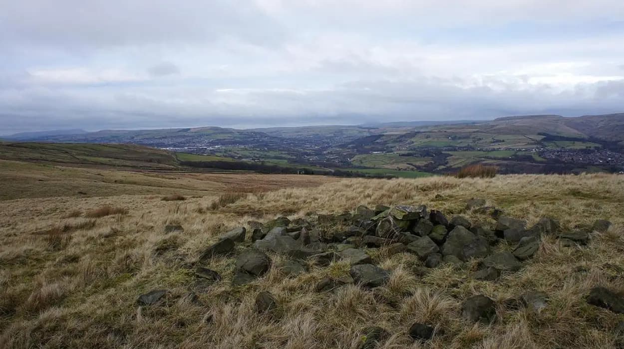
Bolton's landscape evolved through geological processes, prehistoric settlement, medieval agriculture, industrial transformation, environmental recovery, and modern conservation. The borough's hills, moorlands, rivers, reservoirs, woodlands, villages, and urban districts collectively illustrate thousands of years of natural development and human adaptation across what is now Greater Manchester. Understanding this evolution provides valuable insight into Britain's environmental history, industrial heritage, and ongoing landscape preservation.
What shaped Bolton's landscape before human settlement?
Bolton's earliest landscape formed over hundreds of millions of years through geological activity, glaciation, erosion, and river systems. Ancient rocks, Ice Age deposits, peat moorlands, and natural valleys created the physical framework that later influenced settlement, agriculture, transport, industry, and conservation throughout the borough.
The landscape surrounding Bolton originated during the Carboniferous Period, approximately 359 to 299 million years ago. During this era, tropical swamps covered much of north-west England. Layers of vegetation accumulated beneath shallow seas and river deltas before transforming into extensive coal seams under pressure over millions of years. These coal deposits later became one of Bolton's most significant natural resources.
Sandstone, mudstone, shale, and coal formed alternating geological layers across the region. Millstone Grit dominates the higher western uplands, while Coal Measures underlie much of central and eastern Bolton. This geological diversity created contrasting landforms that continue to define the borough today.
The last Ice Age dramatically reshaped Bolton approximately 20,000 years ago. Retreating glaciers deposited boulder clay, gravel, and sand across the landscape while carving valleys through softer rock formations. Meltwater established river corridors that later became important locations for settlement and industry.
The River Croal, River Tonge, River Bradshaw, and River Irwell gradually eroded valleys across the region. These waterways provided fresh water, fertile floodplains, and natural transport corridors long before engineered infrastructure existed.
The western uplands developed into extensive blanket peat moorlands. These peat deposits accumulated over approximately 8,000 years through slow decomposition of vegetation in waterlogged conditions. Today, these peatlands remain significant carbon stores and valuable ecological habitats.
How did prehistoric communities transform Bolton's natural environment?
Prehistoric communities introduced permanent environmental change through woodland clearance, farming, trackways, ritual monuments, and seasonal settlements. Archaeological evidence demonstrates that Bronze Age and Iron Age populations actively managed Bolton's hills, valleys, and upland landscapes thousands of years before written history began.
Human activity around Bolton dates back to the Mesolithic period, roughly 10,000 years ago. Small hunter-gatherer communities exploited woodland resources, hunted red deer and wild boar, and fished local rivers. Their environmental impact remained relatively limited.
The Neolithic period, beginning around 4000 BC, marked a significant transition. Farming communities gradually cleared sections of woodland to establish permanent agricultural land. Tree pollen preserved within peat deposits demonstrates a measurable reduction in native forest cover during this period.
Bronze Age communities expanded agricultural activity across Bolton's uplands. Archaeologists have identified burial cairns, field systems, and settlement evidence on elevated ground including Winter Hill and surrounding moorlands. These features indicate increasingly organised land management.
Three principal prehistoric landscape features include burial cairns, for example those on Winter Hill; enclosed settlements, for example Iron Age farmsteads; and agricultural field boundaries, for example surviving earthworks on upland moors.
Woodland clearance accelerated during the Iron Age. Communities developed enclosed farms connected by trackways that linked settlements across the region. Livestock grazing maintained open landscapes that contrasted sharply with earlier forested environments.
Archaeological investigations have recovered stone tools, pottery fragments, charcoal deposits, and environmental samples that reconstruct changing land use over thousands of years. Pollen analysis remains one of the most valuable methods for understanding prehistoric environmental transformation.
Why did medieval Bolton develop where it did?
Medieval Bolton developed where fertile valleys, reliable rivers, defensive topography, and productive farmland supported permanent communities. The combination of agricultural opportunity, water resources, woodland management, and local governance shaped settlement patterns that continued influencing development for several centuries.
Following the Norman Conquest in 1066, Bolton became part of the Manor of Manchester. Small agricultural settlements expanded gradually through mixed farming, woodland management, and local trade.
The Domesday Book of 1086 records nearby settlements, although Bolton itself remained relatively modest during this period. Population growth accelerated between the twelfth and fourteenth centuries as agriculture became increasingly productive.
Medieval Bolton consisted primarily of dispersed farmsteads connected by narrow tracks rather than concentrated urban development. Villages emerged where streams supplied dependable water and valley soils supported crop cultivation.
Open-field farming dominated the agricultural landscape. Farmers cultivated cereals while surrounding common land supported sheep and cattle grazing. Woodland supplied timber, fuel, fencing materials, and seasonal forage.
Three important medieval landscape elements included open fields, for example cultivated strips near settlements; common grazing land, for example upland pasture; and managed woodland, for example coppiced forests providing sustainable timber.
Watermills appeared along rivers and streams. These mills processed grain, demonstrating how natural watercourses increasingly powered local economic activity before industrialisation.
Religious institutions also influenced landscape development. Parish churches became focal points for surrounding communities, while church lands contributed to agricultural production and local administration.
How did coal mining and industry permanently reshape Bolton?
Coal mining, textile manufacturing, canals, railways, and urban expansion fundamentally transformed Bolton between the eighteenth and twentieth centuries. Natural valleys became industrial corridors, rural villages expanded into towns, and engineered infrastructure permanently altered both the physical environment and local economy.
The Industrial Revolution represented the most dramatic period of landscape change in Bolton's history. Abundant coal reserves and flowing rivers supported rapid industrial expansion from the late eighteenth century onward.
Coal mining expanded across the borough as demand increased for domestic heating, steam engines, and factory production. Hundreds of mine shafts, spoil heaps, tramways, and associated settlements altered the rural landscape.
Textile manufacturing became Bolton's defining industry. Cotton spinning mills concentrated along rivers that initially provided water power before steam engines became widespread. Industrial buildings increasingly dominated valley floors.
Three major industrial landscape features included cotton mills, for example large spinning complexes; collieries, for example deep coal mines; and railway infrastructure, for example embankments, cuttings, and viaducts.
The Manchester, Bolton and Bury Canal opened in 1791, improving transportation of coal, limestone, agricultural products, and manufactured goods. Canal construction required extensive earthworks, locks, aqueducts, and engineered embankments.
Railways further transformed the borough during the nineteenth century. Railway lines crossed valleys, tunnels penetrated hillsides, and stations stimulated suburban expansion.
Urbanisation accelerated dramatically. Housing districts expanded around mills and collieries, replacing agricultural land with dense residential development. Population increased from fewer than 20,000 during the late eighteenth century to well over 180,000 by the early twentieth century.
Industrial pollution also altered the environment. Smoke emissions affected vegetation, rivers received industrial waste, and spoil heaps changed local topography. Despite these impacts, industry established the economic foundations that shaped modern Bolton.
How did reservoirs, moorlands, and rivers influence landscape evolution?
Reservoir construction, river management, upland conservation, and water engineering reshaped Bolton's environment while ensuring reliable water supplies. These interventions balanced industrial demand, public health, flood management, and environmental protection across both urban and rural landscapes.
Reliable water became increasingly important as Bolton's population expanded during the nineteenth century. Existing rivers alone could not satisfy growing industrial and domestic demand.
Reservoir construction transformed upland valleys. Engineers created large artificial lakes by damming natural watercourses. These projects submerged farmland while establishing essential public infrastructure.
Three major water landscape components include reservoirs, for example Jumbles Reservoir; river systems, for example the River Croal; and upland catchments, for example Winter Hill's surrounding moorland.
Reservoir catchments encouraged woodland planting to improve water quality and reduce soil erosion. Consequently, many modern woodland areas reflect nineteenth- and twentieth-century environmental management rather than ancient forest survival.
Rivers underwent extensive modification within urban districts. Engineers straightened channels, constructed retaining walls, and installed culverts beneath expanding streets and industrial areas.
Meanwhile, upland moorlands retained significant ecological value. Blanket bog habitats supported specialised vegetation including sphagnum mosses, cotton grass, and heather while regulating water storage across large catchments.
Modern river restoration programmes increasingly reverse earlier engineering practices by improving habitats, reducing flood risk, and enhancing biodiversity throughout the borough.
To experience these historic landscapes in person today, consult our comprehensive [Discover the Best Sunset Views Around Bolton for Evening Sightseeing Adventures] for itineraries and visiting parameters.
What remains of Bolton's historic landscape today?
Historic landscape features survive across Bolton through preserved buildings, archaeological sites, historic field boundaries, reservoirs, canals, moorlands, and protected parks. These surviving elements provide direct physical evidence of successive historical periods and support education, tourism, scientific research, and community identity.
Despite extensive urban development, numerous historic landscape features remain clearly visible.
Winter Hill preserves extensive prehistoric archaeology alongside nationally important peatland habitats. Historic packhorse routes continue crossing upland areas originally developed centuries before modern roads.
Former industrial corridors retain mills, bridges, canal structures, railway infrastructure, and workers' housing. Many redundant industrial buildings have found new uses while preserving architectural character.
Three surviving landscape categories include industrial heritage, for example restored mill buildings; agricultural heritage, for example ancient hedgerows; and natural heritage, for example protected moorland habitats.
Historic field boundaries remain visible in several rural areas despite agricultural modernisation. Hedgerows, dry-stone walls, and earthworks preserve medieval land divisions established hundreds of years ago.
Public parks also reflect changing landscape priorities. Victorian authorities converted former private estates into recreational green spaces that improved public health while preserving mature trees and designed landscapes.
Scheduled monuments, listed buildings, conservation areas, and designated local nature reserves collectively protect many historically significant locations throughout the borough.
These preserved landscapes enable archaeologists, historians, ecologists, educators, and genealogical researchers to investigate long-term environmental change using both physical evidence and documentary records.
How is Bolton's landscape protected for future generations?
Modern conservation combines environmental restoration, heritage protection, archaeological research, planning policy, and community engagement. Local authorities, heritage organisations, conservation charities, and researchers collaborate to preserve Bolton's distinctive landscapes while accommodating sustainable development and climate resilience.
Landscape conservation increasingly recognises that natural and cultural heritage are interconnected. Geological formations, archaeological remains, industrial structures, wildlife habitats, and historic settlements collectively contribute to Bolton's identity.
The planning system protects conservation areas, listed buildings, scheduled monuments, and designated ecological sites through legal frameworks that regulate development.
Three principal conservation approaches include heritage preservation, for example restoring historic structures; habitat restoration, for example peatland recovery; and sustainable planning, for example protecting historic landscape character.
Peatland restoration represents one of the most significant environmental initiatives. Restoring damaged blanket bog reduces carbon emissions, improves biodiversity, and enhances water retention across upland catchments.
Archaeological investigations continue before major development projects. Excavations recover artefacts, environmental evidence, and structural remains that expand understanding of Bolton's historical evolution.
Community organisations contribute through local history projects, volunteer conservation, educational programmes, and heritage interpretation that connects residents with their surrounding landscapes.
Digital mapping technologies, aerial photography, LiDAR surveys, and environmental monitoring increasingly support evidence-based conservation planning. These techniques identify previously unknown archaeological features while documenting landscape change with remarkable precision.
Climate change introduces new conservation challenges including increased flood risk, erosion, habitat alteration, and pressure on historic structures. Adaptive management strategies therefore integrate environmental resilience with heritage preservation.
Bolton's landscape represents the cumulative outcome of geological evolution, prehistoric land management, medieval agriculture, industrial expansion, engineered water systems, environmental restoration, and contemporary conservation. Every hill, valley, river, woodland, reservoir, settlement, and former industrial corridor reflects distinct historical processes operating across different periods.
Coal formation during the Carboniferous Period established the geological resources that later powered industrialisation. Ice Age glaciers shaped valleys and drainage systems that attracted early settlement. Prehistoric communities cleared woodland and established agriculture. Medieval farmers organised the countryside through open fields and managed woodlands. Industrial entrepreneurs transformed rivers, transport networks, and urban districts into one of Britain's significant manufacturing centres.
Although industrial activity dramatically altered Bolton's environment, extensive natural and historic features survive. Upland moorlands continue storing carbon and supporting biodiversity. Historic canals, mills, railways, churches, reservoirs, and agricultural landscapes preserve evidence of successive generations adapting to changing environmental, economic, and social conditions.
Modern conservation recognises that Bolton's landscape is both a historical archive and a living environment. Protecting geological formations, archaeological sites, industrial heritage, historic settlements, and ecological habitats ensures future generations can understand how centuries of natural processes and human activity collectively shaped one of Greater Manchester's most distinctive landscapes.
FAQS
What natural features define Bolton's landscape?
Bolton is characterised by the West Pennine Moors, Winter Hill, rivers such as the River Croal, reservoirs, peat moorlands, woodlands, valleys, and rolling farmland that together create its distinctive scenery.