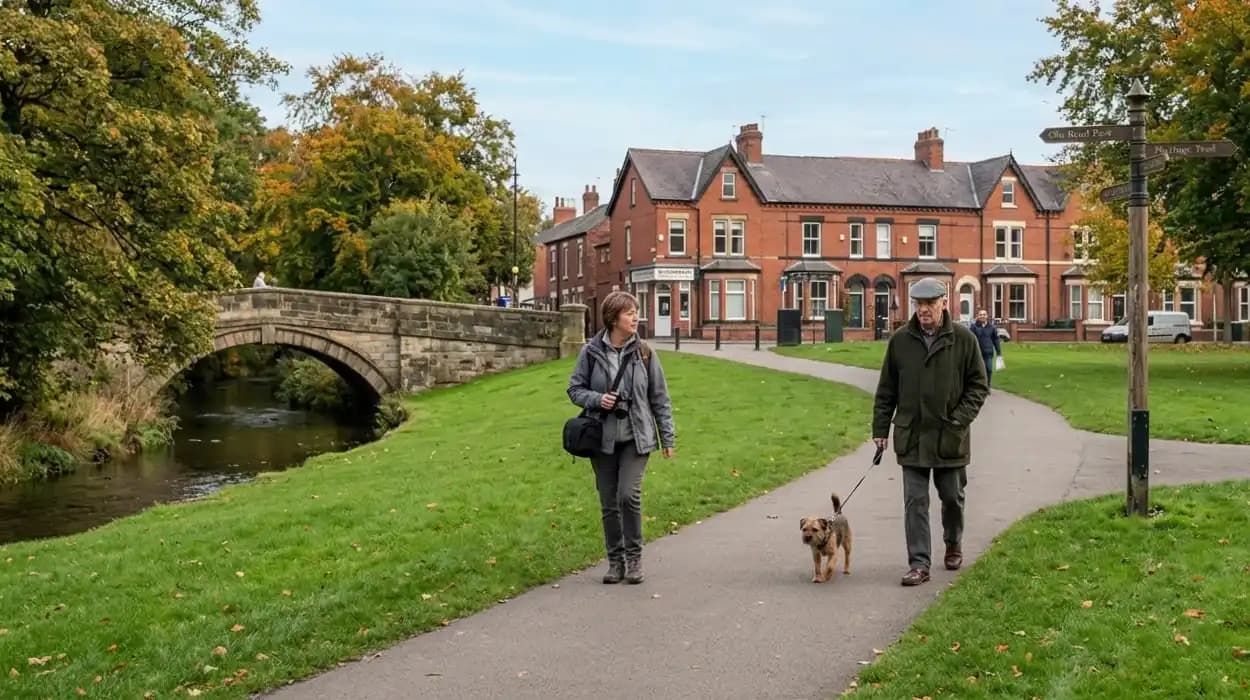
Astley Bridge is a distinct township and electoral ward located approximately 2.5 miles north of Bolton town centre in Greater Manchester, England. For first-time visitors, this historic area provides a combination of environmental conservation sites, suburban infrastructure, and industrial heritage landmarks. This comprehensive guide, presented by Bolton Today, evaluates the primary geographic locations, pedestrian networks, public spaces, and community assets that define the area for new arrivals.
What Is the Geography and Historical Background of Astley Bridge?
Astley Bridge is a northern suburb of Bolton defined geographically by its position along the Blackburn Road (A666) corridor and the historic valley of the River Tonge, which facilitated its transformation from agrarian land into a major nineteenth-century textile manufacturing hub.
The structural development of Astley Bridge began significantly during the Industrial Revolution. Prior to the mid-nineteenth century, the area consisted primarily of dispersed agricultural homesteads and small-scale coal mining operations. The commissioning of the Blackburn Road turnpike in the early 1800s provided a direct transportation line between Bolton and Blackburn, altering local trade routes.
The presence of local water sources, specifically the River Tonge and the Astley Brook, led to the construction of large-scale cotton spinning and weaving mills. Industrial developers established facilities such as the Holden Mills complex, which specialized in fine cotton spinning. By the time the township was formally incorporated into the County Borough of Bolton under the Bolton Improvement Act of 1877, Astley Bridge had transitioned into a high-density urban industrial settlement.
Architecturally, this period left a legacy of red-brick terraced housing built specifically for the factory workforce, alongside imposing mill structures that dominate the local skyline. The modern layout retains these historic boundary markers, flanked by mid-twentieth-century residential expansions and preserved green corridors.
Where Are the Best Public Parks and Green Spaces in and Around Astley Bridge?
First-time visitors can access prominent green spaces within and adjacent to Astley Bridge, specifically Moss Bank Park to the west, Seven Acres Country Park to the southeast, and the localized open grounds of Astley Bridge Park off Moss Bank Way.
Moss Bank Park
Moss Bank Park is a major regional public park spanning approximately 34 hectares (84 acres) located immediately westward of the Astley Bridge boundary. Managed by Bolton Council, the park contains diverse recreational facilities, including:
- Laminated formal gardens and open parkland.
- Dedicated children's play areas and an operational miniature railway.
- The Hive, a community food-growing and environmental education hub managed by the Lancashire Wildlife Trust.
Historically, the land formed the private estate of the Ainsworth family, prominent local bleaching industrialists, before its acquisition for public use in 1923.
Seven Acres Country Park
Situated along the eastern and southeastern borders of the district, Seven Acres Country Park comprises a 32-hectare (79-acre) local nature reserve. The park follows the path of the River Tonge and features an array of distinct ecosystems, such as:
- Broadleaf woodlands dominated by oak and birch trees.
- Managed wildflower meadows.
- Wet woodlands and open ponds providing habitats for local fauna.
The site is a designated Local Nature Reserve (LNR) and features a network of well-maintained pedestrian pathways suitable for nature observation and wildlife tracking.
Astley Bridge Park
For an immediate urban green space, Astley Bridge Park provides local residents with localized recreational fields, standard pedestrian walkways, and clear views across the Astley Brook valley. It serves as a central buffer zone between the dense residential avenues and the primary commercial highway of the A666.
Explore More Things To Do In Bolton
Best Charity Shops for Furniture and Fashion in Bolton
Best Live Music Venues and Local Bands: Bolton
What Are the Most Popular Walking Routes and Trails for Pedestrians?
Pedestrian trail networks in Astley Bridge focus primarily on the Kingfisher Trail along the River Tonge valley, the circular perimeter routes within Moss Bank Park, and the historic urban walking paths tracing industrial mill architecture.
The Kingfisher Trail
The Kingfisher Trail is an established 11-mile environmental walking route that passes directly through the eastern fringes of Astley Bridge. The trail utilizes the river valley of the River Tonge, the Croal, and the Irwell. For visitors entering the trail at Astley Bridge, the route provides clear access to:
- Dense riparian woodland zones where bird populations, including the common kingfisher (Alcedo atthis) and grey heron (Ardea cinerea), are regularly documented.
- Remnants of industrial stonework, weir systems, and historical sluice gates used by nineteenth-century mills to divert water.
- Geologically stable pathways constructed on top of reclaimed railway ballasts and old towpaths.
The Moss Bank and Barrow Bridge Link
This pedestrian route connects the western edge of Astley Bridge to the historic industrial village of Barrow Bridge. Walking westward through Moss Bank Park, pedestrians can join the trail leading up to the West Pennine Moors. The route includes specific landscape features:
- The 63 Steps, a historic stone staircase leading up towards the high moorland fields.
- The High Rid Reservoir trail, which offers open, elevated views of the wider Bolton basin.
- Wooded valley walks tracking the Dean Brook.
The Industrial Heritage Urban Walk
This self-guided architectural route follows the linear path of Blackburn Road and its intersecting avenues. It allows visitors to document the structural scale of early industrial developments, starting from the southern approach near the historic Astley Bridge tram depot sites, moving north past the remaining structural masonry of Holden Mill, and concluding near the stone-built bridge over the brook that gave the district its name.
What Local Architectural and Heritage Highlights Should Visitors Look For?
The primary structural and heritage highlights in Astley Bridge consist of Grade II listed industrial cotton mills, late-Victorian civic architecture, and historic stone bridges that mark the ancient boundaries of the township.
Holden Mill (The Cotton Works)
Holden Mill stands as one of the most architecturally significant industrial structures in northern Bolton. Constructed in 1926, this massive facility was designed as a double spinning mill and represents the final generation of monumental brick-built textile factories erected in Lancashire before the economic decline of the UK cotton trade (Lyon, 1963). Key structural elements include:
- A distinct concrete flat-roof configuration designed to maximize interior space and safety.
- A prominent, unaltered rectangular brick staircase tower.
- An external facade characterized by multi-light windows designed to maximize natural illumination on the spinning floors.
The building has undergone comprehensive structural regeneration and functions as a modern residential apartment complex known as The Cotton Works.
The Astley Bridge Methodist Church and Local Chapels
The religious architecture of the area reflects the socio-religious demographics of the nineteenth-century industrial workforce. The Astley Bridge Methodist Church, alongside nearby historic stone chapels, features characteristic late-Victorian Gothic Revival styles, including pointed-arch fenestration, localized gritstone masonry, and preserved internal structural timbers.
The Historic Bridge Infrastructure
The physical bridge structure crossing the Astley Brook near the junction of Blackburn Road and Crompton Way marks the historic geographic core of the district. While modern road engineering has widened the transport surface, the lower foundational stonework contains structural elements from early iterations of the crossing that connected the historic townships of Little Bolton and Sharples.
How Do Visitors Access the District and What Practical Logistics Matter?
Astley Bridge is highly accessible via the regional transport network of Greater Manchester, using multiple high-frequency bus corridors, primary arterial roads, and nearby rail infrastructure located in central Bolton.
Public Bus Services
The area is serviced continuously by Transport for Greater Manchester (TfGM) bus networks running along the A666 corridor. Multiple regular bus routes operate between the Bolton Interchange and Blackburn, providing direct access to Astley Bridge at intervals of 10 to 15 minutes during standard operational hours. Key boarding and alighting points are positioned directly outside the main commercial zones on Blackburn Road.
Road and Rail Connectivity
For visitors arriving via private motor vehicles, the district is linked directly to the regional motorway network:
- The A666 (St Peter's Way): Connects the area directly southward to the M61 motorway, providing an direct link to Manchester, Liverpool, and Preston.
- The A232 (Crompton Way / Moss Bank Way): Functions as a critical northern ring-road component, enabling east-west orbital transit across Bolton without entering the central business district.
The closest national rail station is the Bolton Railway Station, located approximately 2.6 miles south of Astley Bridge. From the station, visitors can transfer directly to northern-bound bus routes or utilize taxi ranks to reach the suburb within approximately 10 to 12 minutes under normal traffic conditions.
Local Amenities and Retail Footprint
The commercial center of Astley Bridge is concentrated linearly along Blackburn Road. Visitors can access a large, modern Asda superstore, which provides extensive parking facilities and public electric vehicle charging stations. This commercial corridor contains a dense mix of independent retail shops, local pharmacies, post offices, and traditional pub establishments that serve the local population.
What Is the Future Urban and Environmental Outlook for Astley Bridge?
The future development of Astley Bridge focuses on the environmental preservation of its river corridors, the continuous adaptive reuse of its remaining industrial architectural footprint, and active transportation upgrades overseen by local authorities.
Bolton Council’s long-term environmental strategies emphasize the preservation of the River Tonge and Astley Brook valleys as key structural components of the town's green infrastructure. These policies ensure that areas like Seven Acres Country Park receive continuous ecological protection to safeguard biodiversity indexes while expanding pedestrian access networks.
Infrastructure improvements focus heavily on sustainable transport initiatives. Plans include upgrading the cycling and pedestrian pathways intersecting the A666 and Crompton Way junctions to reduce carbon emissions and promote active travel. Additionally, the district's remaining Victorian architectural structures are continuously monitored under local heritage frameworks to ensure that any future urban regeneration respects the structural history and industrial character of the area.
FAQS
What is Astley Bridge known for?
Astley Bridge is known for its industrial heritage, historic cotton mills, Victorian terraced housing, green spaces, and access to walking routes connected to the River Tonge valley and West Pennine Moors.