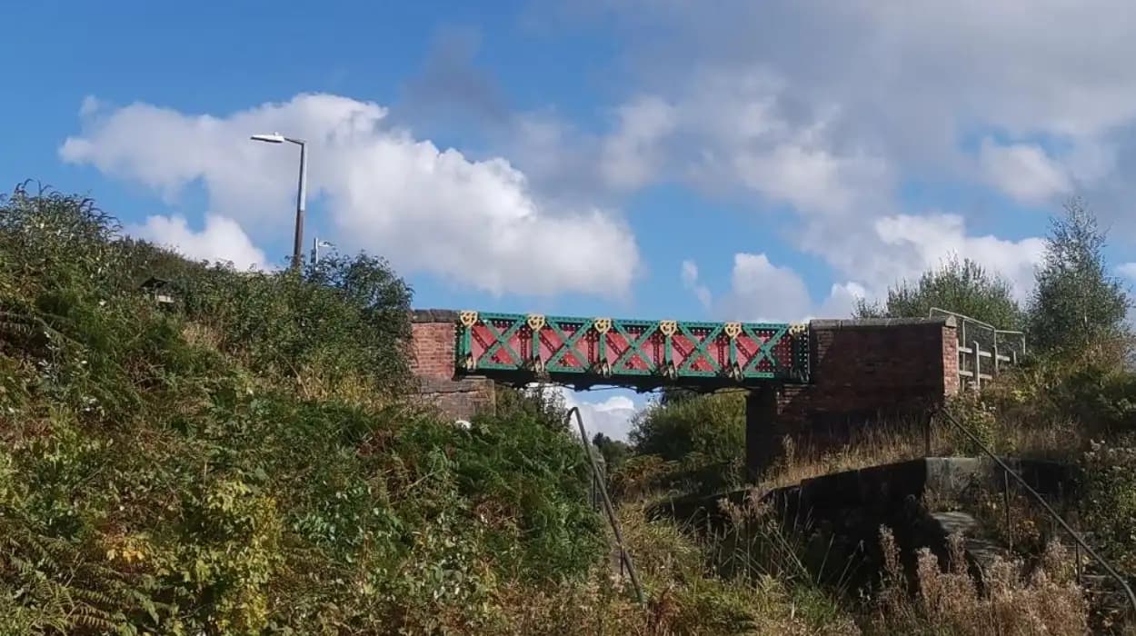
Moses Gate developed within a wider industrial transport network shaped by the River Croal, Manchester, Bolton and Bury Canal, coal mining, papermaking, bleaching, roads and railways. Its waterways connected local industries with Bolton, Bury, Salford and Manchester, transforming regional trade during industrialisation.
Moses Gate is a historic district of Farnworth in the Metropolitan Borough of Bolton, Greater Manchester. Its industrial history is closely connected with the Croal-Irwell valley, where water, coal, mills, chemical works, roads, railways and canals operated within a compact industrial landscape.
The Manchester, Bolton and Bury Canal was central to this transformation. The canal connected the industrial districts around Bolton and Bury with the River Irwell at Salford. From there, goods entered the wider waterway network serving Manchester and beyond. The canal therefore formed part of a much larger system rather than functioning as an isolated local waterway.
Moses Gate also had an important relationship with the River Croal. The river supplied water for industrial processes, powered earlier mills and shaped the valley through which later transport infrastructure developed. The remains of industrial activity are still visible around Moses Gate Country Park, including the river, mill ponds, canal retaining banks and other archaeological features.
Why did canals become important around Moses Gate?
Canals became important because industrial Bolton, Farnworth and surrounding districts needed cheaper transport for coal, raw materials and manufactured goods. The Manchester, Bolton and Bury Canal connected local industries with Salford and Manchester, reducing dependence on poor roads for heavy cargo.
Before canal construction, industrial transport depended heavily on packhorses, carts and existing roads. Heavy commodities such as coal were expensive to move by road because of their weight and the poor condition of many routes.
The growth of textile manufacturing increased the demand for reliable fuel and raw materials. Steam engines also increased industrial coal consumption from the late eighteenth century. The districts north-west of Manchester contained extensive coal resources, but efficient movement towards Manchester required better transport infrastructure. The Manchester Bolton & Bury Canal Society identifies this pressure on transport as a major reason for constructing the canal.
The Bolton-to-Manchester road had been turnpiked in 1763, with a toll bar at Moses Gate. Turnpike roads were privately managed roads funded partly through tolls. The presence of a toll bar demonstrates that Moses Gate already occupied an important position on the regional land route before the canal era.
The canal introduced a second major transport corridor. It handled bulk goods more efficiently than horse-drawn road transport and connected industrial settlements with the River Irwell.
This combination of road, river and canal transport helped create the infrastructure required by the Industrial Revolution in the Bolton-Farnworth area.
When was the Manchester, Bolton and Bury Canal built?
The Manchester, Bolton and Bury Canal received its Act of Parliament in 1791, opened between Bolton, Bury and Salford in 1797, and reached the River Irwell through additional locks in 1808, creating a major regional industrial waterway.
The canal was authorised by Parliament in 1791. Construction followed during a period when canal building was transforming Britain's transport system.
The first major section opened in 1797. It connected Bolton and Bury with Oldfield Road in Salford. The canal was subsequently extended through five additional locks to the River Irwell, completing the connection in 1808. The full canal measured approximately 15 miles and one furlong according to records cited by the Manchester Bolton & Bury Canal Society.
The canal's route was designed around industrial geography. It served settlements containing coal mines, textile mills and other businesses rather than simply connecting population centres.
At Prestolee, near Little Lever, the canal divided into two routes. The main line continued towards Bury while the Bolton arm headed north-west towards Bolton. Moses Gate and the Croal valley therefore sat within the industrial landscape surrounding this canal system.
The engineering required bridges, locks, embankments, cuttings, aqueducts, reservoirs and water-control structures. Later surveys recorded these features in detail. A British Waterways engineering survey from about 1963 documented structures including aqueducts, bridges, banks, culverts, feeders, weirs, locks, pumping stations, sluices and tunnels.
How did Moses Gate connect to the canal network?
Moses Gate connected to the canal landscape through the Croal valley and the Manchester, Bolton and Bury Canal, whose surviving sections lie beside industrial sites, former works and transport routes. The canal formed part of the wider Bolton-Bury-Salford trade corridor.
The canal did not simply run through Moses Gate as a conventional town-centre waterfront. Its relationship with the district developed through the valley's industrial geography.
The Manchester, Bolton and Bury Canal survives in sections around Moses Gate, Prestolee, Nob End and Little Lever. Bolton Council identifies Canal Wood at Moses Gate as being situated on the retaining bank of the Manchester, Bolton and Bury Canal.
The canal also formed part of a wider network of waterways. Its southern connection with the River Irwell at Salford allowed goods to move towards Manchester. The Irwell itself was an important navigation route and connected the canal to the wider commercial system of the Manchester region. Research into Manchester's early waterfronts describes the Manchester, Bolton and Bury Canal as a link intended to connect textile mills and collieries north-west of Manchester with the Irwell at Salford.
This connection mattered because industrial trade depended on multiple stages. Coal could move from a colliery to the canal, travel by boat to Salford and then enter the wider Manchester trading system.
The canal therefore provided an important link between local extraction and regional consumption.
What goods were transported through the Moses Gate canal landscape?
Coal dominated Manchester, Bolton and Bury Canal traffic, while other cargo included stone, timber, bricks, slate, limestone, salt and agricultural materials. The waterway also supported passenger boats and parcel services during its nineteenth-century operating period.
Coal was the principal commodity. Numerous collieries operated along the canal's route, including Outwood and Ladyshore. Some mines were connected to the waterway by short tramways or roads. This arrangement allowed coal to move from extraction sites to canal loading points before being transported by boat.
The canal also carried other industrial materials. Recorded cargoes included stone, timber, bricks, slate and limestone. Salt was particularly important because chemical, bleaching and dyeing industries required it. Salt transported from Cheshire supplied industrial works in the region, and the Bolton arm contained a location known as Salt Wharf.
The scale of trade became substantial. By the late nineteenth century, annual canal traffic included as much as 650,000 metric tonnes of coal and approximately 43,000 metric tonnes of other materials. These figures demonstrate that the canal served a major bulk-transport economy.
The canal was not limited to industrial cargo. Passenger and parcel boats also operated. Canal records and historical research describe packet boats carrying passengers and parcels between Salford and destinations including Bolton and Bury.
The variety of cargo reveals the canal's wider economic function. It supplied factories, transported fuel and raw materials, moved waste and agricultural products, and connected industrial communities with regional markets.
How did coal mining shape trade around Moses Gate?
Coal mining shaped trade by creating sustained demand for efficient bulk transport. Collieries around the Croal and Irwell valleys supplied fuel for textile mills, engineering works and other industries, while canals and tramways moved coal towards Bolton, Bury, Salford and Manchester.
Coal was the foundation of much nineteenth-century industrial transport in the region. Steam power increased demand for coal, particularly from cotton mills and other mechanised factories.
Moses Gate formed part of an industrial landscape containing coal workings and other extraction sites. The wider Farnworth district experienced rapid industrial growth around coal mining during the eighteenth and nineteenth centuries.
Coal did not always travel directly from a pit to a canal. Short tramways and roads connected individual collieries with loading points. This created a multi-stage freight system involving mine, tramway or road, canal boat and destination wharf.
The canal's importance was therefore linked directly to the geography of the coalfield. Collieries were sufficiently close to the canal to make short-distance water transport economically useful.
Research into the canal's industrial role records that the surrounding collieries were major sources of Manchester's canal coal during the nineteenth century. The canal's coal trade supported industries in Manchester and the wider region.
The transport system also influenced the location of industrial facilities. Businesses benefited from proximity to water transport because heavy materials could arrive more efficiently than by road.
What role did the River Croal play in Moses Gate industry?
The River Croal supplied industrial water, provided power for earlier manufacturing and shaped the physical valley around Moses Gate. Its relationship with mills, ponds and the canal created a closely connected industrial landscape before later decline and environmental restoration.
The River Croal is fundamental to understanding Moses Gate's industrial geography.
Before modern industrial infrastructure, rivers supplied water for mills and other manufacturing activities. At Moses Gate, the Crompton family's paper-making operation developed beside the Croal.
Bolton Council records state that the first paper mill in Lancashire is reputed to have been built by Thomas Bonser Crompton in 1766 on the River Croal below Moses Gate. The council also records that Benjamin Rawson established Bolton's earliest recorded vitriol works at the end of the eighteenth century.
The paper industry became particularly important. Lancashire Wildlife Trust identifies Farnworth Paper Mills as one of the largest paper producers in the country during the nineteenth century. Thomas Bonsor Crompton developed a continuous paper-drying process and built the business around the water resources of the valley.
Water quality became an industrial issue as surrounding industries expanded. The paper works required a controlled supply of suitable water, leading to the construction of a large weir and mill ponds.
The surviving Crompton Lodges demonstrate how industrial operators modified the river environment to secure water resources. Today these former industrial water bodies form part of the ecological landscape at Moses Gate Country Park.
How did paper manufacturing affect trade at Moses Gate?
Papermaking established Moses Gate as an important manufacturing site before the canal era reached its mature form. Farnworth Paper Mills used the River Croal, employed local workers, and later became part of the industrial landscape that included canals, coal mines, chemical works, and bleaching.
Papermaking at Moses Gate has roots extending back before the nineteenth-century industrial expansion.
The Crompton family became closely associated with Farnworth Paper Mills. Thomas Bonsor Crompton developed the business into a major paper manufacturer. Lancashire Wildlife Trust records that the Croal-Irwell valley contained 25 paper mills and that Farnworth Paper Mills employed about 500 people at its height.
This scale of employment demonstrates the importance of manufacturing to the local economy.
The paper industry also shows why water infrastructure mattered. Industrial production depended on controlled water supplies, mill ponds, and river management.
Rock Hall, built in 1807, later became associated with the industrial history of the area. Bolton Council records that the building was occupied by the Crompton family before later being associated with managers of a bleach works.
The transition from papermaking to bleaching demonstrates the changing industrial economy of the valley. Industrial premises could be adapted for new manufacturing purposes as markets and technologies changed.
How did bleaching and chemical industries change the area?
Bleaching and chemical industries expanded the industrial economy around Moses Gate by using water, fuel and transported raw materials. Their operations added new manufacturing functions to the valley and contributed to the heavily industrialised landscape later reclaimed as Moses Gate Country Park.
Bleaching became increasingly important in Lancashire during the first half of the nineteenth century. The discovery and industrial use of chlorine-based bleaching processes transformed textile finishing from smaller-scale production into factory-based operations requiring large quantities of clean water.
Moses Gate and the surrounding Croal valley contained several industrial operations connected to this transformation.
The former Farnworth Paper Mills later became a bleach works. Bolton Council records that when the paper-making business failed in the 1890s, the mills became a large bleach works.
Chemical manufacturing also operated in the surrounding landscape. Rawson's vitriol works produced sulphuric acid, known historically as vitriol, which had industrial uses including textile bleaching.
These industries required substantial supplies of raw materials. Canals provided a means of moving heavy commodities such as coal, salt, stone and other materials.
The industrial landscape was therefore integrated. Water supplied processes. Coal supplied energy. Canals supplied transport. Roads connected factories and mines. Railways later provided faster connections.
How did roads and railways compete with canal trade?
Roads initially complemented canal transport, while railways eventually reduced the canal's commercial importance. Moses Gate already had a turnpike route before canal construction, and its railway station later strengthened connections with Bolton, Manchester and other industrial centres.
Transport around Moses Gate did not depend on canals alone.
The Bolton-Manchester road was turnpiked in 1763, demonstrating the importance of road transport before the canal reached the area. A later Moses Gate and Ringley Turnpike Act was passed in 1830, while a Highways Board was established in 1865.
Railways introduced a much more direct competitor.
The Manchester, Bolton and Bury Canal company itself became involved in railway development. An Act of 1831 transformed the organisation into the Manchester, Bolton and Bury Canal Navigation and Railway. The railway opened in 1838, with passenger services beginning in May and goods traffic from early 1839.
The relationship between canal and railway was unusual. Coal traders opposed proposals that would have closed parts of the canal because they feared losing access to water transport. The resulting arrangements required the canal to remain open while the railway was constructed broadly alongside it where practical.
Moses Gate also gained its own railway station, reinforcing its position within the regional transport network.
The railway eventually became more important for passengers and many types of freight. The canal remained valuable for bulk coal traffic for decades, but its commercial role steadily contracted during the twentieth century.
When did canal trade around Moses Gate decline?
Canal trade declined during the twentieth century because railway and road transport became increasingly competitive, collieries closed, canal infrastructure deteriorated, and mining subsidence caused serious structural problems. The Manchester, Bolton and Bury Canal was finally abandoned for navigation in 1961.
The decline was gradual rather than immediate.
By the early twentieth century, road and rail transport offered increasing competition. Coal remained important, but falling coal production reduced the volume available for canal transport.
By 1924, traffic on the Bolton arm had fallen significantly. During the 1930s, colliery closures accelerated the decline. Mining subsidence also affected canal banks along the Irwell and Croal valleys.
A major canal breach occurred at Little Lever in 1936. Bolton Council's flood-risk assessment records that the breach resulted in the disused canal being divided into three isolated sections.
The abandonment process followed. Under the London, Midland and Scottish Railway Act 1941, approximately seven miles of canal were abandoned, including the entire Bolton arm.
Commercial use continued elsewhere for a longer period.
In 1951, the canal carried only 3,933 long tons of coal and no other materials. The British Transport Commission subsequently identified the waterway as having insufficient commercial prospects to justify retaining it for navigation. The canal was abandoned under legislation passed in 1961, although a final coal delivery service continued between Sion Street and Bury Moors until 1968.
This decline marked the end of the canal's primary role as a commercial transport route.
What industrial remains can still be seen around Moses Gate?
Modern Moses Gate retains physical evidence of its industrial past through the River Croal, Crompton Lodges, canal retaining banks, Canal Wood, former industrial sites and surviving transport features. These remnants connect today's landscape with its eighteenth- and nineteenth-century industrial development.
Industrial activity transformed the Moses Gate landscape, but many physical traces remain.
Moses Gate Local Nature Reserve occupies land heavily affected by industrialisation. Bolton Council describes much of the reserve as reclaimed industrial land that had been polluted and degraded during the Industrial Revolution and into the mid-twentieth century.
The River Croal remains the principal natural feature. Crompton Lodges preserve the former water-management landscape associated with paper manufacturing.
Canal Wood occupies the retaining bank of the Manchester, Bolton and Bury Canal across the river from Rock Hall. The canal bank provides a direct physical link between the modern nature reserve and its industrial past.
The wider canal landscape also contains surviving engineering features. The Canal & River Trust identifies Prestolee and Nob End as among the best-preserved parts of the Manchester, Bolton and Bury Canal. Surviving structures include historic canal engineering and the Grade II-listed Mount Sion steam crane.
These features have archaeological value because they demonstrate how industrial transport operated.
For historians and genealogists, the landscape also provides useful geographical clues. Workers, manufacturers, boatmen, miners, railway employees and transport businesses were concentrated around interconnected industrial sites. Local directories, census records, maps and company records can therefore be interpreted alongside surviving physical geography.
How is the canal heritage around Moses Gate being preserved today?
Canal heritage around Moses Gate is being preserved through conservation management, restoration projects, historical research and public access. Local authorities, heritage organisations, volunteers and canal societies continue to protect surviving structures and interpret the area's industrial landscape.
The canal is no longer primarily a commercial waterway, but its heritage value has increased.
The Canal & River Trust states that sections of the Manchester, Bolton and Bury Canal have been restored and that the Manchester, Bolton & Bury Canal Society leads restoration activity. The organisation also identifies the waterway as an important green corridor through the urban landscape.
Bolton Council's biodiversity programme includes management planning for the Manchester Bolton & Bury Canal and Moses Gate among the borough's important wildlife sites. This demonstrates the modern connection between industrial heritage, landscape conservation and biodiversity management.
Moses Gate Country Park itself represents another stage in this transformation. The reserve was designated as a Local Nature Reserve in 2009, while the country park was developed between 1974 and 1982. Former industrial land was progressively reclaimed and converted into a landscape for recreation and wildlife.
Rock Hall is also receiving renewed heritage attention. Bolton Council reported in February 2026 that Bolton Library and Museum Services were seeking photographs, objects and memories relating to the 200-year-old building and Moses Gate Country Park as part of a National Lottery Heritage Fund bid for a Community Heritage Hub.
This work demonstrates that preservation extends beyond individual buildings. It includes waterways, industrial archaeology, natural landscapes, archival material and community memories.
Why does the history of canals around Moses Gate still matter?
The canal history of Moses Gate matters because it explains how transport infrastructure, coal mining, manufacturing and water management transformed Farnworth and the Croal valley. Surviving canal features now provide evidence of the industrial economy that shaped modern Bolton.
Moses Gate's canal history forms part of the wider industrial history of Bolton.
The Manchester, Bolton and Bury Canal was built to solve a specific economic problem: moving heavy goods efficiently between industrial districts and Manchester's wider commercial network.
Coal provided the principal cargo. Textile mills provided major demand. Chemical and bleaching works required raw materials, fuel and water. Papermaking depended on controlled water supplies. Roads and railways added alternative transport routes.
These systems operated together.
The historical geography of Moses Gate therefore cannot be understood by studying the canal alone. The River Croal, paper mills, Crompton Lodges, collieries, chemical works, turnpike roads and railway infrastructure formed an interconnected industrial system.
The surviving landscape also demonstrates the environmental consequences of industrialisation. Former industrial land has been reclaimed as woodland, wetland, meadow and parkland. Bolton Council records that the modern Moses Gate reserve contains broadleaf woodland, wildflower meadows, marshland, heathland, ponds and lodges, alongside industrial remnants.
The canal is consequently both an industrial monument and part of a modern ecological corridor.
To experience this historic landscape in person today, consult our comprehensive [Best Canal Walks in Moses Gate for Peaceful Nature and Photography Experiences] for itineraries and visiting parameters.
What is the historical timeline of canals and trade around Moses Gate?
The history developed through distinct stages: early river-based industry, eighteenth-century papermaking, canal construction from 1791, nineteenth-century industrial expansion, railway competition after 1838, twentieth-century canal decline, and modern heritage restoration and landscape conservation.
The earliest industrial story centres on water-powered and water-dependent manufacturing along the River Croal. Farnworth Paper Mills became a major industrial operation, while the wider valley developed additional manufacturing.
The 1760s marked an important transition. Thomas Bonser Crompton is associated with the establishment of a paper mill at Moses Gate in 1766, according to Bolton Council's heritage research.
The 1790s brought major canal development. Parliament authorised the Manchester, Bolton and Bury Canal in 1791. The canal opened to Bolton and Bury and Oldfield Road in Salford in 1797.
The 1800s saw further canal construction and industrial expansion. The canal reached the River Irwell in 1808. Rock Hall was built at Moses Gate in 1807.
The 1830s and 1840s brought railway competition and corporate restructuring. The canal company became associated with railway development, while goods traffic continued on the canal.
The late nineteenth century represented the mature commercial period of the canal. Coal dominated traffic, with annual coal movement reaching hundreds of thousands of tonnes. Other materials included salt and industrial goods.
The 1930s brought serious decline. Colliery closures reduced coal traffic, while mining subsidence and canal breaches damaged infrastructure. The 1936 breach at Little Lever became a major turning point.
The 1940s and 1950s saw further contraction. Canal toll revenue became very small compared with operating costs, and commercial prospects deteriorated.
The 1960s marked the formal end of commercial navigation. The canal was abandoned in 1961, with the final recorded coal delivery continuing until 1968.
The late twentieth and early twenty-first centuries brought a different purpose. Former industrial land was reclaimed, sections of the canal were restored, and the valley became increasingly important for recreation, biodiversity and heritage interpretation.
What is the long-term legacy of canal trade around Moses Gate?
The long-term legacy is a distinctive industrial landscape where waterways, railways, roads, mills, mines and chemical works shaped the growth of Farnworth and Bolton. Today, restored landscapes and surviving canal structures preserve evidence of that interconnected industrial economy.
The history of Moses Gate demonstrates the importance of transport infrastructure in industrial development.
The Manchester, Bolton and Bury Canal did not create the area's industries by itself. Papermaking and coal mining already existed. Instead, the canal strengthened the connections between extraction, manufacturing and regional markets.
Its importance came from integration.
Coal could move from mining districts towards industrial consumers. Salt could reach bleaching and dyeing works. Stone and building materials could travel to expanding settlements. Passenger boats connected communities before railways became dominant.
The canal also contributed to a wider transformation in the geography of work. Industrial employment expanded around mills, mines, chemical works and transport facilities. Moses Gate became part of the larger industrial belt connecting Bolton, Farnworth, Little Lever, Bury, Salford and Manchester.
The decline of the canal did not erase this history. Instead, abandoned infrastructure became archaeological evidence.
Today, Canal Wood, canal banks, the River Croal, Crompton Lodges and surviving industrial features form parts of a landscape where industrial heritage and environmental restoration coexist. The Canal & River Trust's continuing restoration programme and Bolton Council's conservation work demonstrate the continuing historical value of these remains.
For educators, the Moses Gate area provides a compact case study in the Industrial Revolution. It connects transport history with economic history, industrial archaeology, environmental change, social history and local geography.
For cultural tourists, the surviving canal corridor provides a physical route through the former industrial landscape.
For genealogical researchers, the area's industrial geography helps explain why ancestors worked as miners, mill workers, paper makers, chemical workers, railway employees, boatmen and other transport occupations.
For preservationists, the site demonstrates the value of conserving industrial landscapes rather than treating individual buildings or structures in isolation.
Moses Gate's canal history is therefore not simply a record of boats and cargo. It is a record of how infrastructure changed the economic geography of Bolton and Farnworth. The canal connected local resources to regional markets, while the River Croal supplied the water and landscape conditions that supported earlier industry.
The surviving landscape preserves both sides of this history: the industrial infrastructure created during Britain's manufacturing expansion and the restored natural environment that followed industrial decline. That combination makes the canals and waterways around Moses Gate an important part of Bolton's industrial heritage.
FAQS
When was the Manchester, Bolton and Bury Canal built?
The Manchester, Bolton and Bury Canal was authorised by Parliament in 1791. It opened between Bolton, Bury and Salford in 1797 and reached the River Irwell in 1808.