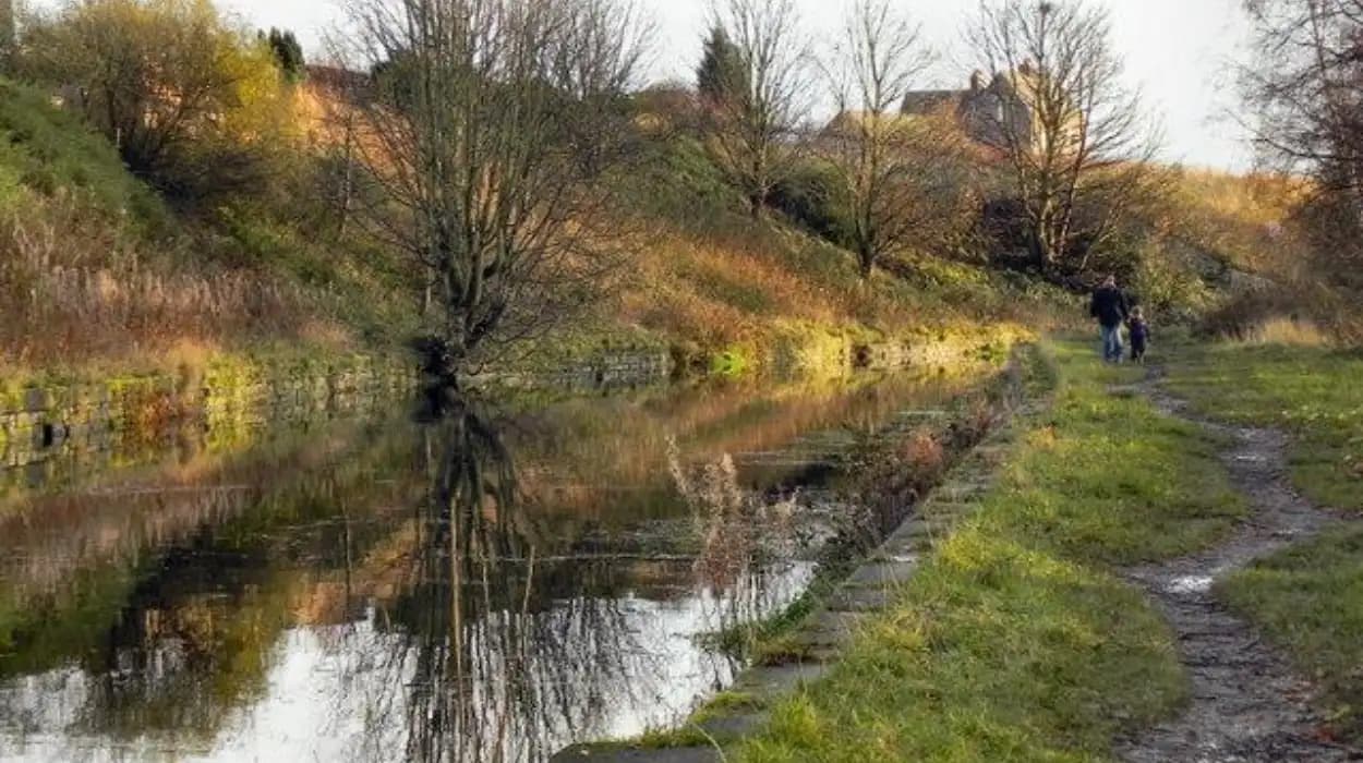
Moses Gate in Farnworth, within the Metropolitan Borough of Bolton, combines waterways, woodland, former industrial land and surviving transport heritage. The area provides access to the Manchester, Bolton & Bury Canal, River Croal, River Irwell and Moses Gate Country Park.
For walkers and photographers, this landscape is significant because its present-day green character developed from an intensely industrial environment. Paper manufacturing, canals, railways, mining, chemical works and water management shaped the area before later clearance and ecological regeneration transformed it into a recreational landscape.
The canal is particularly important. The Manchester, Bolton & Bury Canal was created during the Industrial Revolution as a transport route linking Bolton and Bury with Manchester and the wider canal network. Today, restored and surviving sections form a distinctive heritage corridor through woodland and countryside.
The best canal walking around Moses Gate therefore involves more than following a waterside path. It connects industrial archaeology, waterways, historic bridges, locks, former mills, wildlife habitats and modern public green space.
What makes Moses Gate a good starting point for canal walks?
Moses Gate provides a practical starting point for canal walks because the country park connects woodland, rivers, historic industrial landscapes and the Manchester, Bolton & Bury Canal. Its paths also connect with longer routes towards Prestolee, Nob End, Radcliffe and the River Irwell.
Moses Gate Country Park is located on Hall Lane in Farnworth. Bolton Council describes it as a large country park and local nature reserve containing woodland and waterside walks, nature trails, horse routes and cycle routes.
The park occupies a landscape associated with the Croal and Irwell valleys. The surrounding waterways explain why the area developed industrial importance. Water provided power and industrial supply, while canals and railways provided transport for raw materials and manufactured products.
The country park itself is a modern landscape. Bolton Council records that Moses Gate Country Park was created between 1974 and 1982. During that period, former industrial land was cleared and transformed into a nature reserve and recreational environment.
This transformation is central to understanding the walking experience. A visitor can move from woodland and lakes into a canal corridor where surviving structures preserve evidence of the area's industrial past.
The Woodland Trust records a 5.43-hectare woodland known as Moses Gate – Canal. It occupies land between the northern edge of the country park and the Manchester, Bolton & Bury Canal, with paths running beside the canal and through the woodland towards the aqueduct and Nob End Local Nature Reserve.
This combination makes Moses Gate particularly useful for photography. Water, mature vegetation, bridges, industrial structures and changing elevations provide different visual settings within a relatively compact area.
For visitors planning a broader day in the district, To experience this historic landscape in person today, consult our comprehensive [History of Canals and Trade Around Moses Gate] for itineraries and visiting parameters.
What is the history of the Manchester, Bolton & Bury Canal?
The Manchester, Bolton & Bury Canal was authorised by Parliament in 1791 to improve trade between Bolton, Bury and Manchester. It became an important industrial waterway, carrying coal and other goods before decline, abandonment and later restoration created today's heritage walking corridor.
The Manchester, Bolton & Bury Canal originated in the late eighteenth century, when industrial and commercial interests sought more efficient transport between the developing manufacturing districts of Lancashire and Manchester.
An Act of Parliament in 1791 authorised construction. The canal was a broad waterway approximately 15 miles, or 24 kilometres, long. It connected with the River Irwell and developed three arms around Nob End. The principal routes served Bolton and Bury.
Coal formed a major part of the canal's traffic. Coal was essential to Lancashire's industrial economy because it supplied fuel for manufacturing, steam power and domestic consumption.
The canal's engineering also reflected the difficult topography of the region. Its route crossed the valleys around Bolton, Bury and the River Irwell, requiring locks, bridges, aqueducts, reservoirs and other water-management structures.
The canal contained 17 locks, including four staircase locks. Staircase locks are groups of locks placed directly together, allowing boats to overcome a significant difference in elevation within a concentrated section of canal.
The relationship between canal and railway became particularly important during the nineteenth century. An Act passed in August 1831 converted the former canal company into the Manchester, Bolton & Bury Canal Navigation and Railway and authorised a railway between Bolton and Manchester.
Coal traders opposed proposals that would restrict canal access. An amendment obtained in 1832 required the canal to remain open and maintained while the railway was developed alongside it where practical. Construction began in 1833 under engineer Jesse Hartley.
The railway eventually became part of the Lancashire and Yorkshire Railway system. Canal records held by the Canal & River Trust document the changing ownership and administration of the waterway during the nineteenth and early twentieth centuries.
This history explains why the Moses Gate canal landscape contains evidence from more than one transportation era. Walkers encounter a waterway originally designed for horse-drawn boats alongside later railway infrastructure and modern paths.
Which canal walk from Moses Gate is best for a peaceful nature experience?
The Canal & River Trust's Moses Gate Wellbeing Walk is the most direct short canal experience. It covers about 3.3 kilometres, or two miles, takes approximately one hour, and connects Moses Gate Country Park with the Bury Arm through the River Croal.
The Wellbeing Walk begins at Moses Gate Country Park and follows a circular route incorporating the River Croal, Prestolee locks, Meccano Bridge and the historic canal corridor. The Canal & River Trust gives the route a total distance of approximately 3.3 kilometres.
The route is particularly useful for visitors who want a manageable introduction to the waterway without committing to a long-distance excursion.
The first section leads through the country park environment. This part provides a mixture of water, vegetation and open space. The landscape differs from the canal corridor because the park represents a later phase of land restoration and public recreation.
The River Croal then becomes an important part of the route. The river has a direct relationship with Moses Gate's industrial history. Water management supported local manufacturing, while the surrounding valley provided space for mills, transport routes and industrial development.
The route continues towards Prestolee. Here the historic canal infrastructure becomes more prominent. The surviving locks provide physical evidence of the engineering required to move canal boats through changing levels.
The Canal & River Trust identifies the section around Prestolee and Nob End as one of the best-preserved parts of the Manchester, Bolton & Bury Canal. The towpath provides a quieter walking environment away from the urban centres of Bolton and Bury.
For photography, this short route provides several distinct subjects without requiring extensive travel. The canal surface provides reflections, woodland creates natural framing, and the locks introduce strong geometric lines.
The route also works well as an educational walk. Students can examine how transport infrastructure, water management, industrial development and ecological regeneration occupy the same landscape.
Where can walkers see historic locks, bridges and canal engineering?
Prestolee and Nob End contain some of the most significant surviving canal features near Moses Gate, including staircase locks, bridges, an aqueduct, canal milestones and the Mount Sion steam crane, creating a concentrated landscape of industrial engineering and transport heritage.
Prestolee is one of the most important heritage sections accessible from Moses Gate. The area contains surviving structures associated with the original canal engineering system.
The Prestolee locks were designed to raise or lower boats between different canal levels. Historical walking material identifies six locks at Prestolee, arranged in two groups of three, providing a substantial change in elevation.
These structures are valuable photographic subjects because the staircase arrangement creates repeated architectural forms. Stonework, water channels, towpaths and surrounding vegetation create layers within the landscape.
Another significant feature is the Meccano Bridge. The bridge opened in 2013 on the site of an earlier wooden bridge. It was designed by artist Liam Curtin and constructed by members of the Manchester Bolton and Bury Canal Society.
The bridge provides a clear example of contemporary interpretation within a historic landscape. Its steel construction references the appearance of oversized Meccano components while serving a practical pedestrian function.
Nob End provides another major concentration of industrial heritage. The area contains surviving canal infrastructure and is connected to the former industrial landscape around the River Croal and River Irwell.
The Mount Sion steam crane is another important feature of the canal corridor. The Canal & River Trust describes it as a Grade II-listed cast-iron structure with its original pistons and winding gear intact.
Canal milestones also have historical value. During the Industrial Revolution, canal companies used mileposts to record distances for navigation and toll calculations. Surviving examples remain along the Manchester, Bolton & Bury Canal.
These details demonstrate that the canal was a working commercial system rather than simply a scenic waterway. Every bridge, lock, milestone and crane relates to the practical movement of goods and people.
How did industry shape the landscape around Moses Gate?
Industry transformed Moses Gate through paper manufacturing, water management, mining, bleaching, canal transport and railway development. The modern country park occupies land that previously supported industrial activity, demonstrating how environmental restoration can preserve and reinterpret an area's industrial heritage.
Paper manufacturing is one of the most important historical themes at Moses Gate. Rock Hall was built in 1807 by John Crompton, proprietor of several paper mills across Lancashire, including Farnworth Paper Mill near the hall.
The Crompton family became closely associated with paper manufacturing in the area. The industrial complex depended on local water resources, making the River Croal an important component of the manufacturing landscape.
A weir on the River Croal was constructed to provide water for Crompton's Paper Mill. The relationship between river and industry therefore extended beyond transport. Water served as an essential industrial resource.
The industrial landscape later changed. Bolton Council records that when the paper-making business failed in the 1890s, the mills became a large bleach works. This change reflects the wider evolution of Lancashire's textile-related industries and their dependence on water.
Mining also altered the surrounding land. Former mine workings exist around the Nob End landscape. Modern landforms therefore reflect both natural valley geography and centuries of industrial extraction.
The canal provided another layer of infrastructure. It connected the industrial districts around Bolton and Bury with Manchester and the River Irwell, allowing bulk materials to move more efficiently than earlier road transport systems.
Railways subsequently introduced faster land transport. The Manchester, Bolton & Bury railway followed a route broadly parallel to the canal after the 1830s. This created an unusual concentration of canal and railway infrastructure within the same valley landscape.
The resulting landscape is valuable for historical study because industrial development did not replace the natural environment completely. Rivers, valleys and woodland remained part of the physical setting while industrial structures occupied selected locations.
Today, walkers can therefore read the landscape as a sequence of industrial functions: water supply, manufacturing, transport, mining, waste deposition, land clearance and ecological recovery.
What wildlife and photography opportunities can walkers find along the canal?
The Moses Gate canal corridor combines open water, woodland, riverbanks and restored industrial land, creating varied photographic conditions. The landscape supports wildlife associated with wetlands and woodland, while water reflections, vegetation, bridges and historic structures provide distinctive subjects.
Moses Gate Country Park is recognised by Bolton Council as a local nature reserve as well as a country park. Its combination of woodland and waterside environments provides habitats within a heavily urbanised borough.
The park contains several water bodies associated with the historic industrial landscape. The Crompton Lodges originated as mill ponds or lodges connected with paper manufacturing.
Water creates particularly strong photographic opportunities because it reflects vegetation, bridges, skies and surrounding structures. Early and late daylight also changes the appearance of these reflections.
The woodland along the canal adds another ecological layer. The Woodland Trust describes Moses Gate – Canal as mature mixed woodland containing paths along the canal and into the park. It extends towards the aqueduct and Nob End Local Nature Reserve.
Birdlife forms another important component of the park's modern identity. Bolton Council introduced dedicated wildfowl feeding dispensers at Moses Gate Country Park because inappropriate bread feeding created environmental and animal-health problems. The council specifically identifies ducks, swans and geese among the wildfowl present at its parks.
Photography should therefore focus on observing wildlife rather than disturbing it. Long lenses allow visitors to photograph birds from a distance, while quieter movement reduces disruption.
The park has also become an established setting for community photography. In January 2026, Bolton Council launched the Park Life photography competition, inviting photographs taken in Moses Gate Country Park showing flora, fauna, heritage or people. The competition allowed up to three photographs per entrant.
This official photography initiative demonstrates the cultural value placed on the landscape. It also confirms that the park's photographic identity extends beyond scenic views to include ecological and historical subjects.
For photographers, the strongest approach is to treat the canal as a layered subject. A single frame can combine water, vegetation and historic infrastructure, while closer compositions can isolate masonry, engineering details or reflections.
What is the best longer canal walk from Moses Gate?
The longer Moses Gate heritage walk follows the Rivers Croal and Irwell and the Manchester, Bolton & Bury Canal for approximately 5½ miles, with a shorter 2½-mile circular option. It includes locks, milestones, bridges, an aqueduct and industrial remains.
The Milestone Society's heritage walk provides a longer route beginning at Moses Gate Country Park. The published route is approximately 5½ miles, with a shorter circular option of approximately 2½ miles.
The route follows the River Croal, River Irwell, and the Manchester, Bolton & Bury Canal. It is therefore broader than a conventional canal walk because it demonstrates how the waterway formed part of an interconnected valley transport and industrial system.
The route includes several heritage features. These include canal milestones, a flight of six locks, the Mount Sion steam crane, packhorse bridges and an aqueduct.
The shorter circular version provides an efficient option for visitors interested mainly in the Prestolee and canal heritage. The longer version provides greater geographical context.
The distinction between these route lengths is important for planning. A short walk allows visitors to concentrate on photography and individual heritage structures. A longer walk provides a stronger understanding of how the canal interacted with rivers, roads, mills and settlements.
The Milestone Society describes the route as mostly easy on towpaths and tracks but notes that surfaces can become muddy. Its historical walking material also identifies Moses Gate railway station and bus services as access points.
The route therefore works particularly well for heritage-focused walking. Instead of treating the canal as an isolated attraction, it presents the waterway as one component of a larger historic landscape.
The River Irwell is especially important because the Manchester, Bolton & Bury Canal connected with it. This connection allowed canal traffic to reach the wider Manchester waterway system.
The longer route also provides a useful framework for educators. A field visit can be organised around individual themes such as canal engineering, industrial transport, water management, landscape restoration and heritage conservation.
How is the canal being preserved for future generations?
The Manchester, Bolton & Bury Canal is being preserved through restoration, volunteer activity, heritage interpretation and improved public access. Restored sections around Prestolee and Nob End demonstrate how historic waterways can function simultaneously as ecological corridors, walking routes and industrial heritage assets.
The canal experienced serious decline during the twentieth century. Repeated breaches damaged the waterway, and the canal was eventually abandoned in 1961. Restoration activity began in 1987 through community and heritage efforts.
Restoration has progressed in stages. Sections around Prestolee and Nob End have been revitalised, creating walking routes and preserving surviving structures.
The Canal & River Trust identifies the Manchester, Bolton & Bury Canal as a green pathway through an urban landscape. Its restored sections provide walking, fishing and opportunities for interpreting industrial heritage.
The canal's restoration also has ecological significance. Historic waterways provide linear habitats connecting different green spaces. Woodland, water and river environments around Moses Gate and Nob End contribute to this wider ecological network.
Nob End itself has a particularly unusual industrial history. Historic industrial activity altered the chemistry of the ground, while later natural processes produced conditions supporting specialised vegetation. The site is now recognised for its ecological and geological interest.
Preservation at Moses Gate extends beyond the canal. Rock Hall is a Grade II-listed building and an important surviving reminder of the area's industrial past. Bolton Council records that it was built in 1807 and became the focal point of Moses Gate Country Park after opening as a visitor centre in 1982.
Rock Hall closed to the public in 2014. In 2026, Bolton Library and Museum Services were seeking memories, photographs and objects relating to the hall and country park as part of heritage development work.
This approach demonstrates that preservation is not limited to physical structures. Oral histories, photographs, maps and personal memories also provide evidence about how industrial landscapes changed.
Bolton Council has also identified investment in Moses Gate Country Park, including proposals for improved woodland access, a bird hide, new infrastructure and step access to the river.
These measures connect conservation with public access. Better paths and interpretation allow visitors to understand historic features while protecting the wider landscape.
Why are Moses Gate canal walks important for Bolton's heritage?
Moses Gate canal walks are important because they connect Bolton's industrial history with modern environmental restoration. The routes preserve evidence of canals, mills, mining, railways, bridges and water management while providing public access to woodland, rivers, wildlife habitats and historic structures.
The historical importance of Moses Gate rests on its layered landscape. The area did not develop around one isolated industry or structure. Paper manufacturing, bleaching, mining, canal transport and railways interacted within the same valley environment.
The canal represents the transportation revolution of the Industrial Revolution. Its construction reduced the difficulty and cost of moving heavy materials between industrial districts.
The paper mills represent another stage of industrial development. Their dependence on water demonstrates how natural resources influenced the location and operation of manufacturing.
The railway represents the next major transformation. Its development alongside the canal illustrates how new transport technologies competed with, complemented and eventually overtook earlier systems.
The country park represents a later transformation. Industrial land was cleared and reorganised into a public landscape beginning in the 1970s. Bolton Council records the creation of the country park between 1974 and 1982.
The result is an unusual heritage environment in which industrial archaeology and nature conservation occupy the same space.
For history enthusiasts, the canal provides physical evidence of eighteenth- and nineteenth-century infrastructure. For educators, it offers a practical case study in industrialisation, transport geography and environmental change.
For cultural tourists, the combination of canal, river, woodland and surviving structures provides a coherent heritage landscape rather than a collection of disconnected attractions.
For local heritage preservationists, the area demonstrates the value of retaining structures and landscape features even when their original industrial functions have disappeared.
For genealogical researchers, the landscape also provides contextual information. Families recorded in historic documents often lived and worked near mills, transport routes, mines and industrial employers. Understanding the physical geography of Moses Gate helps researchers interpret historical occupations, addresses and movement through the district.
The canal is therefore more than a walking route. It is a surviving framework through which the development of Moses Gate can be understood.
What should visitors know before walking and photographing the Moses Gate canal?
Visitors should plan around towpath conditions, route length, weather, daylight and the mixed-use nature of the paths. Short routes suit casual photography, while longer heritage walks require more time, appropriate footwear and preparation for muddy sections and changing ground conditions.
The Canal & River Trust recommends the two-mile Wellbeing Walk as an approximately one-hour circular route from Moses Gate Country Park to the Bury Arm.
The longer heritage route covers approximately 5½ miles, while the shorter circular option covers approximately 2½ miles.
Towpaths and woodland paths can become muddy after wet weather. Appropriate footwear is therefore important, particularly for visitors intending to leave the principal surfaced sections.
Cyclists and other path users also share parts of the canal corridor. Walkers should maintain awareness around narrow sections and bridges.
Photography equipment should match the route. A lightweight camera or smartphone is sufficient for landscape compositions, while a telephoto lens provides greater flexibility for wildlife photography.
Early morning offers quieter conditions and soft natural light. Later afternoon and evening provide different shadows across bridges, woodland and canal structures.
Photographers should avoid entering unstable industrial remains, restricted areas or water. Historic structures require observation from designated paths rather than physical exploration.
Wildlife should be photographed from a respectful distance. Feeding wildfowl with bread is discouraged because Bolton Council has identified associated environmental and animal-health problems.
Visitors should also check current local access information before travelling because restoration work, path improvements, weather or maintenance can change conditions.
The most effective approach is to divide the experience into sections. The country park provides nature and water photography. The Croal provides river landscapes. Prestolee provides canal engineering. Nob End provides industrial and ecological interpretation.
This progression turns a simple walk into a structured heritage and photography experience.
How can the canal landscape be understood as a complete heritage route?
The Moses Gate canal landscape works as a complete heritage route because its waterways, woodland, industrial remains, bridges, locks, railway connections and restored public spaces represent successive phases of local development from industrial expansion to modern conservation and recreation.
The strongest interpretation begins with geography. Moses Gate sits within a valley system shaped by the River Croal and connected downstream to the River Irwell.
Water determined both natural and industrial patterns. Rivers provided water resources, while valleys influenced the routes of canals, roads and railways.
The Manchester, Bolton & Bury Canal added a deliberate engineered waterway to this natural system. Its construction connected local industry with Manchester and wider commercial networks.
Industrial businesses then used the surrounding resources. Paper manufacturing and later bleaching demonstrate the economic importance of water-dependent production at Moses Gate.
Transport infrastructure expanded further with the railway. The nineteenth-century railway followed a route broadly parallel to the canal, creating a landscape in which canal and railway engineering existed together.
Later industrial decline removed much of the original built environment. Mining, manufacturing and transport left altered landforms and surviving structures.
The creation of Moses Gate Country Park introduced a new function. Industrial land became public open space, woodland and nature reserve. Rock Hall remained as a physical link to the earlier landscape.
Modern restoration adds another chapter. The canal is no longer simply an industrial transport system. Its surviving sections now support walking, wildlife, heritage interpretation and community activity.
The Canal & River Trust's current walking material identifies Prestolee and Nob End as particularly well-preserved sections. These areas demonstrate the value of restoring historic waterways as accessible green corridors.
For photography, this creates a rare combination of subjects. A single route can contain natural reflections, mature woodland, historic masonry, industrial engineering and contemporary public infrastructure.
For historical education, the route demonstrates change over time without requiring visitors to move between distant museums or monuments.
For Bolton's wider heritage identity, Moses Gate shows how industrial landscapes continue to shape the borough after their original economic functions have disappeared.
The canal walk is consequently both a recreational activity and a form of place-based historical research. The landscape records how transportation, manufacturing, water management, environmental change and public conservation interacted across more than two centuries.
Moses Gate's canal routes remain valuable precisely because the past and present are visible together. The waterway survives as a physical reminder of industrial Bolton, while the surrounding country park demonstrates the continuing transformation of that heritage landscape into a public ecological and cultural resource.
FAQS
What is the best canal walk in Moses Gate?
The Moses Gate Wellbeing Walk is one of the best short routes. It covers approximately 3.3 kilometres (2 miles) and connects Moses Gate Country Park with the historic canal and Prestolee area.