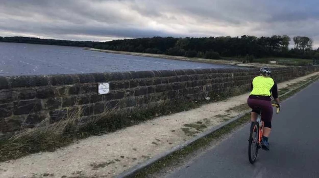
Horwich is one of Bolton’s strongest starting points for cycling because its urban streets connect directly with historic railway landscapes, the Middlebrook corridor, Rivington, reservoirs, woodland and the West Pennine Moors. A weekend cycling route here can combine outdoor recreation with industrial, transport and landscape history.
Horwich developed from a small settlement into a major industrial town during the nineteenth century. The arrival of the Lancashire and Yorkshire Railway and the development of Horwich Locomotive Works transformed its population, employment and built environment. Today, remnants of that industrial expansion sit beside modern housing, retail areas, green corridors and countryside.
For cyclists, this historical layering creates routes with more than scenery. Roads and paths around Horwich connect places associated with railway engineering, Victorian industry, water supply, agriculture, recreation and twentieth-century transport. The result is a compact area where a weekend ride can move from an urban heritage landscape to reservoirs and open moorland within a relatively short distance.
Bolton Council’s Rights of Way Improvement Plan identifies a 4.5-mile shared footpath and cycleway between central Bolton and Middlebrook at Horwich through the Middlebrook river corridor. The same plan identifies further cycling connections forming part of National Cycle Network Route 55.
Why is Horwich a good starting point for a scenic cycling weekend?
Horwich combines accessible cycling infrastructure, industrial heritage, reservoir landscapes and moorland scenery within one compact area, making it suitable for weekend rides that connect urban history with countryside exploration without requiring a long-distance journey.
Horwich occupies an important position on the western side of the Bolton metropolitan area. The town lies close to Rivington and the West Pennine Moors while remaining connected to Bolton, Middlebrook and surrounding communities.
This location gives cyclists several distinct environments. A ride can begin among Victorian streets and railway-era buildings before continuing towards Middlebrook, Rivington Lane, Rivington reservoirs or the higher ground around Winter Hill.
The historical importance of Horwich strengthens the character of these routes. The Lancashire and Yorkshire Railway acquired land for a major locomotive works in 1884. Construction followed in 1885, and the works officially opened in November 1886. The industrial complex subsequently became one of the defining institutions in the town.
The railway also preceded the locomotive works. The Blackrod–Horwich branch opened for goods traffic in 1868, with passenger services beginning in 1870. The original Horwich station therefore formed part of the town’s transport development before the locomotive works transformed local employment.
That chronology matters when cycling through Horwich. The modern landscape is not separate from the historic landscape. Present-day roads, housing districts and transport corridors occupy a town shaped heavily by nineteenth-century industrial investment.
Cyclists interested in heritage can therefore treat the route itself as a historical journey. The changing landscape provides evidence of how Horwich moved from an industrial settlement towards a modern residential, commercial and recreational community.
Which cycling route connects Horwich with Middlebrook and Bolton?
The Bolton-to-Middlebrook corridor provides one of Horwich’s clearest cycling connections, using a 4.5-mile shared footpath and cycleway along the Middlebrook river corridor and linking urban areas with Horwich’s modern leisure and employment landscape.
This route is particularly relevant for cyclists seeking a lower-intensity weekend ride. Bolton Council identifies the 4.5-mile connection as an off-road cycling facility between central Bolton and Middlebrook at Horwich.
The Middlebrook corridor represents an important change in the geography of Bolton and Horwich. The route passes through a landscape where waterways, transport infrastructure and later commercial development have reshaped former industrial and open land.
Middlebrook itself is also associated with Horwich’s modern development. The area contains major retail, leisure and employment facilities, while Horwich Parkway provides a significant transport connection. The modern landscape contrasts with the nineteenth-century industrial economy centred on railway engineering.
The corridor works well as a weekend cycling option because it can function as either a destination ride or part of a longer circuit. Riders can approach Middlebrook from Bolton before continuing towards Horwich and the countryside.
The route also illustrates how former industrial landscapes acquire new uses. Railway engineering once dominated Horwich’s economic identity. Today, cycling infrastructure, commercial development and recreational travel form part of the town’s contemporary landscape.
A cycling journey through Middlebrook therefore has historical relevance even where the surroundings appear modern. It demonstrates the long-term process through which transport corridors and industrial land are adapted for new economic and recreational purposes.
Cyclists should distinguish shared paths from dedicated cycle tracks and follow signs, surface markings and local restrictions. Pedestrians also use shared sections, so riders should maintain appropriate speeds and give priority where required.
How can cyclists explore Horwich’s railway heritage?
Horwich’s railway heritage is centred on the former Lancashire and Yorkshire Railway locomotive works, the railway branch to Horwich and surviving industrial features that demonstrate how railway engineering transformed employment, population growth and the physical structure of the town.
The strongest heritage section of a Horwich cycling itinerary is the area associated with Horwich Locomotive Works.
The Lancashire and Yorkshire Railway selected Horwich for a new engineering complex after purchasing a large estate in 1884. The site covered approximately 736 acres and included land associated with Wallsuches, Makinson Moor and Pilkingtons.
The works were designed as a large-scale engineering facility. Heritage Gateway records that the complex was built between 1884 and 1892 and included three principal parallel sheds connected by a standard-gauge railway system.
The works changed Horwich’s demographic structure. The town had a population of about 3,500 in 1881. By 1891, the population had exceeded 13,000, and by 1901 it had reached approximately 15,000. Much of this growth resulted from railway employment and migration into the town.
The Science Museum Group records that Horwich Works became responsible for locomotive construction, repair and mechanical, electrical and hydraulic engineering. During its first decade, it produced 677 new locomotives.
The works also had a wider technological role. Between 1902 and 1918, the Lancashire and Yorkshire Railway experimented with railway electrification, with motor and trailer equipment and bogies associated with Horwich engineering.
The site later entered the national railway system. The Lancashire and Yorkshire Railway became part of the London and North Western Railway structure in 1922, followed by the creation of the London, Midland and Scottish Railway in 1923. British Rail Engineering Limited took over Horwich Works in 1970. The works finally closed in 1983.
For cyclists, the railway heritage is best understood through the surviving townscape rather than by treating the former works as an isolated attraction. Streets around the former locomotive estate, railway-related buildings and heritage information points demonstrate the scale of the industrial transformation.
Horwich Heritage has also worked with local authorities to install information boards at locations including Old Station Park, Winter Hey Lane and the former Loco Works.
The Horwich Heritage Centre on Beaumont Road maintains exhibitions and archive material relating to local social and industrial history. Its resources also support family-history research, making it particularly relevant to visitors investigating former railway communities.
To connect this cycling itinerary with the town’s wider attractions, consult our comprehensive [History of Cycling and Transport in Horwich] for itineraries and visiting parameters.
What makes the Horwich to Rivington ride historically important?
The Horwich-to-Rivington connection links an industrial railway town with a historic rural landscape shaped by reservoirs, engineered water systems, Lever Park and Rivington’s nineteenth-century recreational development, creating a cycling journey between industrial and landscape heritage.
Rivington is one of the most important countryside destinations accessible from Horwich. Rivington Lane connects the Horwich area with Rivington village and the reservoir landscape.
The landscape around Rivington is strongly connected with water engineering. The reservoir chain supplied water to the surrounding urban population and created an engineered landscape of dams, reservoirs, roads and associated structures.
The recreational character of Rivington also developed through the work of William Hesketh Lever, later Lord Leverhulme. Lever Park became associated with the landscape around Rivington and provided an important recreational setting.
Rivington Terraced Gardens form another major historical component. The gardens contain engineered paths, structures, woodland and elevated viewpoints. Although many sections are more suitable for walking than cycling, cyclists can use surrounding roads and appropriate routes to experience the wider landscape.
Rivington Pike provides another major landmark. The Pike lies on the West Pennine Moors and overlooks Rivington. Its tower is one of the area's best-known historic structures.
The wider Rivington landscape also contains archaeological evidence. The West Pennine Way records a Bronze Age round cairn dated to approximately 1600–1400 BC on the moors. A stone axe dated to about 2500 BC was found in the River Douglas area, while a flint knife and two arrowheads were also discovered.
These discoveries demonstrate that the landscape predates the industrial development of Horwich by thousands of years.
A weekend cyclist can therefore encounter several chronological layers within one outing. The sequence runs from prehistoric activity to agricultural landscapes, nineteenth-century water engineering, Victorian and Edwardian recreation, railway expansion and modern outdoor tourism.
The route towards Rivington also provides significant changes in elevation. Riders should expect steeper sections as they approach the higher landscape. Rivington Pike itself is not a conventional cycling destination because its steep paths and walking routes are unsuitable for ordinary road cycling.
The safer approach is to treat Rivington Pike and its terraces as walking destinations reached from suitable cycling access points. This preserves the distinction between cycling routes and pedestrian paths.
Can cyclists follow a reservoir and countryside route around Rivington?
A Rivington reservoir cycling itinerary uses the roads and appropriate shared routes around Horwich and Rivington, while the reservoir landscape provides historical evidence of water engineering, Victorian infrastructure, estate development and changing recreational use.
Rivington’s reservoirs form a distinctive landscape east of Horwich. The area includes Upper Rivington Reservoir and Lower Rivington Reservoir, with roads connecting the surrounding settlements.
Horrobin Lane crosses the embankment separating Upper and Lower Rivington Reservoirs. Rivington Lane connects the village southwards towards Horwich and Bolton.
These roads provide useful orientation points for cyclists planning a countryside loop.
The reservoir landscape should be understood as an engineered environment rather than untouched countryside. Reservoir construction altered valleys, watercourses, land ownership and transport patterns. It created infrastructure that continues to shape recreation in the area.
Rivington is also associated with historic monuments and structures. Horwich Heritage maintains a Reservoir Monument Trail around Upper Rivington Reservoir, identifying six monuments that explain aspects of the reservoir chain’s history.
For cyclists, these monuments provide opportunities to stop and interpret the landscape. The route therefore works particularly well for heritage-focused outdoor education.
A cycling itinerary can begin in central Horwich, continue towards Lever Park Avenue and Rivington Lane, reach the Rivington area and return through the same corridor or form a wider local circuit depending on conditions and rider ability.
The exact route should be adapted to current road conditions, access restrictions and event closures. Bolton Council publishes information about temporary road restrictions, including restrictions affecting Horwich and surrounding roads.
Riders should also remember that not every attractive path around Rivington is a cycle route. Footpaths, bridleways, concessionary routes and byways have different legal statuses. The West Pennine Way documentation, for example, identifies bridleways, concessionary bridleways, byways and public-road sections separately.
This distinction is essential for responsible countryside cycling.
Which route is best for cyclists seeking West Pennine Moor scenery?
Cyclists seeking open views should use appropriate roads and permitted cycling routes around Rivington and the lower West Pennine Moors, where elevated terrain provides views towards Horwich, Bolton and surrounding countryside alongside important archaeological and industrial heritage.
The West Pennine Moors form the elevated landscape immediately beyond Horwich and Rivington. Winter Hill is one of the dominant geographical features.
The moorland provides a sharp contrast with Horwich’s dense urban environment. Roads approaching the hills become more exposed, gradients increase and the landscape becomes less developed.
Rivington Pike is a major reference point. Views from the summit extend across the surrounding countryside, with clear conditions allowing extensive visibility.
The landscape also has archaeological importance. The West Pennine Way identifies prehistoric remains on the moors, including the Bronze Age cairn and artefacts associated with earlier human activity.
Cyclists should not assume that every moorland trail is suitable for bicycles. Some routes are designated primarily for walking. The West Pennine Way itself is described as a walking route, although its documentation identifies bridleways and byways among its components.
For a cycling weekend, road-based access around the lower Rivington landscape provides a more appropriate foundation. Riders can stop at viewpoints and heritage sites before returning towards Horwich.
The surrounding countryside also has a long history of public access disputes. The Winter Hill Rights of Way memorial records the 1896 mass trespass associated with access to Winter Hill. The route was not opened to the public until 1966.
This history gives outdoor recreation in the area a significant social dimension. Access to countryside was not always guaranteed. Public rights of way developed through legal, political and community processes.
Cyclists therefore participate in a landscape shaped by both physical geography and public-access history.
The higher sections require greater preparation than the Middlebrook corridor. Weather conditions change rapidly on exposed moorland, and surfaces can deteriorate after rainfall. Riders should check weather forecasts, daylight hours, route conditions and access notices before departure.
How can a weekend cycling route combine Horwich history with modern outdoor recreation?
A heritage-focused weekend ride can begin in Horwich town centre, follow the Middlebrook or railway landscape, continue towards Rivington and return through established roads, connecting industrial history, transport infrastructure, reservoirs, archaeological remains and modern recreational facilities within one regional landscape.
The strongest approach is to treat Horwich as a connected historical landscape rather than a collection of isolated attractions.
A shorter ride can concentrate on the town and Middlebrook corridor. This option suits cyclists seeking a lower-gradient route with opportunities to examine the relationship between Horwich and Bolton.
A longer ride can continue towards Rivington. The landscape then changes from urban development to reservoirs, woodland, estate features and moorland.
A heritage-focused cyclist should identify the major chronological stages before setting out.
Horwich’s pre-industrial landscape included agriculture and textile-related activity. Wallsuches Bleachworks, established by Thomas Ridgway in 1780, became an important local industrial enterprise. The site closed in 1933.
Railway development followed. The Horwich branch opened in 1868, passenger services began in 1870, and the locomotive works arrived from 1884 onwards.
The locomotive works then created substantial population growth and a new industrial community. Heritage Gateway identifies the works as a major complex that helped create a new community, with rows of brick workers’ cottages surviving around Chorley New Road.
The twentieth century brought further technological and industrial changes. Horwich Works produced locomotives, supported wartime manufacturing and later continued railway engineering before closing in 1983.
The modern town contains another layer. New housing, retail development, transport infrastructure and cycle connections occupy areas once dominated by railway and industrial activity.
Rivington provides a different historical sequence. Reservoir construction, Lever Park, terraced gardens, historic buildings and moorland access created a landscape where engineering and recreation became closely connected.
This makes the area particularly useful for educators. A single cycling itinerary can demonstrate industrialisation, migration, transport development, water engineering, public access, landscape conservation and modern regeneration.
The route also provides a practical way to explain how infrastructure shapes communities. Railway works created employment and housing demand. Reservoir construction altered the landscape. Modern cycleways respond to contemporary transport and recreation needs.
Horwich Heritage continues to preserve and interpret this history. The Heritage Centre contains exhibitions and archive material, while its programme includes subjects such as the locomotive works, Victorian life, wartime history, Winter Hill mines and turnpike roads.
This continuity between historical research and outdoor exploration gives Horwich its distinctive character as a cycling destination.
What historical legacy does cycling reveal across Horwich?
Cycling across Horwich reveals a long transition from agricultural settlement to textile and railway industry, followed by twentieth-century engineering decline and modern recreational reuse, while surviving buildings, transport corridors, reservoirs and public-access routes preserve evidence of each major phase.
The historical importance of Horwich is visible because its major economic changes left physical evidence.
The locomotive works created an industrial landscape that influenced housing, roads and population patterns. Its closure in 1983 ended the town’s most significant industrial era, but the former works remains central to local heritage interpretation.
The railway also left a lasting geographical structure. The original branch connected Horwich with Blackrod and provided transport infrastructure before the locomotive works arrived. The later railway network supported the expansion of industrial employment and movement of workers.
The demographic evidence is particularly significant. Horwich grew from approximately 3,500 residents in 1881 to more than 13,000 by 1891 and around 15,000 by 1901. This rapid increase demonstrates the scale of industrial migration generated by the locomotive works.
The countryside preserves a much older history. Archaeological discoveries around the West Pennine Moors include prehistoric artefacts and a Bronze Age cairn.
The reservoirs represent another major historical layer. Their construction created infrastructure for water supply while permanently changing the valleys and surrounding land. Later landscape management and recreation gave the area another function.
Cycling now provides a modern way to move between these historical environments.
The Middlebrook corridor demonstrates contemporary investment in active travel. Bolton Council identifies the 4.5-mile shared route between central Bolton and Middlebrook as part of its off-road cycling provision.
The relationship between heritage and cycling is therefore practical as well as educational. Cycle routes can connect heritage sites without requiring visitors to rely entirely on motor vehicles. They also expose riders to the spatial relationships between industrial sites, housing, waterways and countryside.
Horwich’s heritage organisations recognise this connection. Horwich Heritage states that preservation and promotion of local heritage can support tourism and that appropriate use of the surrounding countryside forms part of its heritage framework.
For weekend visitors, this means a Horwich cycling trip can serve as both outdoor recreation and historical exploration.
The most significant lesson is the continuity of the landscape. Horwich did not abandon its past when its industrial economy changed. Former railway land, historic streets, transport corridors, reservoirs and moorland remain part of the town’s identity.
A scenic cycling route across Horwich therefore provides more than a recreational journey. It connects the physical evidence of centuries of settlement with the modern need for sustainable transport and outdoor access. The route from town to countryside shows how industrial heritage, public infrastructure and natural landscapes continue to shape the identity of Horwich today.
FAQS
What are the best scenic cycling routes in Horwich?
The best options include the Middlebrook cycleway, Horwich to Rivington route, Rivington reservoir roads and routes towards the West Pennine Moors. These routes combine countryside scenery with Horwich’s industrial and railway heritage.