Moses Gate Country Park is a 750-acre (300-hectare) regional park and Local Nature Reserve situated in the Croal and Irwell Valleys, three miles south of Bolton town centre. Managed by Bolton Metropolitan Borough Council, the site serves as a vital environmental asset for Greater Manchester, attracting thousands of recreational visitors annually. This comprehensive guide by Bolton Today explores the ecological, historical, and recreational dimensions of this premier green space.
What is the history of Moses Gate Country Park?
Moses Gate Country Park occupies a landscape deeply shaped by the Industrial Revolution, transitioning from a heavily polluted industrial complex of paper mills, chemical works, and coal mines into a protected, 750-acre Local Nature Reserve established in 1975.
The Industrial Era and Crompton’s Paper Mills
The etymology of Moses Gate derives from the Old English word gata, meaning a pathway, combined with a corruption of mosses, referencing the peaty, marshy lands characteristic of the South Lancashire landscape. Industrial operations commenced significantly in the 18th century. Robert Crompton (1667–1737) initiated papermaking in the area, establishing a lineage of industrial production that culminated under Thomas Bonsor Crompton in the 19th century. Under his management, the Farnworth Paper Mills became one of the largest paper manufacturing operations in the United Kingdom.
Because the River Croal became severely contaminated by surrounding heavy industries, the river water was unusable for manufacturing high-quality paper. To secure a clean, regulated water supply, the Crompton family constructed a large weir across the River Croal and engineered three massive mill ponds, known today as Crompton Lodges.
Beyond papermaking, the land supported multiple extraction and manufacturing industries. The Farnworth Bridge Collieries operated deep shafts and shallow pits across the landscape. In 1828, James Rothwell Barnes opened a steam weaving mill, which later converted into a cotton spinning mill. Adjacent to the site at Nob End, chemical manufacturing operations flourished, utilizing the Leblanc process to manufacture soda ash.
Reclamation and the Transition to a Country Park
The industrial decline of the late 19th and early 20th centuries left the valley highly derelict. Farnworth Paper Mills closed during the economic depression of 1883, underwent brief conversion to a bleach works by J.B. Champion in 1894, and eventually fell into total abandonment. For decades, the site functioned as a fragmented landscape of disused mines, a sewage treatment plant, and a landfill site.
Demolition of the derelict mill structures occurred in 1972, initiating a massive environmental reclamation project led by local authorities. Over the subsequent decade, the land was systematically cleared, capped, and landscaped. Rock Hall, a historic property built in 1807 by John Crompton to house mill managers, was preserved and transformed into a visitor centre. The park officially opened to the public in 1975. In 2009, Bolton Metropolitan Borough Council formally designated the site as a Local Nature Reserve under the National Parks and Access to the Countryside Act 1949, legally protecting its diverse habitats.
What are the key habitats and wildlife species in the park?
The park contains a complex matrix of broadleaf woodlands, wetland ecosystems, and alkaline grasslands that support diverse populations of native fauna, including rare orchids, European roe deer, protected amphibians, and over 100 documented species of resident and migratory waterfowl.
Broadleaf Woodlands and Terraced Forests
Native broadleaf woodlands cover approximately 50 per cent of the total land area within the reserve. These secondary woodlands, which have matured over the past 40 to 50 years since reclamation, are dominated by native British tree species. The primary canopy includes three types of deciduous trees:
- Pedunculate Oak (Quercus robur)
- European Silver Birch (Betula pendula)
- Sycamore (Acer pseudoplatanus)
The understory consists of hazel, holly, and hawthorn, creating dense nesting habitats for woodland birds. The woodland floor displays dynamic seasonal variations, producing carpets of native bluebells (Hyacinthoides non-scripta) and wood anemones (Anemone nemorosa) during the spring months.
The Crompton Lodges Wetland Ecosystem
The central hydrographic features of the park are the three Crompton Lodges. These water bodies are isolated by purpose-built earthen banks and fed by controlled channels. Each lodge serves a distinct ecological or recreational function, with the largest lake strictly preserved as an undisturbed wildlife sanctuary.
These wetlands provide critical breeding and wintering grounds for diverse waterfowl. Resident species include the mute swan (Cygnus olor), tufted duck (Aythya fuligula), and mallard (Anas platyrhynchos). Specialized avian species utilise the margins, including three types of wetland birds:
- Great Crested Grebe (Podiceps cristatus)
- Water Rail (Rallus aquaticus)
- Grey Heron (Ardea cinerea)
During the summer season, common terns (Sterna hirundo) utilize the open water sections for foraging. The margins are stabilized by dense reed beds consisting of common reed (Phragmites australis) and reed sweet-grass (Glyceria maxima), which provide essential cover for the elusive water rail and nesting moorhens.
The Alkaline Botanical Anomalies of Nob End
Situated at the eastern confluence where the River Croal joins the River Irwell lies Nob End. This 1.94-hectare sector within the park holds distinct legal protections as a Site of Special Scientific Interest (SSSI), designated in 1988 under Section 28 of the Wildlife and Countryside Act 1981.
The unique ecological value of Nob End stems directly from its industrial pollution. Massive deposits of alkaline waste from the historical Leblanc chemical process altered the soil chemistry, creating a highly specific calcium-rich, alkaline substrate. This artificial habitat mimics natural limestone environments, allowing rare calcicole (lime-loving) botanical species to colonise the area. Nob End supports an internationally recognized population of wild orchids, featuring three notable species:
- Fragrant Orchid (Gymnadenia conopsea)
- Northern Marsh Orchid (Dactylorhiza purpurella)
- Common Spotted Orchid (Dactylorhiza fuchsii)
Darcy Lever Gravel Pits and Amphibian Conservation
To the northern perimeter of the reserve lie the Darcy Lever Gravel Pits, a specialised habitat zone managed in collaboration with the Gravel Pits Action Group. This area comprises disused gravel extraction pits that filled naturally with groundwater, creating a mosaic of oligotrophic ponds, developing heathlands, and marshy bogs.
The gravel pits serve as an essential breeding site for British amphibians and aquatic insects. Populations include three types of amphibians:
- Great Crested Newt (Triturus cristatus)
- Smooth Newt (Lissotriton vulgaris)
- Common Toad (Bufo bufo)
The high water quality supports diverse Odonata populations, including the common darter dragonfly (Sympetrum striolatum) and the azure damselfly (Coenagrion puella).
Explore More Bolton Town Centre
Bolton Suspected Kidnapping: Man Forced into Car, Police Search – Bolton 2026
Bolton town centre street shut for repairs in 2026
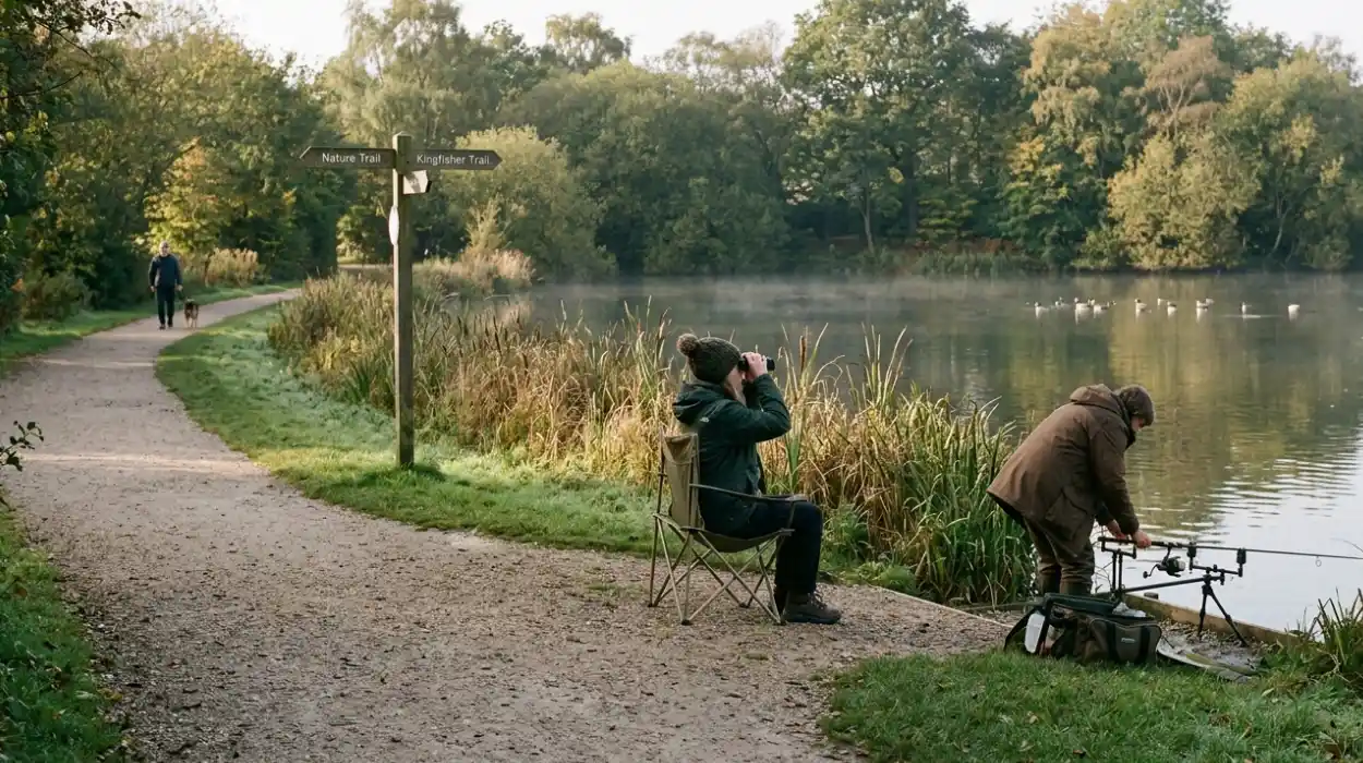
What are the rules and locations for fishing at Moses Gate?
Angling at Moses Gate Country Park is strictly confined to one designated water body within the three Crompton Lodges, requiring fishermen to possess a valid UK Environment Agency rod licence and an official permit issued by Bolton Council.
Regulatory Framework and Permitting
Angling operations within the reserve are governed by national and local statutory regulations to ensure sustainable fish stocks and protect the surrounding waterfowl populations. Anyone aged 13 or older must carry a valid Environment Agency Rod Fishing Licence. Additionally, anglers must obtain a specific day ticket or seasonal club membership permit before setting up equipment. Bolton Metropolitan Borough Council enforcement officers and angling club wardens actively patrol the banks to verify compliance.
The park enforces strict environmental protection mandates. Anglers must comply with three core prohibitions:
- The total ban on lead weights to prevent avian lead poisoning
- The absolute prohibition of nylon keepnets during high-summer temperatures
- The mandatory use of barbless hooks to minimize structural damage to fish
Stock Profiles and Aquatic Conditions
The designated fishing lodge is managed as a mixed coarse fishery. The water body features an average depth varying between 1.5 and 2.5 meters, with a clay-and-silt substrate. The underwater topography includes managed reed margins and lily pads that provide natural cover for mature fish populations. The lodge contains significant populations of coarse fish, including three primary target species:
- Common Carp (Cyprinus carpio) exceeding weights of 20 pounds
- Common Bream (Abramis brama) averaging 3 to 5 pounds
- Eurasian Perch (Perca fluviatilis) found in high densities along the brick walls
Close monitoring of the water quality ensures stable dissolved oxygen levels, supporting a healthy food web of freshwater macroinvertebrates that sustain these fish stocks.
Which family trails and walking routes are available?
The park provides an extensive network of multi-use trails, including the fully accessible, tarmac-surfaced Crompton Lodges Loop and the regional 11-kilometre Kingfisher Trail, accommodating walkers, cyclists, and horse riders across varying terrains.
The Crompton Lodges Loop
The most frequented route for families and individuals requiring flat terrain is the Crompton Lodges Loop. This circular trail spans approximately 2 kilometres around the perimeters of the main water bodies. The path features a wide, tarmacadam surface engineered to support double-width prams, motorized mobility scooters, and manual wheelchairs.
The path incorporates pedestrian access gates measuring a minimum of 1 meter in width to ensure unobstructed passage. Strategically placed timber benches are positioned at intervals of no greater than 150 meters along the lakeside, providing rest options for visitors with limited mobility.
The Kingfisher Trail and Regional Connectivity
For long-distance walkers, Moses Gate Country Park serves as a central hub for the Kingfisher Trail. This regional route covers 11 kilometres (6.8 miles) through the Croal and Irwell Valleys, connecting Clifton Country Park in Salford to the Jumbles Reservoir north of Bolton. The section passing through Moses Gate guides walkers past the historic Manchester, Bolton and Bury Canal.
The trail features varying terrains, including three specific pathway types:
- Surfaced crushed-stone paths
- Elevated timber boardwalks over wetland zones
- Natural earthen tracks through the deep woodlands
Walkers on this route encounter distinctive industrial archaeology, including the massive "blue wall," an engineered stone retaining structure that supports the high canal bed along the eastern flank of the River Croal.
What family amenities and play areas are on site?
Family infrastructure at the park is centered around a large, modern play area situated adjacent to Rock Hall, featuring specialised zoning for toddlers and older children, alongside public restrooms, picnic zones, and mobile catering facilities.
The Geological and Biological Themed Play Area
The main children’s playground features specialised equipment installed on impact-absorbing safety surfacing. The ground design incorporates educational graphics illustrating the life cycle of the common frog (Rana temporaria) alongside a blue pathway tracking the historic course of a natural stream.
The play space is divided into two age-appropriate zones. The toddler zone features inclusive equipment, including three specific installations:
- The Inclusive Springie Helicopter
- The Inclusive Springie Ladybird
- The Kiddabout Inclusive Roundabout
The older children's section focuses on physical development and climbing challenges, featuring heavy-duty timber and steel apparatus. This area contains three prominent climbing features:
- The Galaxy Supernova rotating ring
- The Nexus Freerider track rider
- A large embankment slide integrated into the natural topography
Visitor Support Infrastructure
The park provides essential facilities to support extended family visits. Public toilets, including dedicated accessible facilities and baby changing rooms, operate within the main courtyard area during daylight hours. A dedicated picnic site features permanent timber tables situated on level lawns near the primary car park.
While the historical Rock Hall Visitor Centre undergoes phased structural restoration, mobile catering vans provide refreshments, selling ice cream, hot beverages, and snacks throughout the peak spring and summer seasons.
How does the park contribute to environmental conservation?
Moses Gate Country Park serves as a critical urban biodiversity sink and carbon capture zone, managed through systematic habitat restoration, volunteer conservation programs, and scientific monitoring of its distinct ecosystems.
Community-Led Conservation Work
Active habitat management relies heavily on partnerships between Bolton Council and community organisations, notably the Bolton Conservation Volunteers. A primary focus of recent operations is "Rick’s Wildlife Garden," an educational green space located near Rock Hall. Following extensive path resurfacing and the removal of degraded timber structures by the council, volunteers maintain this area for educational outreach.
Conservation workers perform regular maintenance tasks, executing three specific ecological procedures:
- The seasonal cutting and weaving of living willow hurdles
- The clearing of invasive duckweed (Lemna minor) from breeding ponds
- The traditional laying of native hawthorn hedges to create bird nesting corridors
Scientific Significance and Future Outlook
The long-term environmental value of the park rests on its ability to support specialized biodiversity within an urbanised region. The ongoing monitoring of Nob End SSSI ensures that scrub encroachment does not shade out the rare orchid populations. Soil core sampling and vegetation mapping occur biennially to track the stability of the alkaline plant communities.
Furthermore, the park acts as a vital wildlife corridor within the wider Croal and Irwell Valley green infrastructure network. By linking fragmented urban green spaces, Moses Gate allows mammals, such as the European roe deer (Capreolus capreolus), and various species of bats, including the common pipistrelle (Pipistrellus pipistrellus), to migrate and forage safely. This ecological connectivity ensures the long-term resilience of Bolton's natural heritage against urban development and climate pressures.
FAQS
What is the history of Moses Gate Country Park?
Moses Gate Country Park was transformed from an industrial landscape of paper mills, coal mines, and chemical works into a 750-acre Local Nature Reserve. The park officially opened in 1975 after major environmental reclamation and was formally designated a Local Nature Reserve in 2009.