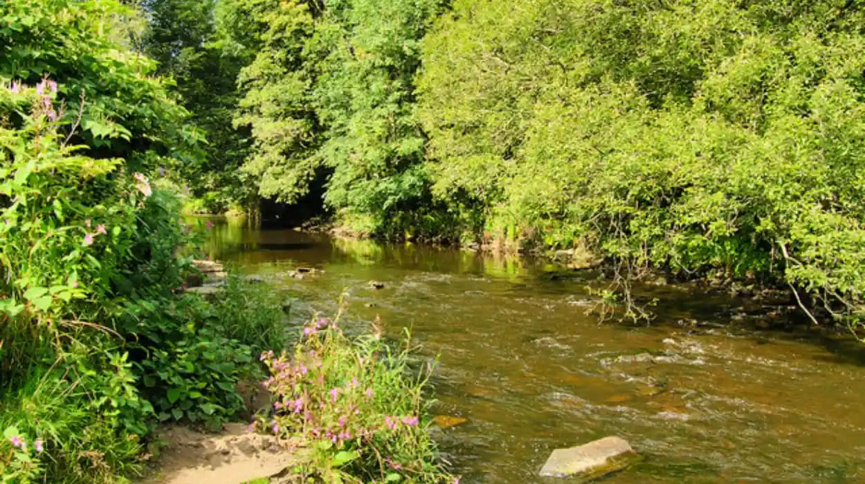
Bolton’s riverside landscapes combine natural waterways, industrial history, historic estates, public parks, cemeteries, wildlife habitats, and modern walking infrastructure. The River Tonge, River Croal, Bradshaw Brook, Middlebrook, and River Irwell have each influenced the physical development of the borough.
Today, these waterways provide some of Bolton’s most useful landscapes for understanding how geography and human activity developed together. Dedicated walking routes pass through areas that once supported farming, manufacturing, transport, settlement, and municipal expansion.
For history enthusiasts, riverside walking offers direct contact with physical evidence. For cultural tourists, the routes connect green spaces with heritage locations. For educators and students, they provide outdoor settings for studying industrialisation, landscape change, public health, architecture, transport, and environmental management.
Bolton Council identifies several accessible walking routes, including the Middlebrook Valley Trail and Moses Gate Country Park. Its walking programme also identifies the eight-mile Tonge Trail, which follows the River Tonge and Bradshaw Brook.
What makes Bolton’s riverside walks historically important?
Bolton’s riverside walks connect waterways, parks, industrial heritage, historic estates, cemeteries, and wildlife habitats. Key routes include the eight-mile Tonge Trail, Middlebrook Valley Trail, and waterside paths through Moses Gate Country Park, each offering distinctive year-round landscapes across Bolton today.
The historical importance of these walks comes from the relationship between water and settlement.
Before modern urban expansion, rivers and streams influenced where communities developed. Water provided resources for agriculture and domestic activity. During industrialisation, flowing water also became closely connected with manufacturing, drainage, transport infrastructure, and urban growth.
Bolton developed as an important textile and manufacturing centre during the Industrial Revolution. Its waterways became part of a much wider industrial landscape that included mills, factories, workers’ housing, roads, bridges, and engineered channels.
The River Croal has particular importance in Bolton’s civic history. Bolton Council records that Great Bolton lay south-east of the River Croal while Little Bolton occupied the area broadly north-west of it. The two parts were brought together when Bolton Borough was incorporated in 1838.
This geographical division demonstrates how a watercourse functioned as more than a natural feature. The river formed part of the town’s historic spatial structure.
The same landscape later acquired recreational value. Industrial waterways became associated with public parks, footpaths, ecological habitats, and open-space management. Modern walking routes therefore preserve evidence of several historical phases within the same landscape.
This makes riverside walking particularly useful for heritage interpretation. A single route can reveal natural geography, industrial development, Victorian municipal planning, twentieth-century land-use change, and contemporary environmental management.
How did Bolton’s rivers influence the development of the borough?
Bolton’s rivers and brooks shaped settlement, farming, industry, transport, and later recreation. The River Croal divided Great Bolton and Little Bolton, while the River Tonge, Bradshaw Brook, Middlebrook, and Irwell formed connected landscapes that still structure walking routes today.
The River Croal is one of the most important waterways for understanding Bolton’s historical geography.
Its relationship with Great Bolton and Little Bolton demonstrates how watercourses influenced administrative and settlement boundaries. The 1838 incorporation of Bolton brought these historic divisions into one municipal borough.
Other waterways contributed to the development of surrounding communities.
The River Tonge and Bradshaw Brook run through landscapes that contain evidence of agriculture, settlement, industry, public recreation, and changing land management. Their modern walking route provides a practical way to examine these layers together.
Middlebrook represents another important landscape connection. The modern Middlebrook Valley Trail links Red Moss with Bolton town centre. Its route demonstrates how a water-associated valley can become part of modern transport and recreation infrastructure.
The River Irwell also has significance at the eastern side of the borough. At Prestolee, the River Croal joins the River Irwell. Historic buildings remain associated with this riverside setting.
Historic England records a cruck barn at Seddon’s Fold, Prestolee, positioned on the highest point of land formed by a meander of the River Irwell where the River Croal joins it. The listed building provides physical evidence of the long relationship between settlement, farming architecture, and river geography.
The waterways therefore provide a geographical framework for understanding Bolton beyond the town centre.
Where can walkers follow the River Tonge and Bradshaw Brook?
The Tonge Trail is Bolton’s clearest dedicated riverside heritage walk. The eight-mile route follows the River Tonge and Bradshaw Brook, linking urban green space with historic landscapes and providing a continuous route for studying waterways, settlement, recreation, and environmental change.
The Tonge Trail is officially identified by Bolton Council as an eight-mile walking route. It follows the River Tonge and Bradshaw Brook through the borough.
Its importance extends beyond recreation.
A river-following route allows walkers to observe how the landscape changes along a watercourse. Urban areas, open green spaces, wooded sections, residential environments, bridges, paths, and historic features occur within the wider landscape.
The route also demonstrates the continuing importance of waterways in contemporary place-making. A watercourse that once formed part of an agricultural and industrial environment now provides a framework for public recreation.
For educators, the Tonge Trail provides a useful fieldwork setting. Students can compare the current landscape with historical maps and documentary records. They can identify changes in settlement density, land boundaries, vegetation, transport infrastructure, and water management.
For genealogical researchers, the route provides geographical context. Historic records become more useful when researchers understand the physical relationship between settlements, waterways, roads, cemeteries, mills, and former industrial areas.
The Tonge Trail also provides seasonal contrasts. Vegetation changes between spring and autumn, while winter exposes landscape structures that become less prominent during periods of dense foliage.
Bolton Council provides official directions and a map for the Tonge Trail through its walking-routes service.
Why is Moses Gate Country Park important for riverside walking?
Moses Gate Country Park provides a major waterside walking landscape around three large lakes, woodland, parkland, and the River Croal. Its paths combine natural habitats with the history of Rock Hall, the Crompton family’s paper-making industry, and changing land use.
Moses Gate Country Park is one of Bolton’s principal waterside recreational landscapes.
Bolton Council describes the park as containing three large lakes, extensive parkland, woodland, walking routes, bridleways, and wildlife habitats. The largest lake is reserved for migratory birds and wildlife, while other water areas support fishing and canoeing.
The park is also historically important because of Rock Hall.
Rock Hall was built in 1807 and was associated with the Crompton family, whose business included paper-making. The building later accommodated managers of a bleach works before being divided into separate apartments during the 1940s and 1950s. In 1982, Rock Hall opened as a visitor centre for Moses Gate Country Park.
This sequence provides a clear example of changing land use.
A building originally associated with private occupation became connected with industrial management. It then became residential accommodation before gaining a public heritage and recreation function.
Rock Hall closed to the public in 2014. In 2026, Bolton Library and Museum Services launched a call for memories, photographs, objects, and stories connected with the hall and country park as part of proposals for new heritage interpretation.
The history of Moses Gate therefore extends beyond its lakes and woodland. The landscape records industrial enterprise, residential change, public recreation, wildlife management, and heritage preservation.
For visitors interested in experiencing Bolton’s heritage alongside its modern outdoor spaces, consult our comprehensive [Rivers That Powered Bolton's Industrial Growth] for itineraries and visiting parameters.
What can walkers see along the Middlebrook Valley Trail?
The Middlebrook Valley Trail provides a purpose-built walking and cycling route between Red Moss at Middlebrook and Bolton town centre. It passes through Deane Church Clough and Ladybridge before reaching Lostock Junction, connecting modern recreation with Bolton’s historic urban landscape.
The Middlebrook Valley Trail demonstrates the modern recreational use of Bolton’s valley landscapes.
Bolton Council states that the trail runs between Red Moss at Middlebrook and Bolton town centre. A purpose-built footpath and cycleway passes through Deane Church Clough and Ladybridge before reaching Lostock Junction.
The route forms part of the borough’s wider public-access network.
Its significance lies in the way it connects places rather than functioning only as a circular park walk. The trail links urban and semi-rural landscapes while following a valley corridor.
This structure provides opportunities to examine changes in land use.
The wider Middlebrook area contains evidence of modern development alongside older landscape patterns. The trail allows walkers to observe how transport, housing, recreation, commercial development, vegetation, and water-related landscapes occupy the same geographical corridor.
The route also demonstrates how former landscape patterns remain relevant after economic change. Modern walking and cycling infrastructure uses a corridor whose physical geography existed long before contemporary recreation.
Bolton Council identifies the Middlebrook Valley Trail among its accessible walking routes. The authority also identifies country parks and public rights of way as important components of its wider walking network.
How does riverside walking reveal Bolton’s industrial heritage?
Riverside walking in Bolton reveals industrial heritage through surviving buildings, engineered channels, bridges, mills, and altered landscapes. The watercourses supported manufacturing and settlement, while later parks, footpaths, and conservation projects transformed former working landscapes into public recreational spaces over time.
Bolton’s industrial history cannot be separated from its landscape.
The Industrial Revolution transformed the borough from a predominantly rural settlement pattern into a major manufacturing centre. Cotton became central to Bolton’s economy, while other industries also developed around the town.
Watercourses formed part of this industrial environment.
Rivers provided water resources and drainage. Valleys offered corridors through which roads, railways, buildings, and industrial infrastructure developed. Mills and other industrial premises altered riverbanks and surrounding land.
The surviving landscape is therefore an historical record.
A bridge indicates movement across a watercourse. A mill building records manufacturing. An engineered bank shows intervention in natural drainage. A former industrial boundary demonstrates changing land ownership. A mature tree line can mark a former property edge.
These features become more meaningful when studied together.
The Prestolee landscape demonstrates this principle. Historic England identifies the cruck barn at Seddon’s Fold as occupying a distinctive position formed by the westernmost meander of the River Irwell, at the confluence with the River Croal.
The survival of historic structures beside waterways provides evidence for how communities used river landscapes before modern recreation became dominant.
Riverside walks therefore function as informal heritage corridors. They allow visitors to study physical evidence without separating buildings from their geographical setting.
How does Tonge Cemetery add Victorian history to a riverside walk?
Tonge Cemetery adds Victorian heritage to the riverside landscape. Opened in 1856, the Grade II registered park and garden occupies about 15 hectares beside the wooded River Tonge, retaining walks, historic boundaries, funerary monuments, and associations with Bolton’s civic development.
Tonge Cemetery is an important example of Victorian landscape planning.
The cemetery opened in 1856 after Bolton Corporation received an Order in Council concerning the provision of burial places. A Burial Board was appointed, and approximately 29 acres of land at Tonge were purchased for £8,067.
The cemetery was designed as a planned landscape rather than simply as a burial ground.
William Henderson of Birkenhead designed the layout. Charles Holt designed the Church of England and Roman Catholic chapels. George Woodhouse designed the Nonconformist chapel, while John Smalman Smith designed the lodges, entrance, and northern boundary.
The landscape incorporated formal drives and curving paths that responded to the site’s undulating topography.
Historic England designated Tonge Cemetery as a Grade II registered park and garden. The designation recognises the survival of its historic layout and its collection of nineteenth- and early twentieth-century funerary monuments.
The cemetery directly adjoins the wooded bank of the River Tonge.
This relationship gives the area additional value for heritage walks. The river provides the natural setting, while the cemetery demonstrates Victorian responses to urban population growth, burial reform, landscape design, and civic infrastructure.
The cemetery also provides genealogical value.
Family historians researching Bolton residents can use cemetery records alongside parish registers, civil registration, census returns, newspapers, maps, and other archival sources. Physical understanding of the cemetery’s location strengthens interpretation of documentary evidence.
What do Bolton’s riverside walks look like in every season?
Bolton’s riverside landscapes change visibly through spring, summer, autumn, and winter. Spring brings fresh vegetation, summer provides longer daylight, autumn highlights woodland colour, and winter exposes branches, banks, bridges, and landscape structures that remain less visible under dense foliage year-round.
Each season reveals different aspects of Bolton’s riverside landscape.
Spring
Spring highlights vegetation along riverbanks, woodland margins, parkland, and wetland areas. Fresh growth makes ecological features more prominent. Longer daylight also provides increased opportunities for walking and fieldwork.
At Moses Gate, woodland and waterside environments create a clear setting for observing seasonal vegetation and wildlife.
Summer
Summer provides the longest daylight hours and fuller vegetation. Trees and shrubs create dense green corridors along waterways. Open parkland becomes particularly useful for observing the contrast between managed grassland and wooded river margins.
The season also makes it easier to examine how recreational infrastructure interacts with natural landscapes.
Autumn
Autumn provides strong visual evidence of woodland composition and landscape structure. Changing leaf colour makes individual tree groups and wooded boundaries easier to distinguish.
At riverside cemeteries and country parks, fallen leaves also expose some features beneath trees while adding seasonal variation to formal paths and open spaces.
Winter
Winter reveals structural features more clearly.
Bare branches expose riverbanks, walls, bridges, paths, historic buildings, and landscape boundaries. The absence of dense foliage also makes it easier to understand the physical form of valleys and slopes.
For historical fieldwork, winter provides a useful perspective because vegetation obscures fewer built features.
Seasonal change therefore forms part of the heritage value of Bolton’s riverside routes.
How can riverside walks help researchers study environmental change?
Riverside walks provide strong evidence for studying environmental change because waterways preserve relationships between geology, settlement, industry, transport, recreation, and vegetation. Comparing maps, buildings, bridges, paths, and surviving boundaries helps researchers understand how Bolton’s landscape developed over centuries in Bolton.
Riverside environments provide valuable evidence for landscape research.
Historical maps can be compared with present-day paths to identify changes in settlement and land use. Ordnance Survey mapping is particularly useful because successive editions record changing buildings, roads, boundaries, waterways, and vegetation.
Historic England’s record for Tonge Cemetery demonstrates the value of this method. The designation uses historical maps from the nineteenth and early twentieth centuries to assess the survival and development of the cemetery landscape.
The same principle applies to riverside walking routes.
Researchers can examine whether a former field became a park, whether an industrial site disappeared, whether a watercourse was altered, or whether a historic boundary survived.
Environmental change can also be assessed through vegetation.
A mature woodland beside a river can indicate long-term continuity. A recently planted tree line indicates a different period of landscape management. Open grassland beside a watercourse can indicate recreational or agricultural use.
For academic students, this provides a practical method for combining historical geography with environmental research.
For heritage preservationists, it provides evidence for identifying landscape features that deserve continued protection.
How is Bolton preserving and improving its riverside walking infrastructure?
Modern riverside walking depends on preservation, access, drainage, path maintenance, habitat management, and heritage interpretation. Bolton Council identifies public rights of way and country parks as important recreational infrastructure, while current proposals include better access and interpretation at Moses Gate.
Bolton’s public-access network includes formal footpaths, bridleways, restricted byways, country-park paths, and dedicated walking routes.
The council’s Rights of Way Improvement Plan identifies Moses Gate and Smithills as the borough’s two country parks. It states that these areas contain networks of concessionary footpaths and bridleways connected with the wider definitive public footpath and restricted byway network.
The plan also identifies Moses Gate as having predominantly flat parkland paths.
This infrastructure supports recreational walking while maintaining connections between urban areas and more rural landscapes.
Current investment also demonstrates the continuing importance of these spaces. In February 2026, Bolton Council announced proposals involving £1.5 million from the government’s Pride in Place Impact Fund. Proposed work included upgrades to public rights of way and improvements at Moses Gate Country Park, including woodland access, a bird hide, and step access to the river.
The proposed improvements connect recreation with heritage and environmental interpretation.
The council’s 2026 heritage work at Rock Hall also demonstrates the importance of interpreting physical places through community memories, photographs, objects, and historical research.
Preservation therefore involves more than protecting old buildings.
It includes maintaining paths, protecting landscape character, improving accessibility, recording local memories, managing habitats, and explaining historical significance.
Why are Bolton’s riverside walks useful for schools and heritage education?
Riverside routes are valuable for education because they place history within a visible landscape. Students can examine industrialisation, municipal planning, public health, burial reform, transport, ecology, and conservation through physical evidence found along waterways rather than relying on classroom sources.
Riverside walking supports field-based historical education.
A lesson on industrialisation can examine former industrial landscapes. A lesson on Victorian society can use Tonge Cemetery to study burial reform and municipal development. An environmental lesson can investigate woodland, water, habitats, drainage, and seasonal change.
The routes also support interdisciplinary research.
History students can examine chronology. Geography students can study settlement patterns and physical landscapes. Architecture students can document historic structures. Environmental students can examine habitats and land management. Genealogy students can connect archival names with physical places.
Tonge Cemetery provides a particularly strong case study because its history combines municipal administration, architecture, landscape design, burial practices, and social history.
Moses Gate provides another because its history includes Rock Hall, paper-making, bleaching, residential conversion, public recreation, wildlife, and heritage interpretation.
The Middlebrook Valley Trail provides a different model based on connectivity between urban and semi-rural landscapes.
The Tonge Trail provides a direct study of a river corridor extending across multiple land uses.
Together, these landscapes demonstrate why riverside routes are useful educational resources.
What is the long-term heritage value of Bolton’s riverside walks?
Bolton’s riverside walks have long-term heritage value because they preserve links between geography and human activity. Routes beside the Tonge, Croal, Middlebrook, Bradshaw Brook, and Irwell connect surviving landscape features with records documenting Bolton’s industrial, civic, environmental, and recreational history.
The long-term value of Bolton’s riverside routes comes from continuity.
The waterways existed before modern administrative boundaries. Industrialisation transformed their surroundings. Victorian municipal authorities introduced planned public landscapes. Twentieth-century development altered land use. Contemporary authorities now manage many sections as recreational and environmental assets.
The same geographical corridors therefore contain evidence from different historical periods.
Bolton’s municipal history demonstrates the importance of these geographical relationships. The borough was incorporated in 1838, bringing Great Bolton and Little Bolton into one municipality, while the present metropolitan borough was established on 1 April 1974.
The borough’s heritage landscape also contains designated sites.
Bolton Council identifies five registered parks and gardens: Queen’s Park, Smithills Hall, Farnworth Park, Hulton Park, and Tonge Cemetery.
Tonge Cemetery’s Grade II designation provides particularly strong evidence of the importance placed on designed landscapes. Historic England records that its original layout remains substantially intact despite the loss of two historic chapels.
The future significance of Bolton’s riverside walks depends on maintaining this connection between landscape and historical evidence.
Paths need continued maintenance. Historic structures need appropriate conservation. Wildlife habitats require responsible management. Community memories need recording. Historical maps and records need preservation and interpretation.
Riverside walking is therefore not simply a recreational activity.
It is a practical way to encounter Bolton’s historical geography.
The River Tonge and Bradshaw Brook reveal the development of dedicated walking landscapes. Moses Gate connects water, woodland, lakes, Rock Hall, industry, and heritage interpretation. The Middlebrook Valley Trail demonstrates modern connectivity. The River Croal explains part of Bolton’s historic civic geography. The River Irwell and Prestolee preserve evidence of earlier rural and industrial landscapes.
Across every season, these waterways continue to provide visible connections between Bolton’s natural environment and its human history.
For history enthusiasts, the routes provide physical evidence. For cultural tourists, they connect heritage with open space. For educators, they provide fieldwork settings. For genealogists, they add geographical context to archival research. For preservationists, they demonstrate why landscape and built heritage need to be considered together.
Bolton’s riverside walks therefore form an important part of the borough’s wider heritage network. Their value comes from the survival of the waterways themselves and from the historic landscapes that developed around them.
FAQS
What are the best riverside walks in Bolton?
Some of the best riverside walks in Bolton include the Tonge Trail, Middlebrook Valley Trail, Moses Gate Country Park, and routes around the River Croal and River Irwell. These walks combine waterways, countryside, historic sites, woodland, and wildlife.