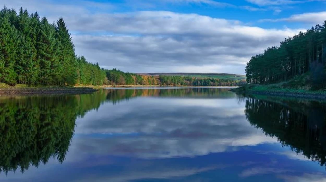
Belmont is a historic moorland village on the western edge of the West Pennine Moors, north of Bolton. Its landscape combines reservoirs, wooded valleys, pasture, stone buildings and industrial heritage. The area provides a strong setting for walking while preserving evidence of Lancashire’s transformation during the Industrial Revolution.
The most important water feature is Belmont Reservoir, constructed in 1826 by Bolton Waterworks. The reservoir was created during a period when Bolton’s rapidly expanding population and textile industries required increasingly reliable water management. Today, Belmont Reservoir supports recreation, sailing and wildlife while remaining an important part of the local water landscape.
Nearby reservoir landscapes add further walking opportunities. Turton and Entwistle Reservoir, Wayoh Reservoir and Jumbles Reservoir form part of a wider chain of engineered water landscapes across the West Pennine Moors. Each site reflects a different stage in the development of water infrastructure, from early nineteenth-century industrial water management to twentieth-century reservoir construction.
For visitors interested in history, these walks provide more than countryside scenery. Reservoir embankments, spillways, bridges, woodland plantations, former industrial sites and old transport routes reveal how water shaped settlement and industry. The landscape also demonstrates how infrastructure created for economic and public purposes later became valuable recreational and ecological assets.
What is the history of Belmont Reservoir?
Belmont Reservoir was constructed in 1826 by Bolton Waterworks during Bolton’s industrial expansion. It regulated water for downstream users and mills, reflecting nineteenth-century efforts to secure reliable supplies for a rapidly growing textile town and surrounding industrial communities.
Belmont Reservoir belongs to an early phase of modern water engineering in the Bolton area. Before large reservoirs became common, Great Bolton and Little Bolton relied heavily on wells and springs. These sources produced variable quantities and faced contamination risks. A reservoir on Bolton Moor was authorised in 1792, establishing an earlier stage in the development of organised water supply.
The 1820s brought stronger pressure on water infrastructure. Bolton’s population was increasing, cotton manufacturing was expanding and industrial processes required dependable water resources. The 1824 legislation concerning Bolton’s water supply authorised Springs Reservoir and also required the construction of Belmont Reservoir for holding water for estates, mills and works.
The Parliamentary Archives preserve evidence of subsequent work. A 1843 plan records proposed enlargement and associated works at Belmont Reservoir to provide a more abundant supply of water to the river and to owners and occupiers of mills and other works. The plan was signed by engineer J. F. Bateman in November 1842.
This history explains why Belmont Reservoir should be understood as industrial infrastructure rather than simply a modern recreational lake. Its original landscape function was closely connected to water regulation and the economic development of the Bolton district.
The reservoir also illustrates a wider Lancashire pattern. During the nineteenth century, water undertakings transformed rural valleys into engineered catchments. Lancashire County Council’s landscape assessment identifies the reservoir valleys as landscapes strongly shaped by nineteenth-century water infrastructure, including embankments, overflow cascades, feeder systems, tunnels and other engineering features.
Why is Belmont important for understanding Bolton’s industrial landscape?
Belmont demonstrates how nineteenth-century water engineering supported industrial Bolton by controlling water flows and protecting downstream resources. Its reservoir, surrounding settlement and historic landscape connect rural land management directly with textile manufacturing and urban population growth.
Bolton’s industrialisation depended on more than mills and factories. Water supply formed an essential part of the industrial system. Streams powered machinery in earlier periods, while later industrial processes required controlled supplies for washing, bleaching and manufacturing.
The valleys around Belmont and neighbouring Turton contained a mixture of agricultural land, industrial works, quarries and watercourses. This combination changed substantially during the nineteenth century. Reservoir construction appropriated land for water management and altered settlement patterns.
Lancashire’s landscape assessment records that the construction of numerous large water bodies in the mid-to-late nineteenth century transformed rural valleys to meet the needs of growing urban populations. The same assessment notes that water-company planting created woodland around reservoirs, producing landscapes that remain visible today.
The landscape therefore contains several historical layers. Older agricultural boundaries and farmsteads represent pre-industrial land use. Reservoir structures represent nineteenth-century engineering. Woodland planting reflects catchment management. Modern paths and recreational facilities represent the later conversion of infrastructure landscapes into public leisure environments.
This layered character is especially useful for educators and heritage visitors. A walk through the Belmont area can demonstrate how one landscape changed from agricultural and industrial use into a managed environment serving water regulation, biodiversity and recreation.
The local government history of Turton adds another important layer. Turton was a Lancashire township and later an urban district. A Local Board of Health was formed in 1873, while Turton Urban District was established in 1894. Its boundaries were extended in 1898 to include Belmont, Bradshaw, Edgworth, Entwistle, Harwood and Longworth, among other areas.
That administrative history matters because Belmont’s landscape was never isolated from neighbouring settlements. Roads, watercourses, farms, industrial sites and local government boundaries connected the village with the wider Turton district.
What makes Belmont Reservoir suitable for a peaceful weekend walk?
Belmont Reservoir combines open water, moorland, pasture and wooded surroundings within a historic landscape. Its quieter character, wildlife importance and established countryside paths make the area suitable for short nature walks, heritage exploration and longer weekend routes.
Belmont Reservoir sits north of Belmont village and is fed by Belmont Brook. The reservoir is now used by Bolton Sailing Club and has ecological importance for wintering wildfowl. The Environment Agency identifies Belmont Reservoir as part of the West Pennine Moors Site of Special Scientific Interest and a local Biological Heritage Site.
The reservoir’s ecological role is particularly significant because its landscape combines water and surrounding land habitats. The Lancashire Local Nature Recovery Strategy identifies Belmont Reservoir among the reservoirs supporting bird features associated with the West Pennine Moors SSSI. Species recorded across the wider landscape include black-headed gull, heron and Mediterranean gull, while upland areas support birds such as merlin, short-eared owl, ring ouzel and twite.
An island within Belmont Reservoir supports one of the United Kingdom’s largest black-headed gull colonies, according to the Environment Agency’s 2025 supporting statement.
This wildlife significance gives the reservoir a clear conservation dimension. Visitors should keep dogs under control, avoid disturbing birds and remain on established paths where access restrictions apply.
The setting also changes with elevation. The village environment contains houses, roads and community buildings, while the reservoir landscape opens towards pasture and moorland. This transition gives walkers a clear geographical connection between settlement and upland countryside.
The surrounding landscape is part of a broader reservoir-valley character area recognised by Lancashire County Council. The county describes these valleys as wooded landscapes with reservoirs, pasture, grassland and habitats supporting important flora and fauna.
Which reservoir walks near Belmont are best for a weekend nature adventure?
The strongest reservoir walking choices near Belmont are routes around Belmont Reservoir, Turton and Entwistle Reservoir, Wayoh Reservoir and Jumbles Reservoir. Each combines water, woodland and heritage features while offering different distances, terrain and historical perspectives.
Belmont Reservoir provides the closest direct connection with the village. Walking around the reservoir allows visitors to understand the relationship between Belmont settlement, water management and the West Pennine Moors. Bolton Sailing Club operates from the reservoir, demonstrating its continuing recreational use.
Turton and Entwistle Reservoir provides a deeper engineering history. The reservoir originated from the Entwistle Dam, constructed in the nineteenth century. Parliamentary legislation authorising the reservoir received Royal Assent on 3 April 1832. The dam was designed by local surveyor Thomas Ashworth under the oversight of Jesse Hartley, the engineer associated with Liverpool’s dock system.
Wayoh Reservoir forms another important part of the local water landscape. A North Turton Parish Council walking guide identifies Wayoh Reservoir as dating from 1876 and describes routes connecting it with Edgworth, Entwistle Reservoir and the surrounding countryside. The same route highlights the railway viaduct built in 1848, adding transport history to the reservoir landscape.
Jumbles Reservoir is younger than the Belmont and Entwistle systems. Construction took place between 1967 and 1970, and the reservoir was officially opened on 11 March 1971. Jumbles Country Park subsequently became a significant recreation area with paths around the reservoir and through the surrounding valley.
A standard Jumbles Reservoir circuit is approximately 2.1 miles and takes around one hour according to a published route description. The route follows woodland paths, crosses bridges and passes the reservoir dam.
A longer Jumbles and Bradshaw Brook route from Bromley Cross station covers approximately 3.3 miles, with about 243 feet of ascent and an estimated walking time of 1 hour 45 minutes excluding breaks. Visit Manchester describes the route as leisurely, with mainly level or gently graded tracks and some steeper sections near Bradshaw Brook.
These routes should not be treated as interchangeable. Belmont offers the strongest direct village-and-reservoir experience, Turton and Entwistle emphasises nineteenth-century engineering, Wayoh connects water infrastructure with railway history, and Jumbles provides the clearest established country-park walking environment.
How did Turton and Entwistle Reservoir change the history of the area?
Turton and Entwistle Reservoir originated from nineteenth-century industrial water management. Its 1832 enabling Act and substantial Entwistle Dam demonstrate how local mill owners organised water resources to regulate Bradshaw Brook and support textile production.
The Turton and Entwistle scheme emerged from the industrial economy of the Bradshaw Brook valley. Local mill owners sought greater control over water resources because textile production depended on dependable flows.
Parliament passed the Turton and Entwistle Reservoir Act in 1832. The legislation authorised construction and maintenance of a reservoir on Bradshaw Brook in the townships of Turton and Entwistle. Its purpose included regulating the water supply for the brook and connected rivers.
The engineering scale was substantial. Entwistle Dam rose 108 feet from its base and measured approximately 110 metres along the crest. Historical descriptions identify Thomas Ashworth as the dam’s designer, with Jesse Hartley overseeing the work.
The reservoir’s construction illustrates nineteenth-century advances in water engineering. The dam used puddle clay construction, while a rock-cut outlet tunnel carried water through the valley side. Later improvements included an overflow channel and valve tower added after Bolton Corporation Waterworks took control in 1864.
This sequence is important when walking the area because the visible landscape contains more than one period of engineering. The original dam belongs to the early Victorian industrial water system, while later modifications reflect changing municipal management.
The reservoir also forms part of the connected Bradshaw Brook water landscape. Wayoh lies downstream, while Jumbles forms another later reservoir within the wider system. Lancashire’s landscape research identifies these reservoirs as components of a landscape shaped by water storage, woodland management and industrial development.
The area also preserves evidence of nineteenth-century transport. The North Turton Trail identifies an 1848 railway viaduct overlooking Wayoh Reservoir. This creates an unusually clear connection between water infrastructure and railway infrastructure within a single walking landscape.
What industrial remains can walkers identify around the reservoir valleys?
Reservoir walks around Belmont and neighbouring valleys reveal industrial remains including dams, spillways, bridges, old roads, quarry sites, former mill locations and engineered waterways. These features document the relationship between water management, transport, mining and textile production.
Industrial archaeology is especially important around Jumbles and Bradshaw Brook. The valley supported industrial activity for centuries before the reservoir was constructed.
Historical descriptions of Bradshaw Brook record the use of its water for fulling mills, which processed woollen cloth. Later textile production involved wool, linen and cotton, while the water was also used for cleaning and bleaching. Paper manufacturing also developed in the valley.
The construction of Jumbles Reservoir changed the visibility of this industrial landscape. Some former sites were submerged or altered when the valley was flooded. During periods of low water, remnants associated with earlier industry have become visible, including remains linked to Horrobin Mill and an old iron footbridge recorded in historical photographs.
Other surviving features include a stone loading ramp beside the eastern side of Jumbles Reservoir. The structure relates to the former road from Walsh Fold and demonstrates how horses and carts once moved goods through the valley. An old water trough also survives along the route.
Horrobin Lane retains stone paving, while former mill-related buildings at Horrobin Fold have been incorporated into later residential use. These features show how industrial infrastructure can survive even when its original economic function disappears.
Quarrying provides another layer. The Jumbles valley contains the former Jumbles Quarry, which was flooded as part of the reservoir landscape. The resulting water body obscures much of the former quarry from ordinary view.
Lancashire’s landscape assessment records that reservoir construction and earlier mineral extraction affected archaeological evidence. Some earlier land-use remains disappeared beneath water or were altered during construction. Surviving farmsteads, field patterns, industrial structures and transport routes therefore have particular heritage value.
Walkers should treat these features as heritage evidence rather than simply scenery. Stonework, embankments and old routes can reveal the chronology of industrial change without requiring a museum building.
How have reservoirs become wildlife and conservation landscapes?
Reservoir construction created managed water environments that later developed ecological value. Belmont and neighbouring reservoirs now support wildfowl, woodland habitats, grassland and upland species while remaining part of engineered water-management systems.
The ecological importance of the reservoir valleys results from the combination of open water, planted woodland, pasture, wet grassland and moorland.
Lancashire County Council identifies the reservoir valleys as landscapes dominated by large reservoirs built during the nineteenth century to serve expanding urban populations. The surrounding woodland was often planted as nineteenth-century catchment woodland and continues to contribute to the character of the landscape.
The county’s landscape assessment specifically identifies Jumbles, Wayoh, Delph, Belmont and Rivington as important for wintering wildfowl. Belmont also supports breeding waders associated with adjacent in-bye pastures.
The West Pennine Moors provides the wider ecological context. The Local Nature Recovery Strategy identifies internationally important habitat mosaics across the area, including blanket bog, upland heathland, wet grassland and rush pasture. Birds such as lapwing and curlew use these interconnected habitats for feeding and nesting.
Belmont Reservoir’s designation within the West Pennine Moors SSSI adds statutory conservation significance. The Environment Agency also identifies it as a local Biological Heritage Site.
These designations do not turn the landscape into a museum. They establish a framework for managing habitats while allowing responsible public enjoyment.
For walkers, the conservation significance means that simple behaviour has practical importance. Staying on established routes reduces trampling. Controlling dogs protects livestock and wildlife. Avoiding disturbance around nesting or roosting areas supports the ecological function of the landscape.
The history of woodland is also significant. Reservoir catchments were deliberately planted in the nineteenth century to protect water resources and manage surrounding land. Much of the woodland visible today therefore has a direct connection with Victorian water engineering rather than being entirely natural woodland.
How should visitors plan a reservoir walk around Belmont today?
Visitors should choose a route according to distance, terrain, accessibility and weather, then follow local signs and responsible countryside guidance. Belmont and neighbouring reservoir paths vary from level surfaced sections to steeper, muddy and uneven countryside routes.
A short visit can focus on Belmont Reservoir and the village. A longer weekend route can connect the reservoir landscape with neighbouring water bodies and historic settlements.
Weather affects walking conditions. Reservoir valleys contain exposed sections, woodland paths, damp ground and slopes. After heavy rain, paths become muddy and stream crossings require additional care. Winter conditions can produce ice on shaded surfaces.
Jumbles provides useful information for understanding accessibility. Visit Manchester states that the paths immediately beside Jumbles Reservoir are level, step-free and mainly hard-surfaced, while the longer Bradshaw Brook route includes gradients and steps that make it unsuitable for wheelchair users.
The Jumbles Country Park visitor centre provides parking, while the park also has toilets and a café. Visit Manchester lists disabled parking and guide-dog access among the facilities.
Public transport provides another option. A published Jumbles Reservoir route identifies Bromley Cross railway station as a possible starting point, with the reservoir reached by walking north along Grange Road.
Visitors should also distinguish administrative boundaries. Bolton Council states that Jumbles Reservoir is managed by United Utilities and that Belmont, Turton, Edgworth, Entwistle and Wayoh Reservoir are outside the Bolton Council administrative area. This matters when checking land management, access information and local facilities.
Reservoirs are working infrastructure. Water levels, maintenance operations, restricted areas and safety requirements take priority over recreation. Visitors should never enter restricted operational areas or approach hazardous structures.
Water itself also presents a serious safety issue. Reservoir edges can be steep, slippery and unstable. Swimming is not appropriate in operational reservoirs unless an explicitly authorised facility exists.
For visitors combining recreation with heritage research, a map and local historical references add value. Comparing current paths with historical maps can reveal old roads, vanished settlements, former mills and altered watercourses.
To connect a reservoir walk with the wider local heritage experience, consult our comprehensive [Why Belmont Reservoirs Were Built and Their Historical Importance] for itineraries and visiting parameters.
Why are Belmont’s reservoir walks important for local history?
Belmont’s reservoir walks preserve a continuous record of rural settlement, industrial expansion, Victorian engineering, municipal water management, twentieth-century recreation and modern conservation. The landscape demonstrates how infrastructure can become heritage while retaining practical environmental functions.
The importance of Belmont lies in the continuity of its landscape rather than one isolated monument.
The first major historical layer is agricultural. Fields, farms and moorland formed the landscape before large reservoirs transformed the valleys. The second layer is industrial. Textile production, quarrying, mining and water-powered activity reshaped the valleys and increased demand for controlled water resources.
The third layer is Victorian water engineering. Belmont Reservoir dates from 1826, while the Turton and Entwistle scheme was authorised in 1832. Wayoh followed later in the nineteenth century. These dates demonstrate the gradual expansion of water infrastructure rather than one single construction programme.
The fourth layer is municipal management. Bolton Corporation Waterworks became involved in managing reservoirs and later added infrastructure such as the overflow channel and valve tower at Entwistle.
The fifth layer is twentieth-century recreation. Jumbles Reservoir was completed between 1967 and 1970 and opened in 1971. The surrounding country park transformed an engineered water landscape into a major recreational destination.
The sixth layer is modern conservation. Reservoirs now contribute to habitat networks and support protected or notable wildlife. Belmont’s SSSI status demonstrates that an infrastructure site can also possess substantial ecological significance.
The administrative history reinforces this long-term perspective. Turton’s local government structure changed significantly between 1873 and 1974, with the former urban district eventually divided between Blackburn and Bolton authorities.
This historical complexity makes reservoir walking valuable for educators and students. A single route can introduce geography, engineering, industrial history, local government, ecology and heritage conservation.
The landscape also has relevance for genealogical research. Historic records for the Turton area include township records, Local Board records, Urban District Council minutes, rate books, valuation records, building plans and public-health documentation. Lancashire Record Office guidance notes that archives for the former Turton Urban District can be held across relevant local collections because of the 1974 administrative division.
For family historians, the landscape provides context for occupations and addresses found in historical records. A person recorded as a mill worker, quarry worker, farmer, waterworks employee or local tradesperson belonged to an economic system visibly represented by the reservoir valleys.
What does the future of Belmont’s reservoir landscape depend on?
The future of Belmont’s reservoir landscape depends on balancing water infrastructure, public access, wildlife conservation and heritage protection. Responsible maintenance and visitor behaviour will preserve both the practical function and historical character of the reservoir valleys.
Reservoir landscapes require active management because they combine engineered structures with natural processes. Dams, spillways, embankments and watercourses require inspection and maintenance, while surrounding habitats require conservation management.
Bolton Council explains that reservoirs are subject to statutory safety requirements. The Reservoirs Act requires owners of qualifying reservoirs to maintain them and arrange inspections by qualified engineers. Although Belmont Reservoir is managed outside Bolton Council’s reservoir ownership, the principle demonstrates why reservoir infrastructure must remain professionally managed.
The Environment Agency’s 2025 Belmont Reservoir supporting statement also demonstrates the continuing technical role of the reservoir. Belmont is not used for public drinking-water abstraction. Its current function is to provide compensation flow to the downstream watercourse, Eagley Brook.
That function connects the reservoir with a much larger water system. Eagley Brook flows downstream before joining other waterways, while Bradshaw Brook carries water from Jumbles Reservoir into the wider River Tonge and River Croal system.
Conservation is equally important. The reservoir is part of the West Pennine Moors SSSI and supports significant bird populations. Future landscape management therefore needs to protect ecological features alongside infrastructure.
Public access is another important consideration. Established paths allow visitors to experience the landscape without unrestricted access to operational infrastructure or sensitive habitats.
The historic dimension also requires protection. Reservoir structures, old roads, industrial remnants and surviving woodland can disappear through neglect, redevelopment or poorly managed works. Lancashire County Council identifies Victorian reservoir engineering features as historically significant elements of the county’s landscape character.
Belmont therefore represents a form of living heritage. Its reservoir continues to perform a water-management function, its surroundings support wildlife, and its paths provide recreational access. At the same time, its structures preserve evidence of nineteenth-century industrial development.
For weekend visitors, this makes a walk around Belmont more than a countryside activity. It is an accessible way to examine how water, industry, settlement, engineering and conservation have interacted across two centuries.
The enduring value of Belmont’s reservoir walks comes from this combination. The landscape records the growth of industrial Bolton, the development of organised water management, the transformation of rural valleys and the later emergence of recreation and conservation. A careful walk can reveal these layers without altering the landscape that preserves them.
For Bolton Today readers, Belmont offers an unusually clear example of how local history remains visible in everyday countryside. The reservoir is not simply a body of water. It is a historical infrastructure site, an ecological resource, a recreational setting and a continuing part of the West Pennine Moors landscape.
FAQS
Where is Belmont Reservoir?
Belmont Reservoir is near Belmont village in the West Pennine Moors, north of Bolton, Greater Manchester. It is surrounded by moorland, pasture and woodland.