Astley Bridge existed as a rural upland fringe of Bolton characterised by farmland, scattered hamlets, woodland corridors, and small watercourses. Before industrialisation, its terrain supported agriculture, sheep grazing, and cottage-based domestic production linked to nearby market settlements.
Before the 18th century industrial expansion of Bolton, Astley Bridge formed part of a transitional landscape between the Irwell valley and the Pennine foothills. The area consisted of irregular fields defined by hedgerows, stone boundaries, and unenclosed commons. Settlement density remained low, with farmsteads concentrated along natural ridgelines and stream edges such as the Astley Brook corridor.
Land ownership patterns reflected feudal and post-feudal agricultural systems, recorded in parish documentation from Bolton-le-Moors. These documents show fragmented holdings distributed among tenant farmers and smallholders. The absence of major infrastructure preserved ecological continuity, including oak woodland fragments and peat-rich soils typical of upland Lancashire.
This pre-industrial landscape provided essential subsistence resources and limited surplus production. Watercourses functioned primarily for irrigation and milling at a very small scale, with only minor corn mills recorded in early land surveys. The transformation of this environment began with population pressure from Bolton’s expanding textile economy in the late 1700s.
How did geology and geography shape settlement patterns in Astley Bridge?
Astley Bridge’s settlement patterns were shaped by glacial till deposits, Pennine foothill gradients, and accessible watercourses. These physical features concentrated early habitation along valleys while restricting dense construction on elevated, unstable, or poorly drained upland terrain.
The geological structure of Astley Bridge consists primarily of Carboniferous Millstone Grit and coal measures typical of Greater Manchester’s northern fringe. These strata provided both building materials and industrial fuel resources. Sandstone outcrops enabled early quarrying activity, while underlying coal seams influenced later industrial siting decisions.
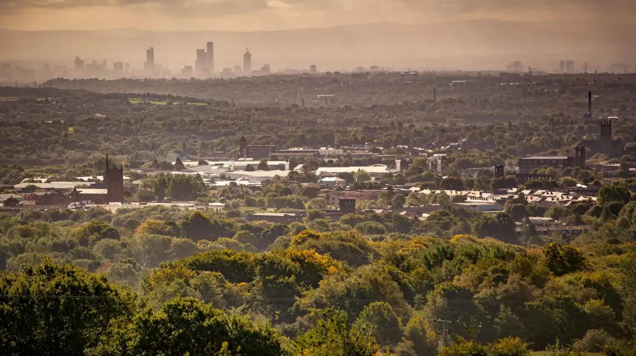
Topographically, the area is defined by steep gradients descending into Bolton’s central basin. Early settlements clustered along gentler slopes where agriculture was viable and transport routes could be maintained. The presence of Astley Brook and its tributaries created natural corridors that later became foundational to industrial water power systems.
Drainage patterns also determined land usability. Poorly drained upland soils limited arable farming, reinforcing pastoral land use before industrialisation. Once mechanised textile production expanded in Bolton, these same watercourses became strategic assets for mill placement. The transition from agricultural to industrial geography followed existing natural pathways rather than artificial planning.
When did industrial transformation begin in Astley Bridge?
Industrial transformation in Astley Bridge began in the late 18th century, accelerating between 1780 and 1850 as cotton spinning, coal extraction, and mechanised milling expanded from central Bolton into surrounding northern districts.
The Industrial Revolution reached Astley Bridge through the expansion of Bolton’s cotton industry. Between 1780 and 1820, early water-powered mills appeared along tributaries feeding the River Croal system. These early industrial sites replaced small agrarian watermills and introduced factory-based production systems.
Steam power adoption in the early 19th century marked a decisive shift. Coal from nearby Lancashire coalfields enabled continuous production independent of water flow. This technological change allowed mills to move away from narrow valleys into more flexible upland sites within Astley Bridge.
Population records from the 1841 census indicate rapid urbanisation during this period. Rural hamlets were absorbed into expanding industrial housing zones. The transformation aligned with broader national trends in textile mechanisation, particularly in north-west England, where Bolton became one of the key cotton manufacturing centres.
The pace of change intensified after railway expansion in the mid-19th century, linking Astley Bridge more directly to Manchester and coastal export routes.
Which mills and industries defined Astley Bridge’s growth?
Astley Bridge’s growth was defined by cotton spinning mills, engineering workshops, and coal-related industries that operated throughout the 19th century, forming a dense industrial corridor integrated with Bolton’s wider manufacturing network.
Cotton spinning dominated the industrial identity of Astley Bridge. Large steam-powered mills, constructed from red brick and locally quarried sandstone, lined the valleys and elevated terraces. These mills operated multi-storey production systems powered by beam engines and later steam turbines.
Engineering workshops developed alongside textile production. These facilities produced machinery components, boilers, and mill equipment essential for maintaining Bolton’s industrial infrastructure. The integration of engineering and textile sectors created a self-sustaining industrial ecosystem within the district.
Coal mining also contributed significantly. Small collieries and drift mines extracted coal from shallow seams in the Lancashire Coal Measures. This resource supported both domestic heating and industrial fuel demand.
By the late 19th century, Astley Bridge functioned as a mixed industrial zone. Textile production remained dominant, but diversified industrial activity reinforced its role as part of Bolton’s wider manufacturing landscape.
How did transport networks alter Astley Bridge’s northern frontier?
Transport networks transformed Astley Bridge from an isolated rural edge into a connected industrial district through turnpike roads, tramways, and railway expansions that integrated it into Bolton’s economic system.
Turnpike roads introduced in the late 18th century improved access between Bolton and northern Lancashire. These roads facilitated the movement of raw cotton, finished textiles, and coal. Improved transport reduced travel time and encouraged industrial investment in peripheral districts such as Astley Bridge.
The arrival of rail infrastructure in the mid-19th century marked a structural change. Railway lines connecting Bolton to Manchester and beyond enabled rapid freight movement. Although Astley Bridge was not always a primary railway hub, its proximity to Bolton stations significantly enhanced industrial viability.
Horse-drawn tramways and later electric tram systems further integrated local mobility. These networks connected residential areas with mills, allowing workers to commute from expanding housing estates.
To experience this historic transformation in context today, consult our comprehensive [Exploring Astley Bridge on Foot: Scenic Routes and Local Landmarks] for itineraries and visiting parameters.
Transport development redefined spatial relationships, compressing distances between production, residence, and markets.
What demographic changes occurred during the Industrial Revolution?
Astley Bridge experienced rapid population growth during the Industrial Revolution, driven by rural-to-urban migration, Irish immigration, and labour demand from expanding textile and coal industries across the 19th century.
Census records from 1801 to 1901 show exponential population increases across Bolton’s northern districts, including Astley Bridge. Workers migrated from surrounding rural counties seeking employment in mills and associated industries. This migration reshaped settlement density and housing patterns.
Irish immigration during the mid-19th century, particularly following the Great Famine (1845–1849), contributed to workforce expansion. Migrant communities settled in densely packed terraced housing near industrial sites.
Population structure shifted toward a younger demographic profile due to labour-intensive employment. Child labour was recorded in textile mills during early industrial phases, gradually declining after legislative reforms such as the Factory Acts of the 19th century.
By the late Victorian period, Astley Bridge had evolved into a fully urbanised district. Its demographic composition reflected broader industrial Britain, with a working-class majority supporting manufacturing and service economies.
What remains of Astley Bridge’s historic mills today?
Several mill structures, chimney bases, and converted industrial buildings remain in Astley Bridge today, reflecting adaptive reuse and partial preservation of 19th-century textile infrastructure within modern urban development.
Although many original mills were demolished during 20th-century industrial decline, structural remnants persist across the landscape. Surviving features include brick-built mill shells, chimney stacks, and retaining walls. These elements provide physical evidence of industrial architecture typical of Victorian Lancashire.
Some former mill buildings have been converted into residential apartments, storage facilities, or commercial spaces. Adaptive reuse has preserved external architectural features while altering internal structures for modern functionality.
Archaeological surveys conducted in Greater Manchester identify subsurface remains of demolished mills, including foundations, water channels, and machinery bases. These remains are protected under local heritage planning frameworks when identified during redevelopment.
Industrial archaeology in Astley Bridge contributes to understanding production scale, labour organisation, and technological evolution during the Industrial Revolution.
How did housing and urban planning evolve in the area?
Housing in Astley Bridge evolved from scattered rural cottages to dense Victorian terraced streets, shaped by industrial expansion, employer-led construction, and minimal early urban planning regulation.
Early worker housing consisted of small stone cottages located near mills and transport routes. As industrial employment increased, demand for accommodation led to rapid construction of terraced housing. These rows were designed to maximise density while minimising construction costs.
By the mid-19th century, housing estates expanded along valley slopes and former agricultural land. Streets were often constructed without formal zoning regulations, resulting in irregular layouts and limited sanitation infrastructure.
Public health reforms in the late 19th and early 20th centuries introduced improvements in drainage, water supply, and housing standards. Municipal authorities in Bolton began regulating construction quality and urban density.
Urban expansion replaced much of the original agrarian landscape. Field boundaries were absorbed into street grids, permanently altering the spatial organisation of Astley Bridge.
What environmental changes occurred due to industrial activity?
Industrial activity in Astley Bridge caused deforestation, air pollution, watercourse modification, and soil contamination, fundamentally altering the ecological balance of the northern Bolton landscape during the 19th and early 20th centuries.
Deforestation occurred as timber was harvested for construction and fuel before widespread coal adoption. Remaining woodland areas were gradually cleared for housing and industrial development.
Air pollution increased significantly due to coal combustion in mills and domestic hearths. Soot deposition affected vegetation and building surfaces, a common condition in industrial Lancashire towns.
Watercourses such as Astley Brook were modified to support industrial needs. Channels were straightened, culverted, or redirected to power mills and manage waste discharge. These modifications reduced biodiversity and altered natural hydrology.
Soil contamination resulted from coal ash disposal and industrial waste accumulation. These environmental impacts persisted into the post-industrial period, influencing modern land remediation strategies.
How is Astley Bridge’s heritage preserved today?
Astley Bridge’s heritage is preserved through conservation planning, adaptive reuse of industrial buildings, archival documentation, and heritage mapping initiatives led by local authorities and cultural institutions in Greater Manchester.
Preservation efforts focus on retaining architectural remnants of mills, transport infrastructure, and Victorian housing. Listed building status protects selected structures of historical significance, ensuring controlled redevelopment.
Local archives maintain records including census data, industrial maps, and engineering drawings. These materials support academic research and genealogical studies tracing family histories connected to Bolton’s industrial workforce.
Community heritage initiatives document oral histories and photographic records of former industrial sites. These projects help reconstruct the lost landscape through collective memory and historical evidence.
Urban regeneration programmes integrate heritage preservation with modern infrastructure planning, balancing development with historical continuity.
What is the historical significance of Astley Bridge within Bolton?
Astley Bridge represents a critical transition zone in Bolton’s expansion, illustrating the shift from rural agricultural land to industrial urban district during the Industrial Revolution and its long-term socio-economic transformation.
Historically, Astley Bridge functioned as Bolton’s northern frontier, marking the boundary between urban expansion and rural Lancashire. Its development reflects the broader trajectory of industrialisation in North West England.
The district demonstrates key processes of industrial urban growth, including mechanised production, transport integration, and demographic restructuring. These processes align with national patterns documented in British industrial history.
Archaeological and architectural evidence from Astley Bridge contributes to understanding industrial settlement planning, labour organisation, and technological change.
Its significance lies in its representational value as a microcosm of industrial Britain, where environmental, economic, and social systems converged during rapid transformation.
How can visitors explore the lost landscape today?
Visitors explore Astley Bridge’s lost landscape through heritage walking routes, preserved mill sites, canal corridors, and surviving Victorian streets that collectively reveal layers of industrial and pre-industrial history embedded in the modern environment.
Modern exploration of Astley Bridge focuses on identifying remnants of its historical landscape within contemporary urban settings. Walking routes follow former mill corridors, transport lines, and residential expansions that overlay older agricultural boundaries.
Surviving industrial architecture provides visual markers of past economic activity. Terraced housing preserves spatial organisation linked to worker settlement patterns. Green corridors along waterways reflect modified natural systems.
Local interpretation boards and heritage trails assist in contextualising historical features. These resources connect physical locations with documented historical narratives.
The district’s layered landscape demonstrates continuity between past and present, allowing systematic reconstruction of its transformation from rural frontier to industrial hub.
FAQS
What was Astley Bridge like before industrialisation?
Before industrialisation, Astley Bridge was a rural upland landscape made up of farmland, scattered farmsteads, woodland areas, and small watercourses such as Astley Brook. The economy was mainly agricultural with some cottage-based textile work.