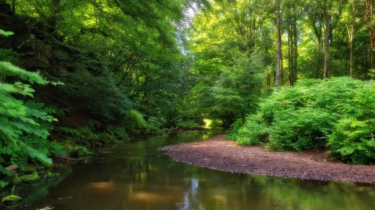
Harwood, a historic settlement in the north-eastern part of the Metropolitan Borough of Bolton, has developed through a close relationship between settlement, agriculture, industry, transport, housing and open land. Its green spaces are not simply modern recreational facilities. They form part of a wider landscape history that connects historic farms and fields with woodland, valleys, playing fields, public parks and newer community-managed habitats.
The story of Harwood's development is therefore also a story about changing land use. Agricultural land supported earlier rural communities. Industrialisation and urban expansion increased the demand for housing and infrastructure. Public health concerns encouraged greater attention to accessible open space. Later planning policy, environmental conservation and community volunteering gave green areas a new role in biodiversity and local identity.
Today, Harwood's green landscape includes important public spaces such as Longsight Park and Millennium Wood, together with walking connections towards the Bradshaw Valley and surrounding countryside. Bolton Council describes Longsight Park as a large informal park with a playground, football pitch, nature trail and walking links to the Bradshaw Valley.
The history of these places is best understood within the wider development of Harwood and Bolton. The landscape records the transition from rural settlement to a modern suburban community while retaining links with the agricultural and natural environment that shaped the area.
What was Harwood like before modern urban development?
Harwood began as a rural landscape shaped by agriculture, dispersed settlement and local routes, with fields, farms, woodland and watercourses forming the physical foundation for later community development. Modern roads and housing gradually occupied parts of this landscape while surviving open land retained elements of its earlier rural character.
Before the expansion of modern housing, Harwood formed part of the wider rural landscape of historic Lancashire. The area around present-day Harwood contained agricultural land, farms, cottages, lanes and natural features that supported local economic activity.
The term rural landscape describes an environment dominated by agriculture and relatively low-density settlement. In Harwood, this landscape provided the physical setting from which the later village and suburban community developed.
Land was an important economic resource. Fields supported livestock and crops, while woodland supplied timber and other materials. Streams and valleys influenced settlement patterns and movement across the landscape.
The area's topography also shaped later development. Harwood sits within a landscape connected to the West Pennine environment, where rising ground, valleys and open countryside remain important features. The relationship between built-up streets and surrounding open land continues to distinguish Harwood from the denser urban core of Bolton.
Earlier land divisions also influenced modern boundaries. Historic field patterns frequently survive indirectly through roads, property boundaries, footpaths and irregular development patterns. A modern street can therefore follow a route that originated as a rural lane connecting farms or settlements.
This continuity is important for historical research. Green space does not always represent land that was deliberately preserved as a park. Some open areas survive because their physical characteristics, ownership history or agricultural use prevented intensive construction.
The distinction between historic countryside and public green space is therefore essential. A historic field was primarily productive land. A public park was deliberately managed for community access. A woodland habitat can have ecological value without being designed as a recreational landscape.
Harwood's modern green infrastructure combines these different historical layers.
How did agriculture shape Harwood’s early community development?
Agriculture shaped Harwood by organising land ownership, settlement and local movement before large-scale urban expansion. Farms, fields, lanes and watercourses established patterns that later influenced housing growth, public paths and the survival of open land within the developing community.
Agricultural activity provided the economic foundation for early settlement. Families lived close to the land they worked, while local routes connected farms with markets, neighbouring settlements and places of worship.
The agricultural economy also influenced the physical appearance of the area. Buildings were commonly associated with farmsteads, barns, cottages and boundary walls rather than the terraces and estates associated with industrial urbanisation.
As the population increased, agricultural land became increasingly valuable for development. The conversion of fields into housing changed the relationship between residents and the landscape.
This process was not unique to Harwood. Across northern England, industrial and commercial growth encouraged the expansion of settlements beyond their historic cores. Formerly separate villages and hamlets increasingly became connected through roads, public transport and residential development.
Harwood's location close to Bolton meant that wider economic changes affected its development. Bolton's industrial expansion created employment and increased demand for housing across the surrounding area.
The resulting landscape was transitional. Agricultural land remained visible while new streets and houses appeared beside older farms and lanes.
This transition explains why Harwood retains a mixture of suburban development and accessible countryside. Green areas are often remnants of earlier land use rather than isolated features created independently of settlement history.
For genealogical researchers, this landscape history also provides useful context. A family recorded in a Harwood census, parish register or property document lived within a landscape that changed significantly over generations. Understanding former farms, roads and boundaries can help researchers interpret historic addresses that no longer exist in their original form.
How did industrialisation change Harwood and its surrounding landscape?
Industrialisation transformed Harwood's wider environment by increasing population, employment and housing demand across the Bolton area. The resulting expansion changed agricultural land into residential and infrastructure uses while increasing the importance of accessible open space for health, recreation and community life.
The Industrial Revolution changed the geography of northern England. Bolton became internationally associated with cotton spinning and textile manufacturing, while coal mining, engineering, transport and associated industries supported wider economic growth.
Harwood was influenced by this regional transformation even where heavy industry was not concentrated directly within every part of the settlement.
Industrial employment generated population growth. Workers needed homes, shops, schools, roads and public services. As urban areas expanded, neighbouring rural districts experienced development pressure.
The physical consequences were substantial. Fields were divided or built upon. Roads became more important. Public transport improved connections between settlements and employment centres.
The expansion of housing also changed the social function of remaining open land. Residents increasingly needed accessible spaces for recreation because dense residential development reduced direct access to agricultural countryside.
This relationship between industrialisation and public open space is a major theme in British urban history. Rapid industrial growth produced economic opportunity but also created concerns about overcrowding, sanitation and public health.
Public parks emerged as part of the response. They provided accessible outdoor environments for recreation and fresh air, particularly for people living in densely built-up districts.
Harwood's development should therefore be understood within this broader transformation. Its green spaces represent both survival and adaptation. Some areas retain links with rural land use, while others reflect twentieth-century planning decisions that incorporated open space into expanding residential neighbourhoods.
Why did public green spaces become important to Harwood’s community?
Public green spaces became important because urban growth increased the need for accessible recreation, healthier environments and shared community facilities. Parks, playing fields, woodland and walking routes provided residents with places for exercise, social interaction, children’s activities and contact with nature.
The concept of public green space developed alongside modern ideas about municipal responsibility.
A public green space is land accessible to the community for recreation, leisure, environmental or social purposes. It includes parks, playing fields, public woodlands, nature trails and other publicly accessible open areas.
The Victorian period was particularly important in the development of public parks across Britain. Municipal authorities and civic organisations increasingly recognised the relationship between environmental quality and public health.
Bolton's Queen's Park, which officially opened in 1866, illustrates the period's wider commitment to public recreation. Its original layout included features that remain recognisable today, demonstrating the long-term durability of Victorian park planning.
Harwood developed within the same broad historical movement, although its green spaces reflect a mixture of rural inheritance and later suburban planning.
Community green space also performs a social function. A park provides a shared environment where residents from different households and generations use the same landscape.
Children use play areas. Sports clubs use pitches. Walkers use paths. Families use open lawns. Nature groups monitor wildlife. These activities create connections between residents and strengthen local identity.
The historical significance lies in the continuity of this function. The reasons for using open land have changed, but the principle of shared access remains central to community development.
How did Longsight Park become part of Harwood’s modern green landscape?
Longsight Park represents the modern recreational side of Harwood's green-space history, combining informal open land with organised facilities. Its football pitch, playground, nature trail and walking connections demonstrate how contemporary community planning integrates recreation, landscape access and links to surrounding countryside.
Located on Longsight Lane, Longsight Park is an important public green space in Harwood. Bolton Council identifies facilities including a football pitch, nature trail and playground, while its walking connections extend towards the Bradshaw Valley and beyond.
The park illustrates a major shift in the meaning of open land.
Earlier rural land was primarily associated with agricultural production. Modern public parks are designed around community access and multiple uses.
Longsight Park combines several functions within one landscape. Recreational facilities support organised and informal activity. The nature trail provides opportunities for environmental engagement. Walking connections extend the park's role beyond its formal boundary.
This connectivity is significant. A green space becomes more valuable when it forms part of a wider network rather than operating as an isolated site.
Walking links between Harwood and the Bradshaw Valley provide residents with access to a broader landscape. They also preserve the experience of moving between urban streets and open countryside.
The park therefore represents both community development and landscape continuity.
To experience this historic landscape in person today, consult our comprehensive [Discover Beautiful Parks in Harwood Perfect for Relaxing Family Days Outdoors] for itineraries and visiting parameters.
The historical value of Longsight Park also lies in its accessibility. Its location within a residential community means that residents can reach green space without travelling to a distant country park.
This principle is increasingly important in modern urban planning. Accessible local parks support everyday recreation, while larger rural landscapes provide longer walks and wider ecological networks.
How did twentieth-century housing growth influence Harwood’s green spaces?
Twentieth-century housing growth changed Harwood from a predominantly rural settlement into a more extensive residential community. New development increased pressure on land but also created opportunities to incorporate parks, playing fields, landscaped areas and pedestrian routes into the expanding urban structure.
The twentieth century brought major changes to settlement patterns throughout Greater Manchester and the former Lancashire region.
Housing demand increased as populations grew and transport connections improved. New residential streets extended beyond older settlement centres.
Harwood's expansion followed this broader pattern. Housing development created a more suburban landscape, with streets, schools, shops and community facilities occupying areas previously associated with farmland.
Planning became increasingly important in managing this growth.
Modern planning treats open space as an essential component of settlement design. Parks and playing fields provide recreation, while green corridors can connect habitats and support walking and cycling.
This approach differs from earlier development patterns in which open land often remained because it had not yet been built upon.
The distinction matters historically. Planned green space reflects a deliberate decision to provide community infrastructure. Surviving agricultural land reflects earlier economic land use.
Harwood contains evidence of both processes.
The twentieth century also changed expectations about leisure. Organised football, children's play, informal walking and community events became important uses of public open land.
Playing fields became particularly significant. They supported schools, clubs and local sports organisations while providing large open areas within residential districts.
This created a multifunctional landscape. A single green space could support recreation, biodiversity, drainage and visual separation between neighbourhoods.
The result was a community in which green space became part of the physical structure of everyday life.
What role do woodland and natural habitats play in Harwood’s history?
Woodland and natural habitats preserve environmental features that predate modern development while supporting contemporary biodiversity. In Harwood, wooded areas, nature trails and connected green corridors demonstrate how historical landscape character continues to influence conservation, recreation and community identity.
Woodland is an important historical record because trees and habitats can survive across generations.
Some woodland areas represent remnants of older landscapes. Others are newer plantings established through environmental programmes or community initiatives.
Millennium Wood is particularly relevant to Harwood's contemporary green-space story. In 2026, Friends of Harwood and Longsight Park received Green Flag Community Awards for Longsight Park and Millennium Wood, recognising community-led stewardship of these spaces.
A Green Flag Community Award recognises high-quality management and community involvement in publicly accessible green spaces. The award is distinct from the formal Green Flag Award system but similarly highlights standards of care and local participation.
The recognition demonstrates a change in the role of communities.
Earlier park management was primarily associated with municipal authorities. Modern green-space management increasingly involves councils, volunteer groups, charities and residents.
This collaborative model is important because local knowledge often supports practical stewardship. Volunteers can identify problems, support events, monitor conditions and encourage responsible use.
Natural habitats also provide ecological value. Bolton's wider greenspace strategy identifies biodiversity, nature recovery and habitat connectivity as key priorities. The borough's landscapes include upland oak woods, restored peatlands and post-industrial habitats, demonstrating the diversity of environments across the wider area.
Harwood's green spaces therefore form part of a broader ecological network.
The historical importance of this network is increasing. Climate change, biodiversity decline and urban growth have made habitat protection a central part of modern planning.
How has community involvement changed the management of Harwood’s green spaces?
Community involvement has shifted green-space management from a primarily municipal responsibility toward partnership working between residents, volunteers, councils and environmental organisations. Friends of Harwood provides a contemporary example of local participation in the care and recognition of shared green assets.
Community stewardship is a modern stage in the history of Harwood's green spaces.
A community group is an organised association of residents or local participants working toward shared objectives. In green-space management, these objectives include maintenance, biodiversity, events, fundraising and advocacy.
The involvement of Friends of Harwood demonstrates the importance of local participation.
The 2026 Green Flag Community Award recognition for Longsight Park and Millennium Wood provides a measurable contemporary milestone. It shows that Harwood's green spaces are not only maintained as municipal facilities but are also connected to active local stewardship.
This development reflects wider changes in public administration.
Local authorities face competing demands for funding and services. Community participation can strengthen local oversight while creating a stronger sense of ownership.
However, community stewardship does not replace professional responsibility. Parks require technical management, safety inspections, ecological expertise and long-term planning.
The strongest model combines these functions.
Residents contribute local knowledge and volunteer effort. Councils provide statutory responsibilities and infrastructure. Environmental organisations contribute specialist knowledge. Together, these roles support sustainable management.
For historians, this represents an important shift in the meaning of heritage.
Heritage is no longer limited to historic buildings or monuments. Landscapes and community-managed green spaces are increasingly recognised as part of local cultural identity.
Harwood's green spaces therefore represent living heritage. Their significance comes from continued use, management and adaptation rather than preservation in a fixed historical condition.
How does Bolton’s modern green-space strategy affect Harwood’s future?
Bolton’s modern green-space strategy places Harwood’s parks, woodlands and open spaces within a wider framework focused on accessibility, biodiversity, community participation, health, climate resilience and landscape protection. This approach connects historical preservation with long-term environmental and social planning.
Bolton Council's Greenspace Strategy covers parks, woodlands, nature reserves, playing fields and blue spaces. Its priorities include safe open spaces, protection, equal accessibility, biodiversity, local nature recovery, health and wellbeing, landscape and the visitor economy, and climate sustainability.
The strategy reflects a significant change in public policy.
Historically, green spaces were often valued primarily for recreation. Modern planning recognises multiple functions.
A park can provide exercise, wildlife habitat, flood management, shade, environmental education and social interaction.
This multifunctional approach is particularly relevant to growing communities.
Bolton's population increased from around 276,800 in 2011 to around 296,000 in 2021, a rise of approximately 6.9%. The increase demonstrates the continuing pressure placed on land, housing and public infrastructure across the borough.
Harwood's green spaces therefore have long-term strategic importance.
As residential areas develop, accessible open space becomes increasingly valuable. Protecting existing parks and improving connections between them can reduce pressure on isolated habitats and support everyday access to nature.
The strategy also recognises the importance of equality. Accessible green space should serve residents across different ages, abilities and income groups.
This principle gives modern green-space planning a social dimension that extends beyond traditional park management.
What historical remnants can still be identified in Harwood’s landscape?
Harwood’s historical landscape survives through the relationship between older routes, settlement patterns, open fields, woodland, valleys and modern parks. These remnants demonstrate how agricultural land, suburban development and environmental management have accumulated over time rather than replacing earlier landscapes completely.
Historical remnants are not limited to listed buildings.
A landscape heritage feature is a physical element that records earlier land use or settlement. Examples include historic lanes, field boundaries, mature trees, woodland, farm buildings, streams and long-established footpaths.
Harwood's green spaces should be examined through this wider definition.
The Bradshaw Valley connection is particularly important because valleys often preserve landscape characteristics that are difficult to remove through urban development. Topography influences drainage, vegetation and routes, helping natural features survive alongside built development.
Longsight Park's walking connections demonstrate how modern recreation can follow older geographical relationships.
Millennium Wood represents a different type of heritage. It is associated with contemporary environmental stewardship rather than ancient woodland history, yet it has already become part of Harwood's community landscape.
This distinction is essential for accurate historical interpretation.
Not every tree is ancient. Not every woodland is ancient woodland. Not every park is historically old.
Historical research must identify the origin of each feature rather than treating all green space as a single category.
The value of Harwood's landscape comes from its layered character.
Agricultural land shaped early settlement. Industrialisation influenced regional growth. Suburban development changed land use. Public planning created recreational spaces. Community groups now contribute to environmental management.
Each period left evidence in the modern landscape.
Why is Harwood’s green-space history important for heritage preservation?
Harwood’s green-space history is important because its parks, woodlands, valleys and open areas preserve evidence of changing land use and community development. Protecting these landscapes safeguards environmental assets while maintaining physical connections between Harwood’s rural origins and its modern identity.
Heritage preservation traditionally focused on buildings, monuments and archaeological sites.
Modern conservation takes a broader approach.
Landscape heritage includes the relationship between natural features and human activity. It considers how settlements, agriculture, industry, recreation and environmental management interact.
Harwood provides a useful local example.
Its green spaces show how communities adapt landscapes over time. Agricultural land became residential land. Former rural routes became urban connections. Open areas became recreational facilities. New woodland became part of community identity.
The preservation of these spaces therefore protects historical information.
Green spaces can also preserve archaeological potential. Undisturbed land can contain buried evidence of former occupation, land division or industrial activity.
However, archaeological significance requires site-specific investigation. It should not be assumed solely from the presence of open land.
Bolton's planning framework recognises the importance of heritage assets and conservation areas. The borough currently has 26 conservation areas, covering environments ranging from the town centre to rural villages in the West Pennine landscape. Conservation areas are intended to protect areas of historic or architectural interest and provide a framework for future development.
Not all Harwood green spaces are conservation areas or registered historic parks. This distinction is important.
Bolton's officially registered parks and gardens include Queen's Park, Smithills Hall, Farnworth Park, Hulton Park and Tonge Cemetery. Harwood's green spaces therefore have a different heritage status from these formally registered landscapes.
Their significance instead rests heavily on community value, landscape continuity, ecological importance and local history.
How does Harwood’s green-space history connect the past with the future?
Harwood’s green-space history connects rural land use, industrial-era growth, suburban expansion and modern conservation into one continuous landscape story. Its future depends on protecting accessible parks, strengthening ecological networks and maintaining community involvement while accommodating responsible development.
The history of Harwood's green spaces is ultimately a history of changing priorities.
Earlier communities depended on agricultural land for economic survival. Industrialisation increased the demand for housing and infrastructure. Urban growth created greater need for recreation and public open space. Modern environmental policy now adds biodiversity and climate resilience to these priorities.
The landscape has therefore changed repeatedly.
Yet the underlying relationship between community and open land has remained important.
Longsight Park provides recreation and access to the Bradshaw Valley. Millennium Wood demonstrates community-based environmental stewardship. Wider green corridors connect residential areas with the surrounding landscape.
The 2026 recognition of Longsight Park and Millennium Wood through Green Flag Community Awards provides a contemporary milestone in this longer history. It demonstrates that Harwood's green spaces continue to evolve through local participation and professional management.
The future historical value of these places will depend on decisions made today.
Development pressure requires careful land-use planning. Biodiversity decline requires habitat protection. Climate change requires resilient landscapes. Population growth requires accessible recreation.
These challenges are interconnected.
A successful green-space strategy must therefore preserve existing assets while improving their ecological and social functions.
Harwood's experience demonstrates why local history should include landscapes as well as buildings. A park, woodland or valley can contain evidence of economic change, planning decisions, community organisation and environmental policy.
The green spaces of Harwood are consequently more than recreational destinations. They are physical records of the community's development.
From agricultural fields to suburban neighbourhoods, from informal countryside to managed parks, and from municipal services to community stewardship, each stage has contributed to the landscape visible today.
The continuing importance of Harwood's green spaces lies in this layered history. Their preservation protects the environmental setting of the community while keeping accessible links to the past.
For historians, educators, genealogists and cultural visitors, these landscapes provide a practical way to understand how Harwood developed.
For residents, they remain part of everyday life.
The history of Harwood is therefore not confined to archives or historic buildings. It remains visible in the paths people walk, the trees they pass, the valleys they cross and the open spaces shared by successive generations.
That continuity gives Harwood's green spaces their lasting historical significance.
FAQS
What is the history of Harwood in Bolton?
Harwood developed from a rural landscape of farms, fields, woodland and local routes into a modern residential community. Industrialisation and the expansion of nearby Bolton increased housing demand and gradually transformed agricultural land into suburban development.