Astley Bridge is a suburban district in the northern part of Bolton. The area developed from a small rural settlement into an industrial community during the eighteenth and nineteenth centuries. While many visitors focus on Bolton’s better-known landmarks, Astley Bridge contains numerous lesser-known historic locations that reveal important aspects of local social, industrial, religious, and architectural history.
These overlooked places provide evidence of centuries of settlement, industrial expansion, transport development, and community life. Their significance extends beyond local interest because they illustrate broader patterns that shaped northern England during the Industrial Revolution and the modern era.
What makes Astley Bridge historically significant beyond its famous landmarks?
Astley Bridge contains surviving evidence of medieval routes, industrial growth, religious development, public recreation, and residential expansion. These lesser-known locations preserve historical layers that demonstrate how a rural Lancashire settlement evolved into an important suburban district connected to Bolton’s industrial economy.
The history of Astley Bridge reflects major transformations that occurred throughout Lancashire between the eighteenth and twentieth centuries. Before industrialisation, the area consisted primarily of agricultural land, scattered farms, and small settlements connected by local tracks.
The arrival of textile manufacturing in nearby Bolton changed the district significantly. Population growth accelerated throughout the nineteenth century as workers sought housing outside increasingly crowded town centres. New roads, churches, schools, and public facilities emerged to support expanding communities.
Many visitors recognise major commercial areas but overlook smaller historic locations that provide direct connections to earlier periods. These hidden sites help historians reconstruct patterns of settlement, employment, transport, and social organisation.
Research conducted through local archives, census records, and municipal documents demonstrates that Astley Bridge experienced substantial population increases during the Victorian period. This growth shaped the physical landscape that remains visible today.
Understanding these overlooked places provides a fuller picture of how local communities adapted to economic and social change across several centuries.
Which forgotten routes reveal the earliest history of Astley Bridge?
Ancient pathways, historic road alignments, and former transport corridors preserve evidence of movement patterns that predate modern development. These routes connected farms, markets, churches, and neighbouring settlements long before twentieth-century urban expansion transformed the local landscape.
Transport infrastructure often survives in subtle forms. Curving roads, unusual property boundaries, and footpaths frequently indicate older routes that existed before modern planning systems.
The district takes its name from a bridge crossing associated with historic travel routes. Early bridges served as essential transport links connecting rural communities to market centres. Such crossings influenced settlement patterns because commerce and movement concentrated around reliable river and stream crossings.
Several roads in the area follow alignments established centuries ago. Historical mapping from the eighteenth and nineteenth centuries reveals continuity between older transport networks and present-day streets.
These routes facilitated movement of agricultural products before industrialisation. During the nineteenth century, the same corridors supported expanding residential development and improved access to factories and commercial centres.
Archaeologists and landscape historians frequently examine transport routes because they provide evidence of economic activity and community interaction. In Astley Bridge, surviving route patterns demonstrate continuity between pre-industrial and industrial landscapes.
Why are Astley Bridge’s historic green spaces often overlooked?
Historic parks, recreation grounds, and landscaped open areas reflect Victorian public health initiatives and community planning. These spaces preserve important social history because they demonstrate how local authorities responded to rapid urbanisation through structured public recreation environments.
Public green spaces became increasingly important during the nineteenth century. Industrial towns across Lancashire faced overcrowding, pollution, and limited recreational opportunities.
Municipal authorities responded by creating parks and public grounds intended to improve quality of life. Such developments reflected broader social reforms occurring throughout Britain.
In Astley Bridge, several green spaces originated as planned recreational areas rather than accidental open land. Their layouts often incorporated walking paths, ornamental planting, and facilities designed for public use.
These sites served multiple functions. They provided opportunities for exercise, social interaction, and organised community events. Historical newspapers frequently recorded sporting competitions, celebrations, and public gatherings held in local recreation grounds.
Many visitors pass through these areas without recognising their historical significance. Yet surviving landscape features often reflect original design principles established more than a century ago.
The preservation of historic green spaces contributes to understanding Victorian approaches to urban planning and public welfare.
How do hidden religious sites illustrate community development?
Churches, chapels, burial grounds, and religious institutions document population growth, migration, and changing social structures. These sites preserve architectural and genealogical evidence that helps researchers understand how local communities developed across multiple generations.
Religious institutions played central roles in nineteenth-century community life. They functioned not only as places of worship but also as centres of education, charity, and social organisation.
Population growth in Astley Bridge created demand for additional religious facilities. New congregations emerged as residential districts expanded beyond older settlement cores.
Church architecture often reflects prevailing design trends of specific periods. Gothic Revival buildings, for example, became widespread during the Victorian era and remain prominent features of many northern English communities.
Burial grounds provide valuable historical information. Gravestones frequently record occupations, family relationships, and demographic patterns. Genealogical researchers use these records to reconstruct family histories and migration patterns.
Several lesser-known religious locations in Astley Bridge contain evidence of changing community demographics throughout the nineteenth and twentieth centuries. Their historical value extends beyond religious history because they preserve records of everyday life.
These institutions also illustrate broader cultural developments affecting Lancashire during periods of industrial growth and social transformation.
What remains of Astley Bridge’s industrial heritage away from the main roads?
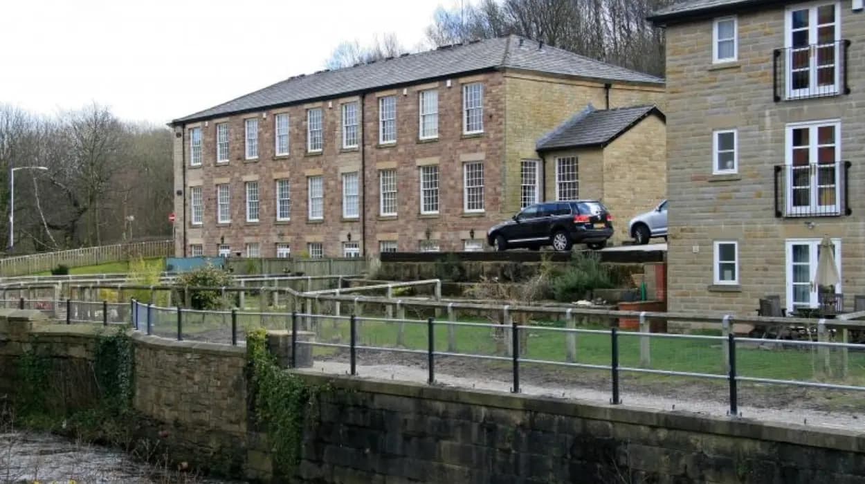
Former mill sites, workers’ housing districts, industrial infrastructure, and surviving commercial buildings reveal the economic foundations of Astley Bridge. Although many structures have disappeared, physical remnants and landscape features continue to document the area’s industrial past.
Industrialisation transformed Bolton into one of Britain’s major textile centres. Astley Bridge benefited from this economic expansion through employment opportunities and residential development.
Cotton manufacturing dominated the regional economy during the nineteenth century. Mills required substantial labour forces, leading to construction of housing and supporting infrastructure.
Many industrial sites no longer survive intact. Demolition, redevelopment, and changing economic conditions altered the physical landscape during the twentieth century.
However, evidence remains visible. Street layouts, former warehouse buildings, and characteristic workers’ housing continue to indicate earlier industrial functions.
Industrial archaeology examines these surviving features to understand production systems and community organisation. Researchers often combine physical evidence with documentary records to reconstruct historical industries.
The district’s industrial heritage reflects broader developments associated with the Industrial Revolution. Understanding these remnants helps explain why Astley Bridge expanded rapidly during the nineteenth century and how industrial employment shaped local society.
Where can visitors find traces of Victorian and Edwardian architecture?
Residential streets, civic structures, educational buildings, and commercial properties preserve architectural styles associated with the late nineteenth and early twentieth centuries. These locations reveal how prosperity and population growth influenced construction throughout Astley Bridge.
Victorian and Edwardian architecture forms a significant component of the district’s historic character. Building styles reflected contemporary tastes, technological developments, and social aspirations.
Residential development expanded substantially between approximately 1850 and 1914. Developers constructed terraces, semi-detached houses, and larger residences intended for different income groups.
Architectural details often include decorative brickwork, stone carvings, stained glass, and ornamental roof features. These elements provide clues regarding construction dates and original functions.
Schools built during this period reflected educational reforms introduced across Britain. Civic buildings similarly demonstrated growing municipal responsibilities.
Many visitors focus on major landmarks while overlooking ordinary streets that contain historically significant architectural ensembles. Yet these areas often provide the clearest evidence of how communities developed during periods of economic growth.
Architectural historians use such buildings to examine changing standards of housing, construction technology, and urban planning.
How do local waterways reveal hidden aspects of Astley Bridge’s past?
Streams, drainage systems, and associated landscape features influenced settlement patterns, industry, transport, and public health. These waterways shaped development decisions for centuries and remain important components of the district’s historical geography.
Water resources played fundamental roles in pre-industrial and industrial communities. Reliable water supplies supported agriculture, domestic needs, and manufacturing processes.
In Lancashire, many industrial enterprises relied upon nearby water sources before widespread adoption of alternative power systems. Water also remained essential for textile production processes.
Local streams influenced the placement of roads, bridges, and settlements. Historic crossings frequently became focal points for commercial activity and community interaction.
Environmental historians study waterways because they reveal relationships between human activity and natural landscapes. Changes in water management often reflect broader technological and economic developments.
Urban growth during the nineteenth century increased pressure on drainage systems and sanitation infrastructure. Public health reforms consequently became important aspects of municipal governance.
Surviving waterways continue to provide evidence regarding historical land use and environmental change within Astley Bridge.
What hidden educational landmarks survive from earlier generations?
Historic schools, educational institutions, and former learning facilities document changing attitudes toward literacy, social mobility, and public education. These sites illustrate how national educational reforms affected local communities across successive generations.
Education expanded dramatically during the nineteenth century. Prior to major reforms, educational opportunities varied considerably according to social class, location, and religious affiliation.
Legislative changes gradually increased access to schooling throughout Britain. Local authorities and religious organisations constructed educational facilities to accommodate growing populations.
School buildings often reflected architectural priorities of their era. Design considerations included classroom size, ventilation, lighting, and recreational space.
Former educational institutions preserve evidence of curriculum development and changing expectations regarding childhood and citizenship.
Many historic schools continue serving educational purposes, while others have been adapted for different uses. Their physical survival provides continuity between past and present community life.
Educational history represents an important aspect of local heritage because schools influenced social mobility, workforce development, and civic participation.
Why do lesser-known community landmarks matter to local history?
Community halls, meeting places, memorials, and social institutions preserve evidence of everyday experiences often absent from national historical narratives. These locations reveal how residents organised cultural, charitable, recreational, and civic activities throughout different historical periods.
Historical research increasingly recognises the importance of community-level institutions. Everyday social spaces often provide insights unavailable through official political or economic records.
Local organisations contributed significantly to social cohesion. Examples include 3 major categories: mutual aid societies, sports clubs, and charitable associations. These groups supported residents during periods of economic uncertainty and social change.
War memorials illustrate community responses to national events. Names inscribed on memorials provide connections between local families and broader historical developments.
Community buildings frequently hosted public meetings, educational programmes, and cultural events. Their histories reveal patterns of participation and civic engagement.
Many lesser-known landmarks survive because communities recognised their local importance even when national attention remained limited.
Preserving these sites helps ensure that ordinary experiences remain part of the historical record.
How can visitors explore Astley Bridge’s hidden corners responsibly today?
Responsible exploration involves respecting heritage assets, consulting historical records, supporting preservation efforts, and understanding historical context. Modern visitors can engage with Astley Bridge’s overlooked locations while contributing to awareness of local cultural heritage.
Historical landscapes require careful stewardship. Preservation depends upon cooperation between local authorities, heritage organisations, researchers, and residents.
Visitors benefit from combining physical exploration with documentary research. Historical maps, archival records, and local studies provide valuable context that enhances understanding of surviving sites.
To experience this historic landscape in person today, consult our comprehensive How to Spend a Day in Astley Bridge: Food, Parks, and Local History for itineraries and visiting parameters.
Heritage interpretation continues evolving as new research emerges. Archaeological investigations, archival discoveries, and conservation projects regularly improve understanding of local history.
Educational institutions increasingly use local heritage sites as teaching resources. Students gain direct exposure to historical evidence while developing research and analytical skills.
The long-term significance of Astley Bridge’s hidden corners extends beyond tourism. These locations preserve evidence of settlement, industry, religion, education, recreation, and community life spanning several centuries.
As urban environments continue changing, the survival of overlooked historic places becomes increasingly valuable. They provide tangible connections to earlier generations and help explain how modern Astley Bridge developed into its present form.
Understanding these hidden corners contributes to broader appreciation of Bolton’s heritage and the historical processes that shaped communities throughout Greater Manchester. Their continued preservation ensures that future generations can study, interpret, and learn from the district’s rich historical landscape.
FAQS
Why is Astley Bridge historically important?
Astley Bridge played a significant role in Bolton’s industrial expansion during the nineteenth century. Its growth was linked to textile manufacturing, residential development, transport routes, and community institutions.