Smithills is one of the most historically layered walking landscapes in Bolton. Its woodland paths run through an estate containing medieval heritage, nineteenth-century industrial history, Victorian landscape design, agricultural land, moorland, streams, cloughs, and modern conservation projects.
The wider Smithills Estate covers 684.66 hectares, or about 1,691.79 acres, making it the largest site the Woodland Trust has acquired in England. The landscape contains grassland, farmland, moorland, woodland, wooded cloughs, bog habitats, dry-stone walls, streams, and extensive walking routes.
Smithills Hall provides the principal historic reference point. Historic England identifies the building as a Grade I listed medieval hall, while the surrounding landscape is a Grade II registered park and garden. The combination gives Smithills unusual importance as both a recreational landscape and a heritage site.
For outdoor enthusiasts, the best woodland walks in Smithills are therefore more than routes through trees. They are paths through a landscape shaped by medieval landowners, agricultural communities, mill workers, miners, Victorian designers, municipal authorities, conservation organisations, and generations of local walkers.
What makes Smithills one of Bolton’s most important woodland walking landscapes?
Smithills offers several woodland walking experiences within a large historic landscape, including the Barrow Bridge Trail, Raveden woodland paths, High Shores Clough, and routes around Smithills Hall. Each combines woodland, streams, historic structures, public access routes, and documented landscape management.
The scale of Smithills explains the variety of walking experiences. The estate extends from lower woodland and farmland towards higher moorland, creating a landscape transition rather than a single uniform forest.
The Woodland Trust describes Smithills as a combination of grassland, farmland, moorland, woodland, wooded cloughs, and bog habitats. A clough is a steep-sided wooded valley, often shaped by water erosion. Smithills contains several such valleys, giving walkers routes with changes in gradient, vegetation, watercourses, and views.
The estate also has an extensive rights-of-way network. Woodland Trust landscape assessments describe an open landscape with high public access, beech-dominated ghyll woodland, small conifer plantations, enclosed pastoral farmland, and a transition between woodland and moorland.
This mixture creates several distinct walking environments. Barrow Bridge provides a compact woodland route. High Shores Clough offers a stream-side woodland setting. Raveden provides a longer wooded valley experience. Smithills Hall adds formal gardens, historic parkland, bridges, water features, and architectural heritage.
The landscape also has exceptional views. Higher ground provides panoramas towards Bolton and Manchester, while wooded valleys create enclosed walking environments closer to streams.
The modern estate is the product of long-term land management. Existing woodland sits beside areas of newer planting and recovering habitats. The Woodland Trust's current programme includes woodland creation, habitat restoration, peatland recovery, access improvements, and conservation management.
This makes Smithills valuable for outdoor recreation and historical education. A walk can demonstrate how land use changed from medieval estate management to industrial-era working landscapes and then to public conservation.
How did Smithills woodland develop through history?
Smithills woodland developed within a wider estate shaped by medieval landholding, farming, Victorian landscape design, industrial activity, and modern conservation. The surviving woods, cloughs, streams, walls, bridges, paths, and parkland preserve evidence of these successive phases in one landscape today.
The earliest documented history of the Smithills estate reaches back to the medieval period. Historic England records that the estate was owned by the Hospitallers from the late twelfth century or earlier. The Hospitallers were a religious military order that administered land and estates across medieval England.
The estate was subsequently leased to different families. The Radcliffe family lived at Smithills from 1335. In the fifteenth century, ownership passed through marriage to the Barton family. This period established Smithills as a landed estate rather than simply an area of woodland.
The landscape was mapped several times. William Senior prepared a map of the estate for Sir Thomas Barton in 1620. Hugh Oldham produced another map for Edward Byrom in 1769. These historic maps provide evidence for understanding changing boundaries, land use, roads, buildings, and landscape organisation.
The Byrom family acquired the estate in 1722. The Ainsworth family acquired it in 1801 and retained ownership until 1938. This succession corresponds with major changes in the economic structure of the surrounding region.
Bolton became a major textile manufacturing centre during the Industrial Revolution. Smithills existed beside this expanding industrial economy. The surrounding landscape retained agricultural functions while nearby communities developed around mills, workshops, transport routes, and worker housing.
The woodland therefore formed part of a wider working landscape. Streams supplied natural drainage. Cloughs provided sheltered woodland. Paths connected communities with farmland and higher ground. Dry-stone walls divided fields and helped manage livestock.
Victorian landscape design introduced another important phase. Historic England records mid-to-late nineteenth-century pleasure grounds, late nineteenth-century gardens, associated parkland, mature woodland, water features, terraces, and paths around Smithills Hall.
Architect George Devey also shaped the historic appearance of Smithills Hall. His nineteenth-century work extended the building and created architecture designed to complement its medieval character. Bolton Council records that Devey's wing was added to the Grade I listed medieval building and incorporated domestic accommodation, a study, library, and servants' quarters.
The result is a landscape where woodland is closely connected to architectural history. Trees, paths, watercourses, terraces, bridges, and parkland were not isolated features. They formed an integrated estate landscape.
Which Smithills woodland walk is best for combining history and nature?
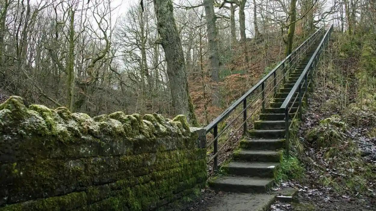
The Barrow Bridge Trail is a short woodland walk for combining scenery and documented social history. The 1.4-kilometre route takes about 30 minutes, passes Dean Brook and High Shores Clough, and includes the historic 63 Steps associated with local workers.
The Barrow Bridge Trail is the most clearly documented short woodland route within Smithills Estate. Woodland Trust information gives the route a distance of 0.87 miles, or 1.4 kilometres, with an estimated walking time of 30 minutes.
The trail begins close to the historic village of Barrow Bridge. The village contains cottages associated with a nineteenth-century model settlement developed for mill workers. This connects the woodland directly with Bolton's industrial and social history.
One of the route's defining features is the 63 Steps. These steep steps were used by workers travelling towards mines on the higher parts of Smithills Estate. Their survival provides a physical reminder of the relationship between industrial communities and the upland economy.
The trail then enters High Shores Clough. Woodland Trust records identify High Shores Clough as woodland dating from at least 1600. The site contains native tree species and follows Dean Brook through a narrow wooded landscape.
Dean Brook begins higher on the moorland, where rainfall feeds the watercourse. The brook then passes through the wooded landscape before continuing through the wider Smithills system.
The trail also contains the remains of a stone bridge known as Lost Bridge. The structure once connected farmland on opposite sides of the brook. Its surviving remains demonstrate how historic transport and agricultural networks were incorporated into the landscape.
Further sections pass through grassland between broadleaf woodland and moorland. The transition provides a useful geographical lesson. Woodland cover changes with altitude, land use, soil conditions, exposure, and historical management.
For visitors interested in historical walking, the Barrow Bridge Trail provides a concentrated route through industrial archaeology, woodland ecology, water management, farming history, and public access.
What can walkers discover along Raveden and High Shores Clough?
Raveden provides a woodland experience beside flowing water, steep cloughs, bridges, and historic landscape features near Smithills Hall. Its paths connect with the Hall's registered parkland and woodland setting, while the wider Raveden landscape records established drainage, planting, and access patterns.
Raveden is one of the most distinctive wooded valleys associated with Smithills Hall. The Woodland Trust lists Raveden as a 20.42-hectare, or 50.46-acre, Bolton Metropolitan Borough Council woodland. The site includes running water, bridges, a waterfall, parking near Smithills Hall, and steep steps.
The valley's watercourse gives the route a different character from higher moorland paths. Water moves through the woodland, creating damp ground conditions and supporting a distinctive riparian environment.
Raveden also has a direct historical relationship with Smithills Hall. Historic England records paths running eastward beside the watercourse from the Hall's pleasure grounds. The water eventually joins Raveden Brook and then Dean Brook.
Historic mapping provides further evidence. A large pond near the south-eastern part of the estate appears on the 1893 Ordnance Survey map. Another stretch of water appears on earlier maps but later disappeared. These changes demonstrate that the landscape's water features were altered over time.
The woodland also retains evidence of former pedestrian infrastructure. Historic England records a nineteenth-century rustic footbridge crossing the stream. It identifies this as the only intact survivor of several similar bridges, with the footings of other bridges still visible along the route.
This makes Raveden particularly useful for heritage-focused walking. A walker can observe how a stream shaped the valley while also identifying bridges, paths, woodland planting, and landscape boundaries.
High Shores Clough provides another important woodland environment. Its documented history extends to at least the seventeenth century. The clough contains native trees and follows Dean Brook, creating a direct connection between woodland ecology and historic water management.
Wet ground is a defining characteristic of both environments. Woodland Trust guidance notes that the Barrow Bridge route can become muddy, while Raveden is also known for muddy conditions during wet weather. Appropriate footwear is therefore an important part of responsible access.
Why is Smithills Hall important to the woodland walking experience?
Smithills Hall woodland walks connect with a historic landscape. The Grade I listed hall dates from the medieval period, while its park and garden includes nineteenth-century pleasure grounds, woodland, water features, paths, and parkland designed to integrate architecture with landscape.
Smithills Hall is the architectural centre of the historic landscape. Historic England describes it as a large house with origins as a medieval hall house dating from the early fourteenth century. It was expanded during the fifteenth or early sixteenth century, with a west wing added later and subsequently remodelled by George Devey in the nineteenth century.
The building's Grade I status places it among England's most important listed buildings. Its architectural significance extends beyond the visible walls because the surrounding landscape forms part of its historic setting.
Historic England lists Smithills Hall's park and garden as Grade II on the Register of Parks and Gardens of Special Historic Interest. The registered landscape covers about 48 hectares and includes formal terraces, wooded pleasure grounds, parkland, water features, paths, and historic planting.
The formal landscape contains an L-shaped grass terrace around the south and east sides of the Hall. Stone steps connect the upper terrace with a lower walkway. A ha-ha wall also survives.
A ha-ha is a sunken boundary designed to separate formal gardens from surrounding land without creating a conventional visible fence. At Smithills, the ha-ha forms part of the historic relationship between the gardens, parkland, and woodland.
The landscape also contains a rustic bridge and cascade near the eastern side of the Hall. Historic England records a narrow wooded valley in this area and describes paths running beside the watercourse.
The kitchen garden provides another surviving element. It occupies sloping land approximately 300 metres north of the Hall. The garden was associated with the Ainsworth period, while nineteenth-century evidence records glasshouses and the cultivation of pineapples.
These features demonstrate that the woodland around Smithills Hall was part of a managed estate landscape. It included productive gardens, formal pleasure grounds, woodland, water management, parkland, agricultural land, and transport routes.
To experience this historic landscape in person today, consult our comprehensive [Ancient Woodland History of Smithills and Bolton] for itineraries and visiting parameters.
How did industrial history shape Smithills woodland paths?
Smithills became an important public-access landscape through nineteenth-century industrial use, twentieth-century municipal ownership, and later conservation. In 1896, about 10,000 people gathered on Smithills moors to demand access, more than three decades before the Kinder Scout mass trespass of 1932.
The industrial history of Smithills is visible in the relationship between woodland, workers, mines, farming, and settlements.
Barrow Bridge provides the clearest example. The model village was associated with mill workers, while the 63 Steps provided a route for workers travelling towards mines higher on the estate. The route demonstrates how industrial communities depended on surrounding countryside for employment and movement.
Smithills also contained an early nineteenth-century tram road. Historic England records that the Ainsworth family constructed the route, probably to transport coal mined on the estate. The tram road later formed part of the route towards the kitchen garden.
This evidence links woodland walking with industrial transport history. The landscape was not separate from Bolton's industrial economy. Its woodland, farmland, coal workings, paths, and streams supported economic activity.
Public access became a major issue in the nineteenth century. The Woodland Trust records that 10,000 people took to the Smithills moors in 1896 to demand the right to access open land. This occurred more than 30 years before the Kinder Scout mass trespass in Derbyshire in 1932.
The 1896 action forms an important chapter in the history of public access to Britain's countryside. It demonstrates that recreational walking and access rights were established local concerns long before the twentieth-century mass-access campaigns.
Smithills later entered municipal ownership. Bolton Corporation purchased the estate in 1938 from the Ainsworth family. Bolton Council records the transfer on 14 September 1938.
Municipal ownership changed the long-term trajectory of the site. The estate became part of a publicly managed landscape rather than remaining solely a private landed estate.
The modern landscape reflects another transformation. The Woodland Trust acquired the Smithills Estate in the twenty-first century, with the organisation describing the site as its largest acquisition in England. The estate is now managed as a major conservation and public-access landscape.
This sequence gives Smithills a clear historical timeline: medieval estate management, early modern ownership, industrial-era land use, Victorian landscape development, municipal acquisition in 1938, and modern conservation.
How is Smithills woodland being restored for future generations?
Modern conservation has reshaped Smithills woodland through tree planting, peatland restoration, path improvements, habitat management, and public-access work. The Woodland Trust manages a 684.66-hectare estate and carefully plans extensive tree establishment while protecting existing woodland, moorland, streams, and cultural heritage.
Modern conservation at Smithills operates across an unusually large landscape. The Woodland Trust currently records the estate at 684.66 hectares. Earlier project documentation described the estate at approximately 686 hectares, reflecting differences in project-era measurement and acquisition stages.
A major conservation objective has been increasing woodland cover while maintaining other habitats. Bolton Council's climate strategy records an objective to increase tree cover from 10 percent to 20 percent of the estate. It also records more than 90,000 trees planted with the participation of more than 1,000 members of the public during the project period.
Woodland Trust material now describes plans for 130,000 new trees and increased tree cover. The organisation's conservation approach focuses on creating wildlife corridors while retaining existing habitats.
Peatland restoration is equally important. Peatland is a wetland habitat formed from partially decomposed vegetation accumulated over long periods. Healthy peat stores carbon, retains water, and supports specialised vegetation.
Smithills has experienced significant peatland restoration. Bolton Council recorded 170 hectares of moorland restoration, including leaky dams designed to slow water movement and more than 70 hectares of sphagnum moss planting.
The restoration programme also responds to wildfire risk. A major fire began at Smithills on 28 June 2018 and continued until autumn. Woodland Trust records state that the fire affected about one-third of the approximately 1,700-acre estate and damaged heathland, peatland, woodland, and wildlife habitat.
The ecological recovery demonstrates why responsible walking matters. Trampling, litter, uncontrolled fires, disturbance to wildlife, and inappropriate access can interfere with long-term habitat restoration.
Conservation also supports public health and community participation. The Woodland Trust's Smithills project ran from 2017 to 2023 under National Lottery Heritage Fund support. During the project, wellbeing walks were organised with community organisations, while later programmes continued to provide accessible walking opportunities.
The estate therefore functions as a living conservation project. Existing woodland is protected, new trees are established, damaged peatland is restored, water flows are managed, and public paths are improved.
The historical significance of this work is substantial. Future researchers will be able to study Smithills as an example of how a former landed and industrial landscape was transformed into a large-scale conservation estate.
What should outdoor enthusiasts know before walking through Smithills woodland?
Walkers should treat Smithills as a working conservation landscape rather than a park. Conditions vary across woodland, cloughs, farmland, moorland, and paths, so suitable footwear, weather awareness, responsible dog control, respect for livestock, and adherence to marked routes are essential throughout.
Smithills contains several types of terrain. Woodland paths can be damp and uneven. Cloughs contain steep slopes. Moorland exposes walkers to stronger weather conditions. Farmed areas contain livestock and working agricultural infrastructure.
The Barrow Bridge Trail is officially described as an easy 1.4-kilometre route, but it includes two steep flights of steps. Woodland Trust guidance recommends walking boots because paths can become muddy.
Raveden also becomes muddy during wet weather. Its landscape contains running water, bridges, a waterfall, and steep steps. These features make the route historically interesting but require greater attention to ground conditions.
Weather changes quickly across the higher Smithills landscape. The longer Smithills History Walk covers approximately 9 kilometres, or 6 miles, and takes around four to five hours. Woodland Trust guidance recommends waterproof clothing and walking boots for this route.
The estate also contains active farms. Walkers should keep dogs under control around livestock and follow countryside access rules. Responsible access protects both visitors and the agricultural operations that remain part of the landscape.
Dogs are welcome in Woodland Trust woods, but owners remain responsible for preventing disturbance to wildlife, livestock, and other visitors. This is particularly important during nesting and breeding periods.
Fire prevention is another essential responsibility. The 2018 Smithills wildfire demonstrated the consequences of uncontrolled fire in upland landscapes. Peatland and heathland can remain vulnerable long after visible vegetation has recovered.
Visitors should also avoid removing stones, damaging historic structures, disturbing archaeological remains, or altering watercourses. Features such as the 63 Steps, Lost Bridge, historic walls, bridges, and landscape boundaries form part of Smithills' cultural record.
The correct approach is simple: use established paths, follow site guidance, leave natural and historic features intact, take litter home, control dogs where required, and avoid lighting fires.
Why do the best woodland walks in Smithills matter to Bolton’s heritage?
Smithills woodland walks preserve an unusually complete connection between natural history and human history. Medieval estate ownership, industrial work, Victorian landscape design, public-access campaigns, municipal stewardship, archaeological remains, and modern habitat restoration remain visible across the same landscape.
Smithills matters because its woodland cannot be separated from the history around it.
The surviving landscape records medieval landholding through Smithills Hall and its estate boundaries. Early maps preserve evidence of historic land organisation. Industrial features record coal extraction, transport, worker movement, and mill-community development.
Victorian features demonstrate a different relationship with the countryside. Formal terraces, pleasure grounds, gardens, bridges, woodland planting, parkland, and water features were designed to create an ordered estate landscape around the medieval hall. Historic England identifies this integration of medieval architecture with nineteenth-century landscape design as a central reason for the site's heritage importance.
The public-access history adds another dimension. The 1896 gathering of 10,000 people demonstrates that access to Smithills was a significant social issue before the better-known Kinder Scout campaign.
Municipal acquisition in 1938 created another stage in the landscape's history. The transfer from the Ainsworth family to Bolton Corporation changed the ownership structure and established a foundation for public stewardship.
Modern Woodland Trust management adds an environmental dimension. Tree planting, peatland restoration, wildfire recovery, habitat connectivity, public access, and community education are now shaping the landscape.
For educators, Smithills provides a field study environment where several subjects overlap. History students can investigate medieval estates and industrialisation. Geography students can examine clough formation, drainage, land use, and peatland. Environmental studies students can investigate woodland succession, habitat restoration, wildfire recovery, and carbon storage.
Genealogical researchers also gain useful context. Families connected with Bolton's industrial communities lived and worked within a landscape that still preserves routes used by workers. The 63 Steps, Barrow Bridge cottages, former mining areas, and surrounding paths provide physical context for researching nineteenth-century occupations and communities.
For cultural tourists, Smithills offers a different form of heritage experience. The landscape does not depend on a single monument. Its significance comes from the relationship between buildings, woodland, water, farmland, moorland, paths, and people.
The best woodland walks in Smithills therefore provide access to a historical landscape that remains active rather than frozen in the past.
Smithills continues to change through conservation. New trees will mature. Restored peatlands will develop. Existing woodland will change through natural succession. Historic structures will require continued maintenance. Public access routes will continue to connect communities with the estate.
That ongoing change gives Smithills long-term historical value. Future generations will inherit not only medieval and Victorian remnants but also the evidence of twenty-first-century environmental restoration.
For Bolton, the result is a landscape where walking, heritage conservation, ecological restoration, public access, and local history remain connected. The woodland trails are therefore important both as outdoor routes and as accessible pathways into the history of Smithills and the wider Bolton area.
FAQS
What are the best woodland walks in Smithills?
The best woodland walks in Smithills include the Barrow Bridge Trail, Raveden woodland, High Shores Clough and routes around Smithills Hall. These routes combine woodland, streams, historic structures, farmland and scenic countryside.