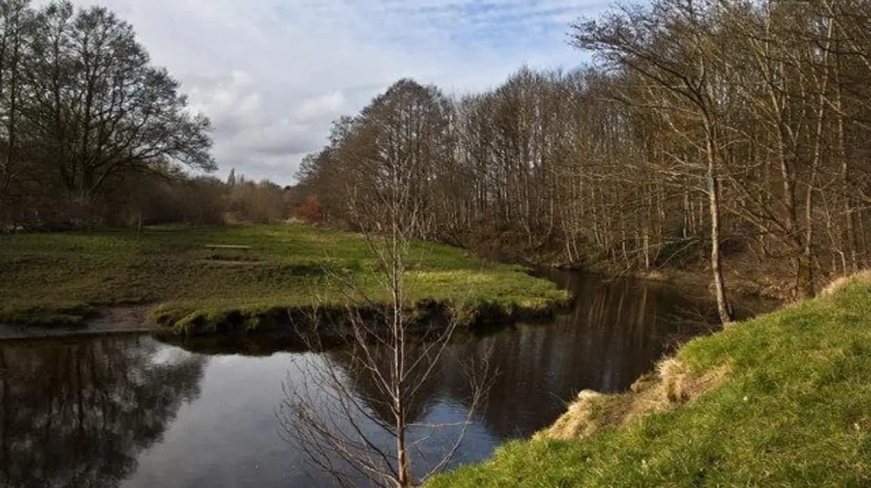
Harwood sits on the northern side of Bolton and combines residential streets, historic farmland, woodland, waterways and public green space. Its walking landscape reflects the area’s transition from an agricultural township into a modern part of Bolton Metropolitan Borough.
For visitors travelling with dogs, Harwood provides access to several types of walking environment. Longsight Park offers an accessible starting point, while the Bradshaw Valley connects recreational paths with woodland, streams and surviving evidence of the area’s industrial past. The wider Upper Bradshaw Valley Local Nature Reserve adds woodland, grassland, wetland and river habitats to the walking experience.
The historical setting is important because Harwood was not originally part of the modern borough of Bolton. It was a township within the historic county of Lancashire and later became part of Turton Urban District before local government reorganisation in 1974.
For dog walkers, this history creates a distinctive landscape. Modern footpaths frequently cross areas shaped by farming, waterways, transport infrastructure and industrial development. The result is a walking environment where natural features and local heritage remain closely connected.
What makes Harwood suitable for dog-friendly historic walks?
Harwood combines accessible parkland, woodland, waterways, public rights of way and historic landscapes, giving visitors with dogs several walking environments within a relatively compact area while retaining strong connections with Bolton’s agricultural and industrial history.
Harwood is particularly suitable for visitors who want a walk that provides more than open grass. The local landscape includes Longsight Park, the Bradshaw Valley and the Upper Bradshaw Valley Local Nature Reserve. Each setting has a different physical character.
Longsight Park is located on Longsight Lane in Harwood. Bolton Council describes it as a large informal park with a play area, football pitch, nature trail and links towards the Bradshaw Valley and beyond.
The Bradshaw Valley provides a transition from the built environment towards a more rural landscape. Bradshaw Brook forms an important geographical feature, while woodland and grassland create a varied setting for walking.
The Upper Bradshaw Valley Local Nature Reserve extends this landscape further. Bolton Council identifies woodland walks, river views, wildlife habitats and connections towards the West Pennine Moors and the Kingfisher Trail.
This combination is important for visitors with dogs because different sections of a walk require different levels of control. A park path can be relatively straightforward, while a rural route near livestock, water or wildlife requires closer attention to local signage and access rules.
Bolton Council states that rural walking routes across the borough include off-road footpaths, bridleways and restricted byways. It also warns that surfaces vary and recommends suitable waterproof clothing and boots.
The landscape therefore works best as a connected walking area rather than as one uniform trail. Visitors can select a shorter park-based outing or continue into the valley environment when conditions and the dog’s fitness allow.
How did Harwood develop from a Lancashire township into part of Bolton?
Harwood developed within historic Lancashire as an agricultural township before becoming part of Turton’s local government structure in the nineteenth century and joining the modern Bolton Metropolitan Borough through the local government reorganisation implemented in 1974.
Understanding Harwood’s administrative history explains why its landscape contains such a strong mixture of rural and urban characteristics.
Bolton Council records Harwood as one of the townships covered by the Bolton Rural Sanitary Authority, established in 1872. The authority included Harwood alongside Bradshaw, Breightmet, Edgworth, Entwistle, Heaton, Longworth and other surrounding townships.
The Bolton Rural Sanitary Authority was created during a period when local government was increasingly concerned with sanitation, public health and the management of rapidly changing communities. Industrialisation had transformed Bolton and its surrounding townships, increasing pressure on existing administrative systems.
In 1895, the Bolton Rural Sanitary Authority became a Rural District Council. Its subsequent dissolution in 1898 altered the administrative relationship between Harwood and neighbouring communities.
Harwood then became part of Turton Urban District. Bolton Council records that the boundaries of Turton Urban District were extended in 1898 to include Bradshaw, Edgworth, Entwistle, Harwood, Longworth and Quarlton.
That arrangement lasted for much of the twentieth century. The decisive change came in 1974, when local government reorganisation created the modern metropolitan borough structure. South Turton, including Bromley Cross, Bradshaw and Harwood, became part of the new Bolton Metropolitan Borough.
The modern walking landscape reflects this layered history. Roads, housing, farms, waterways and public green spaces occupy a landscape that once belonged to a distinct Lancashire township.
This historical continuity gives Harwood’s walking routes relevance beyond recreation. A visitor following a path through the Bradshaw Valley is moving through a landscape shaped by the same administrative, agricultural and industrial changes that transformed much of northern Lancashire.
Where is the best starting point for a dog walk in Harwood?
Longsight Park is one of the most practical starting points because it provides a large informal green space, a nature trail and connections towards the Bradshaw Valley, allowing visitors to begin with an accessible walk before extending into the surrounding landscape.
Longsight Park occupies an important position in Harwood’s modern recreational network. Bolton Council lists the park at Longsight Lane, Harwood, BL2 3JS, and identifies walking as one of its principal uses.
The park contains a football pitch, playground and nature trail. These facilities establish it as a community recreation space rather than a purely heritage site. Its significance for visitors lies in its connection with the wider Bradshaw Valley.
A visitor with a dog can therefore treat Longsight Park as a practical orientation point. The open park environment provides space for an initial walk before continuing towards more enclosed valley routes.
The nature trail also gives the site an educational dimension. For history and geography students, the park provides a straightforward location for examining how modern recreational land uses fit into an older rural landscape.
The connection towards the Bradshaw Valley is particularly important. Bolton Council explicitly describes Longsight Park as having links to the Bradshaw Valley and beyond.
This makes the park useful for visitors who do not want to commit immediately to a longer rural route. A short outing can remain within the park environment, while a longer visit can continue towards the valley.
Dog owners should still follow any signs displayed at the site. The national Countryside Code requires dogs to remain under effective control and in sight, while local signage determines where dogs must be kept on leads or where restrictions apply.
The park therefore works best as a flexible starting point rather than as a single fixed walking circuit.
What can visitors see along the Bradshaw Valley walk?
The Bradshaw Valley combines woodland, grassland, Bradshaw Brook, wildlife habitats and surviving industrial evidence, creating a historic walking landscape where visitors can observe how water, agriculture and industry influenced the development of communities around Harwood and northern Bolton.
The Bradshaw Valley is one of the strongest choices for visitors seeking a dog walk with historical and environmental content.
Bradshaw Brook is central to the character of the valley. The watercourse connects the landscape physically and historically because streams and rivers influenced settlement, agriculture and industrial activity.
The Upper Bradshaw Valley Local Nature Reserve provides particularly useful evidence of this relationship. Bolton Council describes the reserve as supporting woodland walks, river views, woodland flowers, wildflowers, grassland, pond and marsh habitats, dragonflies, damselflies and birdlife associated with Bradshaw Brook.
The reserve also preserves visible industrial archaeology. Bolton Council specifically describes winter conditions as making industrial archaeology more visible through the bare trees.
This feature makes the valley valuable for educational walking. The landscape can be read as a physical record of changing land use. Woodland indicates natural regeneration and managed habitat, while water and industrial remains demonstrate the historical use of local resources.
The reserve connects with routes towards the West Pennine Moors and the Kingfisher Trail.
Visitors should distinguish between a public footpath and unrestricted access. Bolton Council maintains a network of public rights of way, while individual routes can have different classifications and conditions. Its walking guidance identifies footpaths, bridleways and restricted byways across rural Bolton.
For dog owners, the valley is therefore best treated as a controlled countryside walk. Dogs should remain close to their owners and away from wildlife, livestock and other walkers unless invited.
The valley’s historical value also extends beyond Harwood itself. It forms part of a wider landscape connecting Harwood with Bradshaw and the northern rural fringe of Bolton.
Why is the Upper Bradshaw Valley Local Nature Reserve important for dog walkers?
Upper Bradshaw Valley Local Nature Reserve provides woodland, grassland, wetland, river habitat and industrial archaeology, making it a valuable destination for visitors who want a dog walk that combines natural history, local heritage and established public access routes.
The reserve provides one of the clearest examples of how conservation and local history coexist in the Harwood area.
Its habitats change according to season. Bolton Council records woodland flowers and birdlife in spring, wildflowers and insects around ponds and marshes in summer, autumn foliage later in the year, and more visible industrial archaeology during winter.
This seasonal structure gives the reserve educational significance. A repeated visit can demonstrate changes in vegetation, bird activity, water conditions and visibility of historic remains.
For history enthusiasts, the industrial archaeology is particularly relevant. Industrial development in Bolton was closely associated with water, textiles, transport and manufacturing. The survival of archaeological evidence within a modern nature reserve demonstrates how industrial landscapes can become integrated into later environmental management.
The reserve also has practical transport connections. Bolton Council’s information identifies Bromley Cross railway station as a route towards the site, with an entrance approximately half a kilometre from the station. Bus services also serve nearby roads, including Bradshaw Road and Bradshaw Brow.
This makes the area relevant to visitors who arrive without a car.
Dog owners should pay particular attention to wildlife. Government guidance states that dogs should remain under effective control, stay on paths or land where access is permitted, and avoid disturbing wildlife.
Woodland guidance also recommends keeping dogs in sight and close by, using a lead where necessary, and preventing dogs from approaching wildlife, livestock, horses, cyclists or other visitors without invitation.
The reserve therefore rewards controlled walking rather than unrestricted running.
For visitors interested in exploring more of Bolton after the walk, the historic relationship between Harwood, Bradshaw and the wider borough provides useful context. To experience the area beyond its walking routes, consult our comprehensive [Farming Heritage and Rural Life in Harwood] for itineraries and visiting parameters.
What historic buildings and landscapes can be connected with a Harwood walk?
Historic buildings around Harwood and neighbouring Bradshaw preserve evidence of Lancashire’s rural and architectural past, including Bradshaw Hall Farm’s former barn and the surviving early seventeenth-century porch of the former Bradshaw Hall.
Harwood’s walking environment becomes more historically significant when viewed alongside nearby heritage structures.
Bradshaw Hall Farm contains a listed former barn at Bradshaw Hall Fold. Historic England dates the building to the seventeenth and nineteenth centuries. The structure has a timber frame, stone walls and a stone-slate roof, and was later converted for residential use.
The barn demonstrates the agricultural character of the wider landscape. Its construction history spans different periods of rural development, while its surviving materials provide physical evidence of traditional building methods.
Nearby, the surviving porch associated with Bradshaw Hall is Grade II listed. Historic England dates it to the early seventeenth century and records its round-headed entrance, stone construction, fluted columns, entablature and Bradshaw family arms. The original house has been demolished, leaving the porch as a surviving fragment of the former building.
This type of surviving structure is important for heritage interpretation. A building does not need to survive intact to provide evidence about a former settlement. Architectural fragments can preserve information about ownership, status, construction and local craftsmanship.
Historic England’s Bolton heritage material identifies several listed structures across the borough, including Bradshaw Hall Farm’s former barn and the porch associated with Bradshaw Hall.
The surrounding landscape also demonstrates the relationship between rural settlement and later industrial growth. Stone farm buildings, woodland, waterways and modern housing occupy spaces that developed through successive phases of land use.
For visitors walking with dogs, the historical structures should be treated as heritage assets rather than climbing or play areas. The Countryside Code advises visitors not to disturb ruins or historic sites and to leave heritage features intact.
The combination of walking and heritage makes the Harwood-Bradshaw area particularly useful for local history fieldwork. Students can compare architectural evidence with maps, administrative records and environmental features to understand how the landscape changed.
How does Bolton’s wider walking network extend a Harwood dog walk?
Harwood connects with Bolton’s wider public rights-of-way network, allowing visitors to extend local walks towards Bradshaw and other rural areas while using footpaths, bridleways and restricted byways according to their designated access rights.
Harwood should not be viewed as an isolated walking destination. It forms part of a larger network of rural routes across Bolton.
Bolton Council states that rural parts of the borough contain quiet off-road footpaths, bridleways and restricted byways. The council also maintains information about public rights of way and walking routes.
The Tonge Trail demonstrates the wider relationship between Bolton’s waterways and walking infrastructure. The council describes it as an eight-mile route following the River Tonge and Bradshaw Brook.
Although the entire Tonge Trail is not a Harwood-only walk, its connection with Bradshaw Brook demonstrates how watercourses form part of Bolton’s broader recreational geography.
The Middlebrook Valley Trail provides another example of the borough’s approach to connected walking. Bolton Council describes a purpose-built footpath and cycleway between Red Moss at Middlebrook and Bolton town centre, with connections through Deane Church Clough, Ladybridge and Lostock Junction.
These routes demonstrate an important principle for visitors: local walking should be planned according to the legal status and physical condition of each section.
A public footpath is not automatically a route for every type of recreational activity. Bridleways and restricted byways have different access arrangements, while temporary closures and local restrictions can affect use.
The council advises walkers to check route information and notes that rural surfaces vary. Waterproof clothing and suitable footwear are recommended.
Dog owners should also consider the dog’s size, age, fitness and recall ability before choosing longer routes. A short park walk and a longer valley route place different demands on both dog and owner.
The wider network therefore makes Harwood a useful base for progressive exploration rather than a destination limited to one circuit.
What should visitors know before walking a dog in Harwood?
Visitors should check local signs, follow public rights of way, keep dogs under effective control, carry waste bags, protect wildlife and use leads around livestock, because Harwood’s parks and rural paths combine public recreation with farming, conservation and sensitive habitats.
Responsible dog walking is essential in Harwood because recreational paths pass through environments used by people, wildlife and land managers.
The Countryside Code states that visitors must follow signs showing where they can go and who can use a right of way. It also advises visitors to stay on marked paths and use gates, stiles and designated crossing points.
Dog control is particularly important. The government guidance states that dogs should remain under effective control and in sight. Owners should prevent dogs from approaching wildlife, livestock, horses and other people unless invited.
Livestock requires additional caution. The Countryside Code identifies keeping dogs on a lead around livestock as good practice. Open-access land also has specific legal requirements for dogs near livestock and during the period from 1 March to 31 July.
The rules have become more significant because legislation strengthening protection for livestock from dog attacks came into force in England in 2026. Government guidance explains that chasing or disturbing livestock can constitute an offence under the strengthened provisions.
Waste management is another basic responsibility. Dog waste should be bagged and placed in an appropriate public bin or taken home if no suitable bin is available. Leaving a bag beside a path does not comply with the Countryside Code.
Wildlife protection also matters in the Upper Bradshaw Valley. Woodland, marsh, pond and river habitats support birds, insects and plants. Dogs should remain on permitted paths and under control to reduce disturbance.
Weather affects route conditions. Bolton Council notes that rural walking surfaces vary and recommends waterproof clothing and boots.
For visitors with dogs, practical preparation therefore includes a lead, waste bags, suitable footwear, water for the dog and a route plan based on current local signage.
Why do Harwood’s dog walks matter for Bolton’s heritage today?
Harwood’s dog walks preserve access to landscapes shaped by agriculture, local government, water management and industry, demonstrating how historic environments remain part of everyday community life rather than existing only within museums or isolated heritage buildings.
The significance of Harwood’s walking landscape extends beyond recreation.
The area demonstrates how historical change leaves physical traces across an ordinary modern community. Agricultural buildings survive beside housing. Industrial archaeology appears within woodland. Bradshaw Brook continues through a landscape that has experienced substantial changes in land use.
Harwood’s administrative history provides another layer. The township was incorporated into changing local government structures before becoming part of Bolton Metropolitan Borough in 1974.
The survival of rural features within the modern borough demonstrates the importance of landscape continuity. A nature reserve is not simply an isolated ecological site. It can also contain evidence of earlier economic activity.
The Upper Bradshaw Valley provides a strong example. Bolton Council records both wildlife habitats and industrial archaeology within the reserve.
Longsight Park provides another example of modern adaptation. It functions as a contemporary community park while linking directly towards the Bradshaw Valley and its historic landscape.
This relationship is valuable for educators. A local walk can become a field study covering geography, environmental science, architecture, social history and local government. Students can observe how land use changes over time without travelling to a dedicated museum.
The landscape also supports local heritage preservation. Historic structures such as the former Bradshaw Hall Farm barn and the surviving Bradshaw Hall porch demonstrate the importance of recording and protecting individual architectural remains.
For genealogical researchers, landscape history also provides context. Families recorded in parish, township or later municipal records lived within physical environments shaped by roads, farms, mills, waterways and administrative boundaries. Understanding those landscapes helps researchers interpret historical addresses and occupational information.
Harwood’s walking routes therefore provide a direct connection between present-day recreation and the historical development of Bolton.
The best dog-friendly walks are not simply routes for exercise. They are accessible ways to understand how a Lancashire township became part of a modern metropolitan borough while retaining woodland, waterways, agricultural buildings and archaeological evidence.
For visitors exploring Bolton with pets, Longsight Park provides an accessible starting point, while the Bradshaw Valley and Upper Bradshaw Valley Local Nature Reserve offer deeper connections with natural and industrial heritage. Together, these landscapes form a practical and historically significant walking area within the modern Bolton borough.
FAQS
What are the best dog-friendly walks in Harwood?
The best options include Longsight Park, the Bradshaw Valley and Upper Bradshaw Valley Local Nature Reserve. These areas combine accessible green space, woodland, waterways, wildlife habitats and historic landscape features.